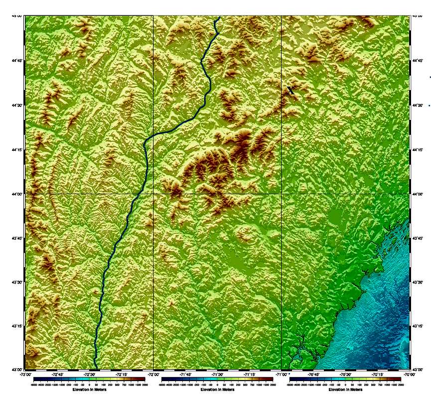
A colorized elevation map showing the White Mountains of New Hampshire, and also most of the Green Mountains of Vermont.
I marked the Connecticut River (border between Vermont and New Hampshire) in blue, and marked Grafton Notch, commonly considered the northeastern boundary of the White Mountains, with an X. The top of the image is at 45° North, along the Canadian border across the top of Vermont (a narrow strip of New Hampshire, and most of Maine, go further North). The western border of Maine is at about 71° W, about four miles west of Grafton Notch - roughly along a visible seam in the image. The ocean inlet visible at lower right is the Great Bay of Portsmouth, NH (New Hampshire bulges East there).
Assembled from NOAA Coastal Elevation series maps (public domain).


