
-
 4137 Hits
-
 76.95% Score
-
 8 Votes
|
|
Mountain/Rock |
|---|---|
|
|
69.54970°N / 19.26549°E |
|
|
Hiking, Mountaineering, Skiing |
|
|
Spring, Summer, Fall, Winter |
|
|
3140 ft / 957 m |
|
|
Overview
Fagerfjell is a popular peak. It is one of the few all-year peaks in the Tromsø area. The short approach, gentle slope, and straightforward climb with very low objective dangers makes this peak climbable, even on the shortest winter days. It comes into skiing season early in the year, and has never seen an avalanche by its easiest route. That being said, one skiier has been killed in recent years on an alternative route, and the couliors on the steep NE aspect are loose and steep thus creating a little more adventure for those looking for it.
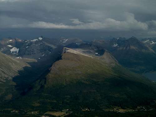
Fagerfjell sunlit under an approaching thunderstorm.
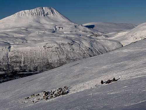
A Sami reindeer herder does a quick stop to check and feed a small group on the side of Fagerfjell. Tromsdalstind in the background.
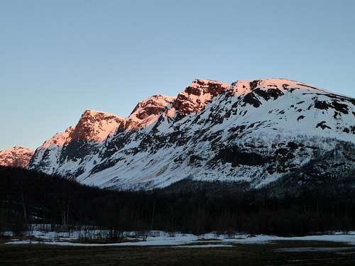
Fagerfjell's steeper side in late spring.
Getting There
From Tromsø, drive out of town on E8. Follow this highway for about 23 kilometers until seeing a sign for Breivikeidet, Svensby, Lyngseidet. There is a symbol for ferries on the sign. Turn left here, on highway 91. Continue on this road a bit more than 1 kilometer until above the hill and all the curves. When the road straightens out, there are some turnouts for buses that can usually be used for parking. The thing to watch for is the zigzagging wood cutters road that provides easy passage through the dense birch forest. Cross a field, pass a tiny hytte (hut) and begin ascending.
Access to Henrikskardet: Continue past the highway 91 sign, and look for pullouts that are used for parking buses. Be sure the main stream is well to your left before you start ascending.
Routes
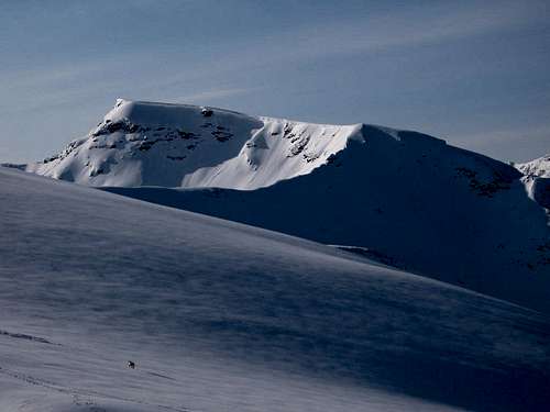
Standard Route: NW slopes. Starts from highway 91, follows a woodcutters track up to treeline and continues over undulating terrain to the skiiers summit at just under 900 meters with a large double cairn. Usually a safe and sane excursion year round. One can continue to the true summit from here, though it gets flatter and more boring. Beware of the cornices along the edge of the summit.
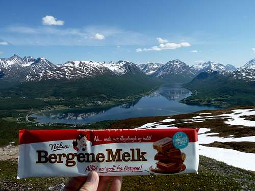
Fagerfjell is above the word Bergene on the chocolate bar.
Henrikskaret: This exciting ski descent starts from the main summit and descends an excellent west facing bowl, followed by tight tree skiing. There was a fatality from off route skiers that triggered an avalanche that funneled them into the narrow canyon on this slope, but usually it's of moderate avalache danger.
Maritind traverse: From the summit of Fagerfjellet, one can continue to the neighboring higher peak to the south with a wide flat summit. This involves an interesting 3rd class bridge\ridge traverse. Recommended for summer, there is a huge cornice blocking this route during the spring.
Maritind from the skiers summit of Fagerfjell. Notice the ridge connecting Maritind to Fagerfjell. And yes, that is one lonely reindeer in the corner.
Eastern Couliors: I have personally climbed one of the 4 main couliors that drain the northeastern aspects. There is high avalanche danger in the winter\spring, and the rock is congealed toothpaste holding stale cookies together in the summer. But they are not boring. Bring a helmet and a set of balls. Move quickly. Don't go there twice. Ok, maybe they are not that bad, but the couliors are not the primary attraction of this peak.
When to Climb
The skiing season is long on this peak. As soon as there is enough snow, and it's even a little consolidated, you are good to go. This is often the first ski peak of the year for many locals. Skiing season usually runs from mid-november until mid-may. Hiking in June and July is possible but miserable mosquitos and black flys. August and September are the best hiking months.
Camping
There is a developed campground at the end of Ramfjord, naturally called... Ramfjord Camping Other than that, wild camping is permitted if you are out of site of permanent dwellings, and not on developed land. There are some good camping areas below Fagerfjell in the valley Bjørnskardalen, but of course, camping isn't neccessary on a peak this small.
External Links
Guidebook Fagerfjell is covered in the skiing guidebook by Espen Nordahl. This book is highly recommended for the visiting Telemark and Randonee skier.