Toggle navigation
Mountains
Routes
Images
Trip Reports
Forum
What's New
People
Areas & Ranges
Articles
Trailheads
Canyons
Huts & Campgrounds
Albums
Logistical Centers
Fact Sheets
Lists
Custom Objects
Gear
Plans & Partners
WELCOME TO SUMMITPOST
SIGN IN
REGISTER
"Parachute Rock"
Additional Parents
Image
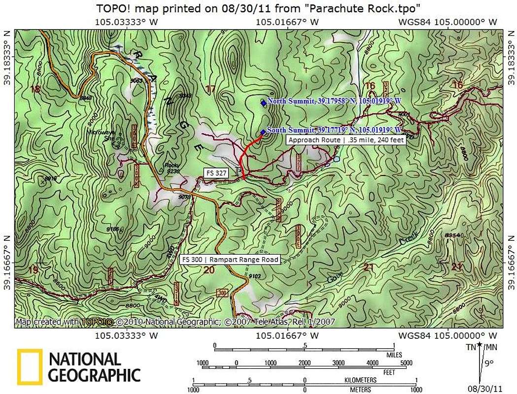
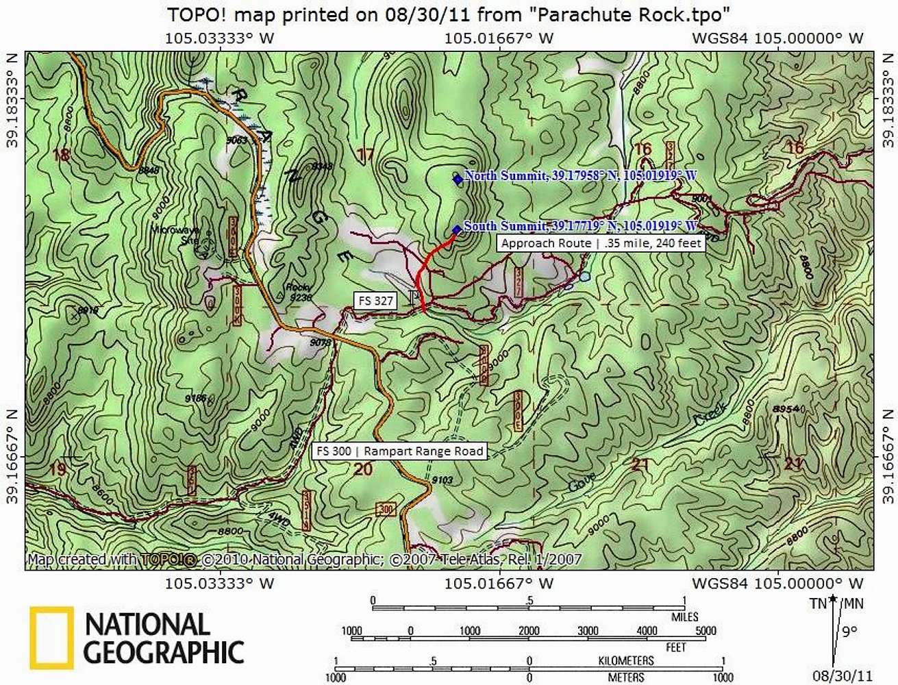
Finding "Parachute Rock"
View High-Resolution Image
Finding "Parachute Rock"
Standard access to “Parachute Rock” is via FS 300 (Rampart Range Road) to FS 327.
Map designed August 2011
« PREV
NEXT »
Sarah Simon
on
Aug 30, 2011 7:42 pm
Comments & voting
Other parents
Lat/Lon:
39.17948°N / 105.01912°W
Image Type(s):
Topo/Diagram
Image ID:
742348
1660 Hits
0
% Score
0
Votes
Log in to vote
Comments
No comments posted yet.
to post!
Don't have an account?
"Parachute Rock"
(Mountain/Rock)
« PREV
Viewing
#25 of 25
GALLERY
You are at
the Last
Image
Sarah Simon's Image Gallery
« PREV
Viewing
#5146 of 5480
GALLERY
NEXT »
×
You need to login in order to vote!
User Name
Password
Remember me
Forgot your password?
Log me out when I close my browser.
Keep me logged in all the time.
sign in as a user
Don't have an account?
Register now for FREE
Rating available
Suggested routes for you
People who climb the same things as you
Comments Available
Create Albums
Register Here


