


-
 2677 Hits
-
 79.78% Score
-
 11 Votes
|
|
Route |
|---|---|
|
|
45.80960°N / 7.24414°E |
|
|
Hiking |
|
|
Summer, Fall |
|
|
Half a day |
|
|
E/F (Easy Excursion) |
|
|
Note
|
La montagna chiama i suoi figli, ed essi rispondono fedelmente al suo appello… Osvaldo Cardellina, Diario alpinistico, 1964-65 Page texts: @ OsvaldoCardellina "Osva", passed away on May 2, 2022. Page owners: Christian Cardellina e Osvaldo Cardellina. Any updates from September 12, 2022: Antonio Giani, page administrator, friend and climbing companion. Testi della pagina: @ OsvaldoCardellina "Osva", scomparso il 2 maggio 2022. Proprietari pagina: Christian Cardellina e Osvaldo Cardellina. Eventuali aggiornamenti dal 12 settembre 2022: Antonio Giani, amministratore della pagina, amico e compagno di salite. |
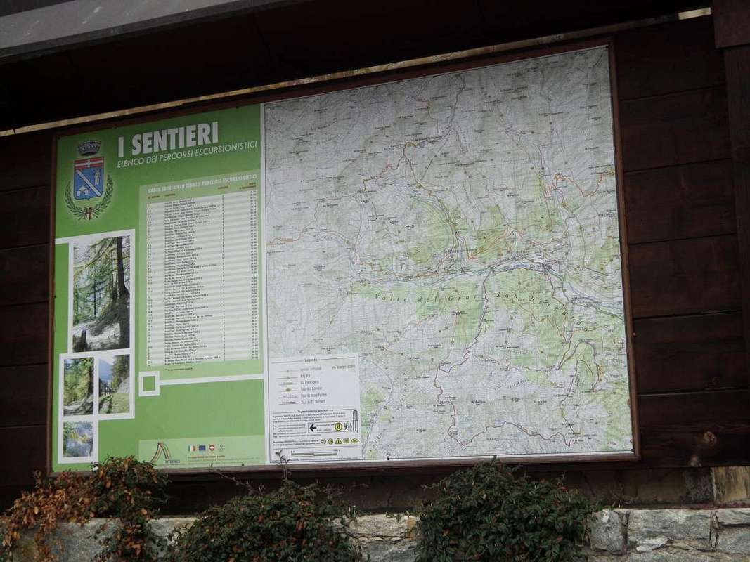
Walks Overview Hikings
The Aosta Valley has a multitude of places where it's possible make beautiful and easy hikes and a serie of trips. In this little work, however, you do not claim to let you all know completely, at least in all its main vallons or small valleys, proposing instead a series of trips, one for each of them, with the primary objective to make a 180° across the lower-middle part of the Valley of Gran San Bernardo. On the whole but, above all, because in all the same will be taken into direct vision of the whole territory. Pheraps a very huge demand or at least exaggerated? Maybe, but exist good guarantee of the feasibility of this end point, although with a single outing for each such session.
Rio Artanavaz or Buthier de Bosses divides at the beginning the vallons This time starting by Aosta reach Gignod Common. Besides opening dates back to large fan Gr. St. Bernardo Valley with a series of more or less small vallons: Buthier, Arsy, Flassin, Citrin, Serena. The waters of which flow into first in Rio de Artanavaz or Buthier de Bosses and Buthier of Ollomont and then unite with the Buthier of Valpelline and generally become the "Buthier", which flows into the Baltea in Aosta after the Arch of Augustus. The ancient Celtic "Bu and Boud" and Roman "Buthiacus and Bautegius" in the Middle Ages become "Balteus" as for the "Dora" in which just pours. Both have left ominous signs in the Valley. Together with Dora Ferret and the Torrents Sapin, Planavalle, Vertosan, Clusellaz constitute the largest catchment area of this vast area, which now has more lakes fed by glaciers that now almost completely disappeared. In fact, for someone ritrovarene it is necessary to climb to Etroubles where the Glacier du Mont Velan powers the Menouve Torrent. So an area, Mont Velan excluded, more suitable for the practice of Hiking that facing away from the Mountaineering or Climbing; an area specifically indicated for Walking into the valleys until the above hills. Seven are also considered the requirements for basic routes description, with the elasticity of only two factors missing for each, which can be summarized in this way:
1)- paths or marked trails, or failing this, simply always detectable both up during descent and where possible coincident. In any case always easy to identify and to follow.
2) - easy route with itineraries aimed at E (Walkers) or EE (Expert Hikers), with the occasional use of the upper limbs; difficulties on rock from F (Easy) At the F+ ((middle intermediate grade more), with steps not greater hardly ever than the I°/I°+ (U.I.A.A. Scale or Union of the International Mountaineering and Climbing Federation).
3) - lack of glaciers or marginal traverses on thereof; snowfields or presence of glacial-snow-capped with a slope of no more than 30/35 degrees and possibly free of crevasses.
4) - possibility of having at not great distances good support points as camps, bivouacs, refuges, alps or natural shelters, generally always well marked along the entire way.
5) - in the absence of these, there are points of cover from the elements as natural shelters, caves in the rock, Alps or "Casotti" (Cabins) by the Parks or Forest Rangers Huts.
6) - absence of large and more or less obvious objective dangers over the path (falling stones, landslides, avalanches, snowslides or simply collapsing scaffoldings glacial).
7) - vantage point of first order of the entire valley visited, possibly central and still to allow the full view on the same and in distance at least over a part of the Valley of Aosta.
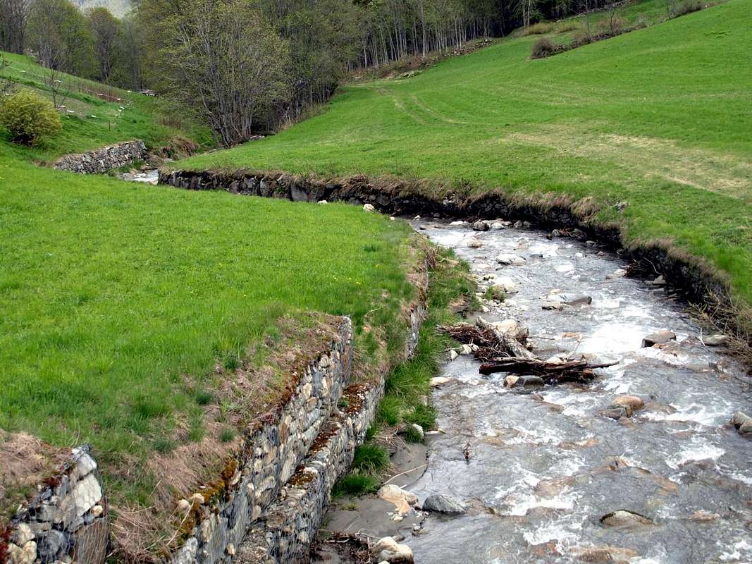
 Rio Artanavaz the end of his "race" at Moulin between Roisan Gignod
La Valle di Aosta possiede una infinità di posti dove si posson effettuare belle e facili escursioni. In questo piccolo lavoro, invece, non si ha la pretesa di farvele conoscere completamente, almeno in tutte le sue principali Vallate, proponendo invece una serie di gite, una per ognuna d'esse, con l'obiettivo primario di farvi spaziare a 180° su tutta la parte medio-bassa della Valle del Gran San Bernardo. Su tutta ma, soprattutto, in tutta perché le medesime comportano la presa in visione diretta dell'intero territorio. Pretesa forse enorme o perlomeno esagerata? Può essere, ma esiste la certezza della fattibilità di un punto d'arrivo, anche se con una singola gita per ciascuna d'esse. Partendo da Aosta si raggiunge Gignod. Oltre risale aprendosi a grande ventaglio la Valle del Gran San Bernardo con tutta una serie di più o meno piccoli valloni: Buthier, Arsy, Flassin, Citrin, Serena. Le acque dei quali confluiscono dapprima nel Rio Artanavaz o Buthier de Bosses e nel Buthier d'Ollomont per poi unificarsi con il Buthier de Valpelline e genericamente diventare il "Buthier", che sfocia nella Dora Baltea ad Aosta subito dopo l'Arco d'Augusto. L'antico celtico "Bu e Boud" e romano "Buthiacus e Bautegius" che nel Medioevo diventerà "Balteus", come per la "Dora Baltea" nella quale appunto si riversa. Entrambi hanno lasciato segni funesti nella Valle. Insieme alla Dora di Ferret ed ai Torrents Sapin, Planavalle, Vertosan, Clusella costituiscono il grande bacino imbrifero di questa vastissima area, che ormai é alimentata più dai laghi che dai ghiacciai ormai quasi del tutto scomparsi. Infatti per ritrovarne qualcuno é necessario salire ad Etroubles dove il Glacier du Mont Velan alimenta il Torrent de Menouve. Quindi una zona, Velan escluso, più idonea alla pratica dell'Escursionismo che non rivolta all'Alpinismo ed all'Arrampicata; un'area molto indicata anche per le Passeggiate nei valloni ed ai vari colli. Sette, inoltre, sono i requisiti per la descrizione degli itinerari di base ed altri, con l'elasticità di solo due fattori mancanti per ognuna d'esse, che così son riassumibili:
1) - sentieri o percorsi segnalati, oppure in mancanza, sempre semplicemente individuabili sia in fase di salita che discesa, laddove possibile coincidenti ed inoltre piuttosto facili.
2) - facilità della via con itinerari rivolti ad E (Escursionisti) oppure ad EE (Escursionisti Esperti), con l'utilizzo saltuario degli arti superiori; difficoltà su roccia da F (Facile) al massimo a F+ (Facile superiore), con passaggi che non vanno quasi mai o quasi oltre il I°/I°+ (Scala U.I.A.A. o dell'Unione Internazionale delle Associazioni Alpinistiche).
3) - mancanza di ghiacciai od attraversamento marginale dei medesimi; presenza di nevai o glacio-nevati con pendenza non superiore ai 30°/35° e possibilmente non crepacciati.
4) - possibilità di avere a non grandi distanze buoni punti di appoggio come accampamenti, bivacchi, rifugi o baite in genere sempre ben segnalati lungo l'intero percorso.
5) - in mancanza di questi, esistenza di punti di riparo dalle intemperie come ricoveri naturali, grotte, Alpeggi o Casotti dei Parchi o della Forestale (attenzione, in genere privati).
6) - assenza di grandi e più o meno evidenti pericoli oggettivi sovrastanti il percorso (cadute di pietre, possibilità di frane, valanghe, slavine o semplicemente crolli glaciali).
7) - punto panoramico di primordine sull'intera vallata visitata, possibilmente centrale e comunque tale da consentire la vista completa sulla medesima nonché in lontananza.
Getting There
BY CAR:
- From TORINO, MILANO, etc: Motorway A5. Exit at IVREA or Quincinetto (PIEDMONT).
- From IVREA Town: in West towards Pont St. Martin, Donnas, Bard, St. Vincent, Châtillon, Nus, St. Christophe, Aosta, Gignod, Etroubles and St. Oyen Municipalities. From Courmayeur Resort: before in East to Morgex, La Salle, Saint Pierre, Sarre, Aosta Municipalities; after in Northwest towards Gignod, Etroubles, St. Oyen Communes.
- From Aosta Town towards the lower Great Saint Bernard Valley From Gignod Commune (988m) with Great Saint Bernard SS.27 to alternative nearby Condemine Hamlet (1.137m); leaving left through Municipal Road to Grand e Petit Buthier Villages (1.302m, 1.439m) in Chaligne Comba. From this last, with private dirt farms roads and through Mendey, Roncaille, Rombason Pastures up to the Chaligne Shelter (1.936m), below Costa Tardiva (2.380m), Tardiva Hill (2.410m) and neighbor the Punta Chaligne (2.608m). From Etroubles Commune (1.270m), with dirt road and through Champ-Reclos (1.425m), Yettes (1.591m), Eteley (1.716m), fork before Praz-Gallet (1.626m), Ars (1.975m) Pastures on Arsy Vallon, up to Chaz d'Arsy (2.543mn); from this paths to Ars Pass (2.534m), Costa Labiez (2.632m). From Etroubles Commune (1.270m), with dirt road through Champex (1.411m; fork), Flassin de Meitin (1.654m), Flassin (1.700m), Tsa de Flassin (2.258m) Pastures on Flassin Vallon; from this paths to Fenêtre Pass (2.729m), Flassin Hill (2.605m), Testa Cordella (2.663m) and Tête Bois de Quart (2.248m). From Saint-Oyen Commune (1.377m), with SS.27 to alternative 1.502 meters; leaving North the same to great St. Bernard Hill, continue West to St. Leonard Fraction. From this to Citrin Vallon up to the Mont Flassin (2.772m) Citrin Hill (2.484m), Punta Valletta (2.801m) and La Raye du Sodzé (2.640m). From Saint-Oyen Commune (1.377m), with previous Municipal Road to Mottes (1.660m) Fraction, Farettes (1.666m) Village; from this, with path through Arp du Bois Dèsott Pastures (1.936m), alternative 1.959 meters to Serena Vallon up to the Hill Serena (2.547m) and Testa Serena (2.830m). Variant: continue West from Farettes Village to Saint Michel (1.732m) Fraction; from this last, tourning South always with Municipal Road, to Arp du Bois Dèsott Pastures.
- From FRANCE: through the Mont Blanc Tunnel to Entrèves-crossroads to Vény/Ferret Valleys - Mountain Guides of Courmayeur - La Saxe Rock Gym - Courmayeur. By Little Saint Bernard Pass, closed since November until half May to La Thuile Valley - Pré Saint Didier - Courmayeur. It is not necessary to take Motorway A5: you can drive on SS.26, in the direction of AOSTA - IVREA - TURIN.
BY PLANE:
- Aeroporto "Corrado Gex" Saint Christophe (Aosta).
Routes Description
 Val Buthier
1) - Chaligne Shelter (1.936m) and Pointe Chaligne (2.708m) or towards Mont de la Tsa (2.742m): towards the new refuge reached before with road in asphalt by Grand Petit Buthier (1.302m, 1.439m) and after through the dirt roads, continue towards the North by the latter, concomitant with the path n° 2A/3A, arriving at
a) - Tardiva Pass (2.410m) at the Southern end of the Costa Tardiva (2.380m). More precisely, from the refuge continue South through the forest path n° 2A/2B until you reach the above small pass 2.126 meters.
b) - Leaving to the left the path that goes back to the South at the Plan de Debat, in the Eastern Slope of Pointe de Chaligne, cross to the West instead coming up with a small path not numbered towards the Tsa de Metz (2.251m). This briefly with the path n° 6/7B to Colle di Met (2.485m) and North Crest in final part (E/F; 1h'10/1h'25). From the hill overlooking the Valley of the Arsy of Ars back toward the Southwest on the watershed with the small path n° 2A/3 bypassing the altitude of 2.484 meters in the direction of the wide saddle (2.518m) with the Pointe de Chaligne (2.608m).
c) - From this, or just before turning right (Northwest) continue always easily along the ridge with scattered traces, easily exceeded the quota (2.535m), with around a semicircular ridge on the East-Southeast division between the Vallons of Chiusella (in South) Arsy (North), both easily to the Mont de la Tsa (2.742m) above Tardiva's Hill (E/F; 0h'50/1h'10 from Passo Tardiva or by shelter; 2h'40/3h'10 in total).
 Ars or Arsy Vallon
2) - Mont Fallère (3.061m) from North: to achieve this you must pass mandatory side of the Great Saint Bernard Valley with various different possibilities of approach, starting from the lower-middle part by the SS.27, leading into the Ars also Arsy Vallon, or by Condemine Village with trail n° 3C also from Echevennoz Hamlet or Etroubles Municipality. Starting by Etroubles (1.270m) via the path n° 5 concomitant with the private road until the junction about 1.400 meters immediately after the village neighbor Alp Lavanche and before Champ-Reclos (1.425m); left on the left (Southeast) a secondary deviation, even from Echevennoz Dessus (1.264m), with path n° 5A, it continues in the opposite direction on the main road to gradually reach the Pastures of Yettes (1.591m), and through the Bois (Wood) de Peson and discarding the right to further branching Teppes (1.879m), those successive Eteley (1.716m). Continuing towards the vallon floor and crossing the Torrent d'Ars, you reach a junction immediately before the Alp Praz-Gallet (1.626m), which is to the left; this finally with a long diagonal to the South-southeast into forest to reach the Ars or Arsy Alpage (E; 2h'15/2h'30).
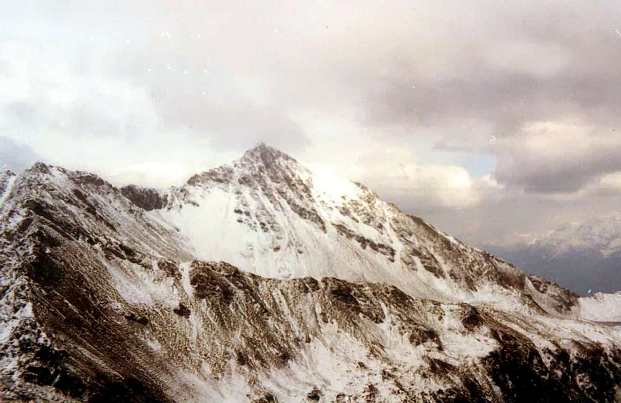
The North Slope is split into two sides: one is farther North-northeast between the East-Northeast Crest (see itinerary below) and a large pillar of broken rocks turned decidedly to the North; this debris over a wide side-rocky stretches from the left (East) to the right towards the large Shoulder (2.971/3 meters about) of the Northwest Ridge in its most Northern branch, which descends to the Col d'Ars (2.543m) among the namesake vallon and the side Flassin. While the former is totally inadvisable, if not with the exceptions suggested in the following itinerary, as regards the second is to note how the same constitutes the "Normal Route" coming from the Low-Middle Valley of the Great St. Bernard; nevertheless it is really poorly attended, although the construction of the Bivouac of the Forest in recent years may have increased the number of visits, at least, being private and closed by the Guards themselves. Maybe in the distant past, when there were no South Slope on the current private dirt farms roads that facilitate the approaches, it was more because the slopes were almost identical to go so that route also appears to have been down in 1904; in practice today is almost completely fallen into disuse for the fact that the almost total absence of snowfields (up to forty years ago there until late in the season) makes the climb somewhat boring and completely devoid of a trail. In turn, however, this face is divided into two distinct sectors: a usually with some debris falling rocks in the terminal directed more to the East, which culminates on the shoulder at about 220 meters from the true Summit and a second much more rocky is subject to the same stretching to Quota 2.971/3 meters around or large shoulder on the opposite side. The latter which until 1971 was still unexplored, has been directly uphill, and perhaps for the only time in 1972; you in any case it is not recommended and dangerous climb to the steepness and poor quality of the rocks at the bottom. Limit then the description is solely for the first route, so to speak "classic or traditional", which, precisely, salt decidedly more to the left. From the Alps of Arsy, reached with one of three regulated approach described above, climb progressively towards addressing Southeast through grassy slopes and bumps of debris; left to right (west) of the three Arsy Ponds, directed towards the base of the Pillar in North altituidine 2.776 meters. Do not get this but, going off to the right (West), and go up through the end boring or very fine and "chopped" debris in the beginning of the season, with snowfields slope from 30° to 38° (usually very hard snow, which requires the need to have with him an ax, or even crampons); then arrive with increasingly steep climb in altitude around 2.970/80 meters. Relying more and more diagonally to the left in the last 70 meters to reach the Great Shoulder or Eastern Top and with a crossing of about 220 meters on the Eastern Crest, equipped with chains, to achieve the true Summit (EE/A/from F to F+; 2h'00/2h'30 by the Tsa of Arsy; 3h'30/4h'15 in total starting from various points above).
 Combe de Flassin
3) - Towards Tsa Flassin and various routes to Northern Fallère Group (3.061m): from St.-Oyen (+; 1.373m) towards the wooden small bridge above Artanavaz Torrent, Hotel Mont Velan, Campings "Mulino & Pineta", through dirt road concomitant with the trail n° 7 between Rond Champex Pastures, Flassin de Meitin Pasture (+; 1.654m), Montagna Flassin (1.700m), crossing the torrent in altitude around 2.210/20 meters to Upper Tsa Flassin (2.258m; E/F; 2h'30/3h'00), into large hemi circular Northern basin below Testa Cordella (2.663m) Mont Flassin (2.762m) near Flassin Hill (2.607m) and Fenêtre Pass (2.728m), Western Shoulder (2.973m) above the North-northeastern Ridge Mont Fallère (3.061m; private and closed shelter by Forest Rangers reached with path n° 7D) towards the Ars Pass (2533m), nearby Costa Labiez Grande Testa (2.457m).
4) - Crossing from Testa Cordella, Mont Flassin, Mont Vertosan towards Fenêtre Pass (2.663m, 2.772m, 2.605m, 2.758m, 2.689m, 2.822m, 2.729m) Approach from Aosta Town through the Great St. Bernard State Road n°27: by the Municipality of Saint-Oyen (1.373m), accessible from the State Road and abandon this, past a bridge over the Rio Artanavaz (Torrent or little stream), come to the Pasture of Pré Neue (1.324m), at the two "Camp del Mulino" (Mill) and "Pineta". Through the farms private dirt road to the trail concomitant n° 7, climb heading Southwest with the Alps of Champex (1.411m) to the East and Rond (1.447m) to reach the nearby Flassin de Meitin (Middle; 1.654m); in a short time through a long diagonal route in South to reach Flassin Pasture (1.700m). From this, going high to the East above the eponymous Torrent reach an altitude of about 2.200 meters, where, turning decidedly to the West, it passes over the coming Tsa (Higher Alp) de Flassin (2.258m; 2h'30/3h'00). From the Upper Alp Flassin or Tsa de Flassin leave the path n° 7 that climbs to Col Flassin, or continue with the same rejoining the hill with the route by Vertosan Vallon (Joux Saddle above Vens Village). Instead go up through the path n° 7B to the Northwest and arrive at an old alp 2.439 meters in ruins. From this continue reaching the Testa Cordella (2.663m) on Southeastern Slope; through this easy trail on watershed to the South, after a small saddle 2.606 meters, reaching a first shoulder or Northern Antesummit (2.767m), from which through the easy West-northwest Crest to the Summit (EE/F+; 1h'00/1h'15 from testa Cordella; 2h'15/2h'45 from Tsa de Flassin; 5h'30/6h'00 by St. Oyen). From Mont Flassin South or better Southeast (2.772m) down through the short, easy, grassy Ridge Southeast towards the below Col Flassin (2.605m), continuing on the watershed, with semi-circular path always Southeast, are reached in succession the Quota 2.758 meters, the carving 2.689 meters or Colle Western Vertosan and soon the Mont Vertosan (2.822m; EE/F; 1h'00/1h'15 by Mont Flassin SE). More than a short descent through the debris Cresta East-northeast leads to the Hill Window (2.729m, stone cairns and numerous positions of hunting). The descent from the same to return in Flassin Vallon is via steep and stony, doubled to the right (East), a rock band, you reach the Tsa (EE/F+; 0h'45/1h'00; with fresh snow the descent is more delicate, calculate almost twice as long; overall EE/F/F+; 7h'30/8h'30 round trip St. Oyen).
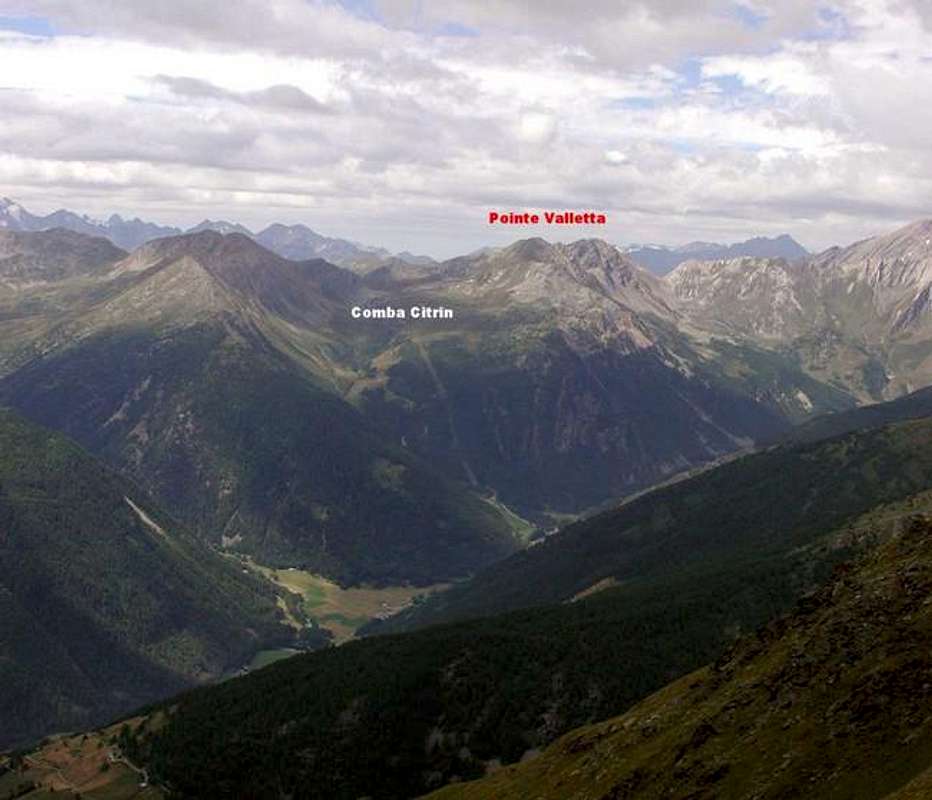
 Comba Citrin
5) - Towards Tsa de Citrin, Citrin Hill (2.484m) and Mont Flassin (2.772m): from St. Oyen reach the Fraction of Bosses Saint Leonardo (1.519m). From this, fording Rio Artanavaz, continue with trail n° 8/VA towards the South until the Middle Montagna Citrin (2.005m). Going up, but more to the Southwest, always through the path n° 8/VA for the Upper Montagna Citrin (2.258m) reach the Citrin Hill (2.484m; E/F; 2h'45/3h'15). From the hill climb on the Ridge watershed Northwest reaching the two altitudes 2.611 meters, 2.767 meters or Northern Antetop, from which in a short time, after a small notch on the ridge, with always easy route to the Summit (EE/F/F+; 0h'50/1h'00 from the hill).
6) - From Citrin Hill (2.484m) towards Punta Valletta (2.801m): with the preceding route until the pass; from this turning right (West-northwest) climb on enough easy East-southeast Crest, possibly avoiding some short step to the left (South) in the low part (EE/F+; 0h'50/1h'00 from the hill; 4h'00/4h'15 from Saint Leonardo Fraction).
7) - From Tsa de Citrin (2.312m) towards "Raye du Sodzé" (2.640m): with the previous route until the Tsa (Upper Alp) de Citrin through the trail n° 8/VA. From this continue West-southwest on morainic Eastern Slope of Cote de Citrin between Citrin Serena Combes reaching the altitute called "Raye du Sodzé or Ledge of the Woodcutter". This is no more than a shoulder of the Northeast Ridge coming down from Punta Valletta leaving South the tiny Lake Citrin (2.445m) (EE/F; 1h'15/1h'30 from highest alp).
8) - Col Serena (2.547m) to Testa di Serena (2.830m): approach from the Fraction of Mottes by the State Road towards the Great St. Bernard Pass. Mottes (1.660/70m, Village of Bosses, accessible from the National Road No. 27 of the Gran San Bernardo) address itself to the West down slightly to pass under the highway to the "big bend", immediately after fording the Rio (Torrent) d'Artanavaz above a small bridge just after Farettes Pasture (1.666m). Continue to the Southwest with trail n° 9 can be reached in the progression the Pasture of Arp du Bois Dèsott (1.935m), where comes, passing near Bernard Alp, even a path not numbered from Alpages Merdeux Dèsott (1.919m), Côtes (1.930m) and Potz-Ardusi (1.784m) on trail of the Alta Via n° 1 and at the entrance of the real and long Comba's Merdeux. Continue instead to Southwest always through the path n° 9, which goes completely shorter Comba Serena to reach the hill of the same name, also known as "Fenêtre de Sereina" (2.547 m; E/F; 2h'30/3h'00). From this climb on brief and easy Crest Northwest, with rotten rocks and debris, reaching before the junction 2.663 meters with the Corléans Ridge (2.807m, towards Northeast) and just after, with trail more to the South on Northern Crest, enough easily the Summit (2.830m; EE/F/F+; 0h'45/1h'00 from hill; 3h'30/4h'00 by Mottes).
9) - Costa di Serena or "Côte Sereina" (2.710m, 2.745m, 2.785m) from Serena Pass: from the hill climb in short time above the brief Southeast Crest of Quota 2.710 meters at the beginning of the Serena's Coastline. Before continue North until the following Altitude 2.745 meters; after, flexing more to the North-northwest, reach an Altitude 2.736 meters, just above a subsequent carving (2.675m). This point, always going up between rocky slope (East) and easy grassy (West), reach the highest Summit (2.785m), where the crest end with an almost vertical wall of about a dozen meters over a more large saddle to Crêton du Midi (see photo below; EE/F/F+; 1h'30/2h'00 from hill).
10) - Crêton du Midi or "Costone di Mezzodì" (2.945m) from Serena Pass: from the saddle about 2.775 meters continue on watershed flexing progressively to the North through a serie of steps more dangerous that difficult with great exposure to the right (East) above the steep Southeast Face, characteristic for the slabs of inclined calcschists to 50°. This ridge rises linearly for about 80 meters to a rocky terrace; after with steep and delicate slope, leaving the left (West) grassy-rocky slopes, you reach the double Summit (EE//F+/PD-; 2h'30/3h'00 from hill). Downhill should go through to the Grand Crêton until you reach the saddle 3.013 meters and from this well in wide ride through the Planaval Vallon back to Serena Hill. Or go directly down to the Comba du Merdeux through one of three steep couloirs where the snow remains until late summer.

Essential Gear
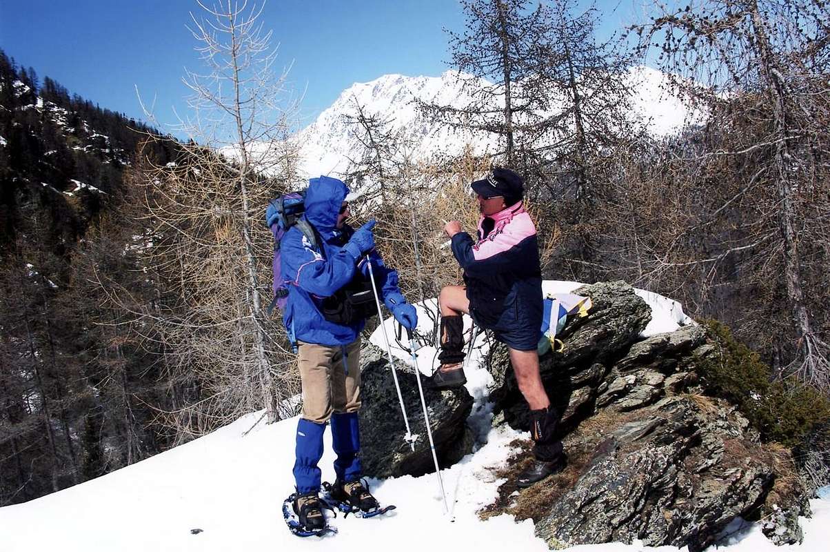
DIFFICULTIES These routes can be considered E/F or EE/F+ (Experts Hikers) in winter (even by snowshoes or Ski).Gli itinerari sono da classificarsi in E/F oppure EE/F+ (Escursionisti Esperti) in inverno (anche tramite Racchette da neve od in Scialpinismo).
EQUIPMENT Hiking gear, in winter as for Ski-Mountaineering or with Snowshoes.
Da Escursionismo, in inverno da Scialpinismo o con Racchette da neve.