
-
 12515 Hits
-
 83.57% Score
-
 17 Votes
|
|
Mountain/Rock |
|---|---|
|
|
39.83325°N / 105.64416°W |
|
|
Clear Creek |
|
|
Hiking |
|
|
10921 ft / 3329 m |
|
|
Overview
Fox Mountain
Distance: Less than a mile each way
Starting Elevation: 10, 470 ft
Elevation Gain: Approximately 500 feet
Trail: To St, Mary’s Lake
Season: Year Around
Jurisdiction: Arapahoe National Forest
Maps: USGS 7½ - Empire, County – Clear Creek
USFS – Arapahoe National Forest, TrailsIllustrated #103
Most of people visiting St. Mary’s Lake or ‘’glacier’’ are not aware of this little mountain. Even,most of hikers going after James Peak bypassing Fox Mountain like it’s not there. Fox Mountain is more like outcrop rising above St. Mary’s Lake but at same easy approach makes you want to hike this liittle peak. This is short and easy hike to the top of Fox Mountain, but hike will get you over 11000 ft or 3300 meters in no time.
Getting There
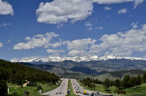
James Peak Wilderness from Gennese Park and I-70
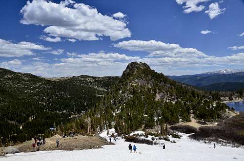
Fox Mountain
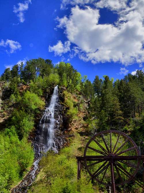 Bridal Falls, Idaho Springs
The hike to St. Mary's Glacier is a short one and includes a beautiful little lake which is fed by the glacier. Directions to the trailhead:from Denver, take I-70 west and follow it past the town of Idaho Springs. Then take exit 238 which is marked “Fall River Road”. From there, take aright, (north), on Fall River Road.You’ll see the sign for St. Mary's Glacier and the town of Alice.Follow Fall River Road past the town of Alice until you see the sign on your left that says: Glacier Hike. This is your trailhead and it’s approximately a twenty minute drive here from I-70. There are some hairpin curves on this road but there are also lots of aspen trees along the way so it makes for a beautiful drive in the fall. Anyway, the parking area is just beyond the trailhead, on your left.The parking area has been expanded and now has 23 spaces. It can actually handle 30-40 vehicles when people who arrive in groups, double park. In addition, the owner of the parking area, (Paul Johnson), has opened anew and bigger parking area which will hold well over 100 vehicles. This new parking lot is located just before the trailhead, just before mile marker # 9,on the left side of the road.Both of these parking lots have 2 porta-potties,trash/recycle cans, dog waste bags, will be open year-round, and overnight stays are allowed. The parking fee is $5.00 per vehicle, per calendar day, and the accepted methods of payment are cash or check only. If you are paying cash,please have the exact amount since there is no place to get change.
Route
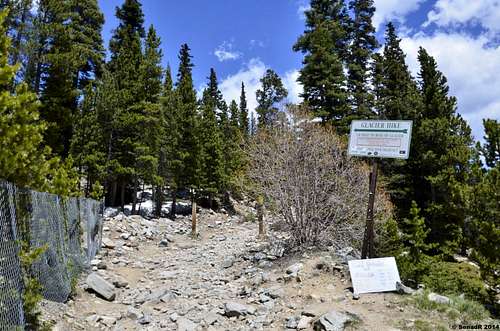
Turn off from the road
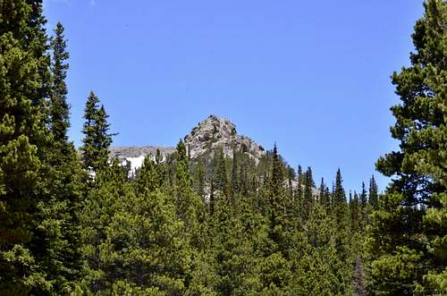
Fox Mountain from the road
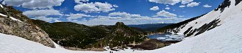
 Area around the Lake
From the four-way intersection, proceed south up and old mining road for about ten minutes to a bend in the road toward north. Follow a trail which passes to the west, on the north side of the creek. Approximately in 15 to 20 minutes or so you will reach St. Mary’s Lake. Fox mountain is more than obvious outcrop, somewhat conical shape, seating next to the St. Mary’s Lake. There is no trail, at least not marked that goes to the top, but summiting this little peak is easy and fun. Some scrambling is required close to summit.Vies from this little peak are great, and it’s worth it tag this mountain,regardless if someone hiking only to the lake or maybe hiking James Peak.
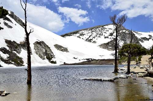
St. Mary's Lake
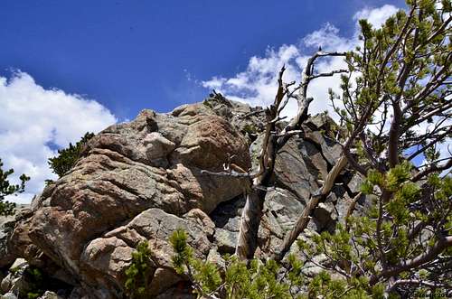
Summit block
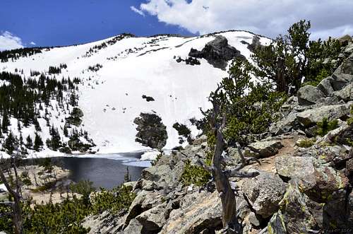 Lake from Fox Mountain
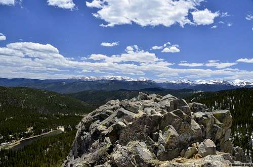 View from the summit.
Red Tape
Important NoteThe land through which you'll pass to reach St Mary's Lake and St Mary's Glacier is private. Landowners are not obligated to allow access, though they've permitted the public to do so for many years. Visitors should respect private land, stay on designated trails and pass with minimal impact. Fishing and camping may only take place on public lands north of the lake. It's the public's responsibility to know of and adhere to private property lines.
When to Climb
This mountain can be hike or climb year around. During the winter Fall River Road is plowed to the Trailhead.Camping
Camping and Backpacking Information
- Contact the Clear Creek Ranger District (303.567.3000) for the latest trail conditions and access restrictions before setting out.
- Camping may only take place on public lands north and west of the lake. It's the public's responsibility to know of and adhere to private property lines.
- Dispersed backcountry camping is permitted in the Arapaho National Forest. No permit is necessary. Camping is prohibited within 150' of any lake or stream. Group size is limited to 15 individuals.
- Campfires are permitted for dispersed camping in the backcountry, with potential seasonal restrictions. Campfires are not permitted above or within .25 miles of treeline, or within 150' of any lake or stream.
Forest Information
The Arapaho National Forest, comprised of 1,024,292 acres, is located in northern Colorado, northwest of Denver. It isadministered jointly with the Roosevelt National Forest. Of the total developed campgrounds, 17 meet the selection criteria.
SUPERVISOR ADDRESS
2150 Centre Ave.
Bldg. E
Fort Collins, Colorado 80526
970-295-6600
RANGER DISTRICT ADDRESSES
101 Chicago Creek
P.O.B. 3307
Idaho Springs, Colorado 80452
303-567-3000
Sulphur
9 Ten Mile Dr.
P.O.B. 10
Granby, Colorado 80446
970-887-4100