Welcome to SP!  -   
 
  MbPost.com -- It's SP for Mountain Biking!
Areas & Ranges·Mountains & Rocks·Routes·Images·Articles·Trip Reports·Gear·Other·People·Plans & Partners·What's New·Forum

Frey climbing area

 
[ Sizes: Orig | Large | Med | Small | Thumb ]
Frey climbing area
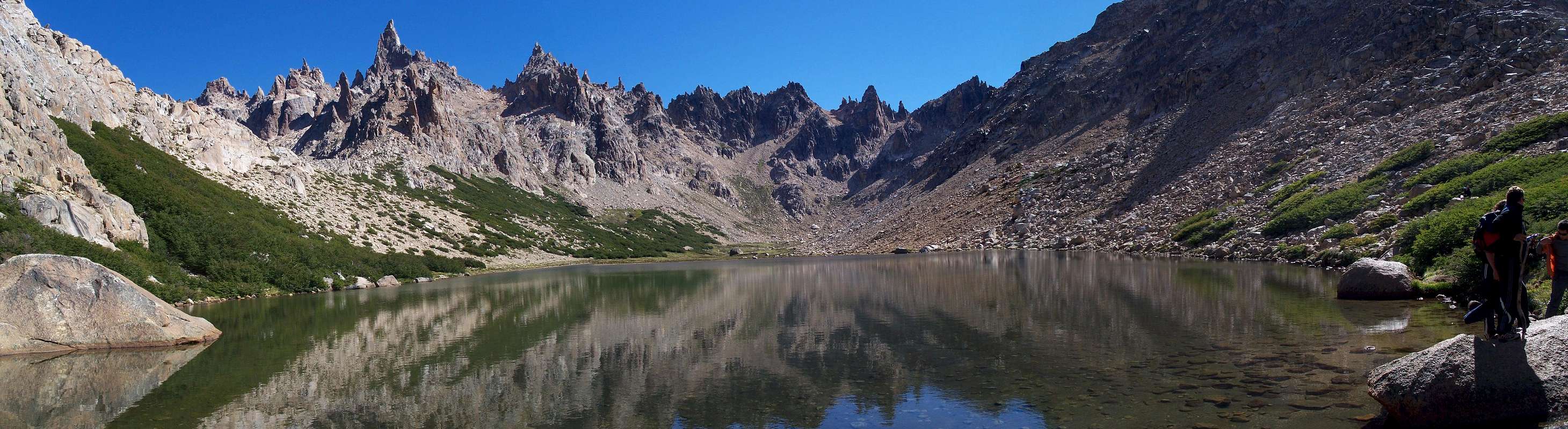
Frey climbing area as viewed from Refugio Frey. Torre Principal is the highest visible peak with Torre La Lechuza to its right. To get to Refugios San Martin or Lynch you would go round the right-hand side of Laguna Tonchek seen here and climb up a pretty steep zig-zagging north trending trail, past Laguna Schmoll and up an even steeper route onto the Cordon. Alternatively you can head up the ridge to the side of the hut (based on a map I've seen) - not sure about path conditions or if there is one.


Comments

No comments posted yet.


Sign in to post!

Don't have an account? Register now.


Rate This Image
Current Score: 86.43

Log In To Vote
Image Data

BaarbSubmitted by Baarb
on Feb 11, 2012 4:47 pm

Image ID: 776108
Hits: 34 

Lat/Lon: 41.19803°S / 71.48615°W

Image Type(s): Scenery


"Please do not use the cuneiform alphabet unless you're from ancient Mesopotamia."

© 2006-2012 SummitPost.org. All Rights Reserved.