
-
 13081 Hits
-
 82.48% Score
-
 15 Votes
|
|
Mountain/Rock |
|---|---|
|
|
39.66682°N / 105.77514°W |
|
|
Hiking |
|
|
Spring, Summer, Fall, Winter |
|
|
12902 ft / 3933 m |
|
|
Overview
Ganley Mountain 12, 902 ft / 3,932 m
Pendleton Mountain 12,275 ft / 3,741 m
Ganley Mountain and PendletonMountain are two unranked peaks in Clear Creek County, Colorado.
Ganley Mountain is named forJohn W. Ganley, the first postmaster of Silver Plume.
Pendleton Mountainis named after George H. Pendleton, the vice presidential running mate ofGeneral George McClellan on the unsuccessful Democratic ticket of 1864.
TrailInfo:
Length: 11.5 Miles
Elevation Gain: 1, 808 ft
Trail Elevation: 11, 594 ft
SummitElevation: 11, 902 ft
Juristiction: Arapahoe National Forest
Maps: USGS 7 ½ - Grays Peak;County – Clear Creek;
USFS – Arapahoe National Forest; TrailsIllustrated - #104
|

|
|
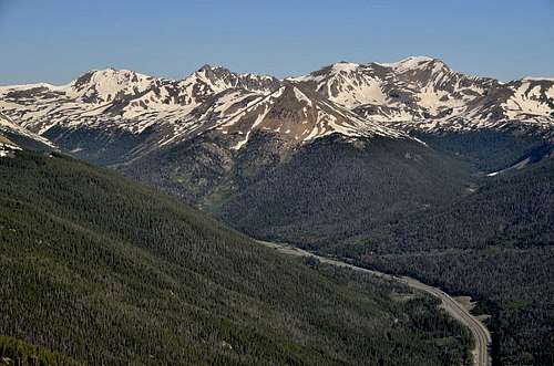
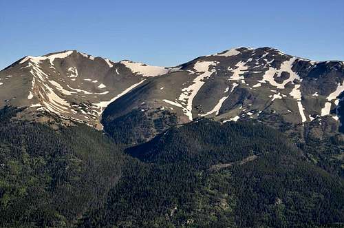
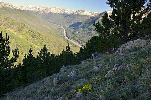
Hiking steep slope.
Views are getting better.
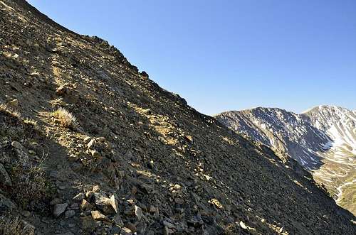
 Above timberline.
Getting There
Waldorf Mine:
From Intersection of Sixth and Rose Street in Georgetown,drive south and toward Guanella Pass for 2.8 miles, to a dirt road on your right. Turn off onto this road, take the right fork at 0.25 miles, another right fork at 0.5 miles and also at 1.0 miles from the paved road. In 0.2 miles further, take the sharp left fork and continue up the basin for a total of 6.25 miles from Guanella Pass Road, to the substantial ruins of the Waldorf Mine, just above timberline. Park here.Although this road can be quite rough in spots, passengers cars with good clearance can usually make it to this point.
StevensGulch:
Take Exit 221 at Bakerville on Interstate 70 and continue tothe south side of the highway and the start of Forest Road 189 (goes to theGrays Peak Trailhead). Start up the 189 road and after over a mile, turn righton the Grizzly Gulch road, park your vehicle at this junction.
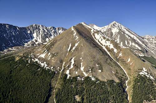
Hagar, Citadel and Petingel
Bard Peak and Mount Parnassus
Sniktau and Grizzly Peak
Route
From Waldorf Mine:
Begin hiking north up the road. After 0.65 miles, take the right fork. Just beyond, at a four-way intersection, continue straight(north). In 0.3 miles, take the right fork and sharp left fork in 0.3 more miles. The road continues in switchbacks. In 0.6 miles, take the right fork and again 0.1 miles later. In another 1.4 miles, take another right fork and soon there after, leave the road and ascend to the left (northwest) over thundra tothe summit of Ganley Mountain. A small cairnlies at the top. The view southwest to Stevens Gulch and two fourtneers, Greays and Torreys, is very rewarding. Descent northeast, loosing 600 feet over the 1.7 miles of tundra to the top of the Pendleton Mountain.Note that this peak is lower than intervening high points. The summit is marked by a small cairn.
FromStevens Gulch:
Cross Stevens Gulch road and find good place to enter trees and start ascending toward Ganley Ridge. This is route is pure bushwhacking, there is no trail or any signs of trail, the only way to go is up and it’s very steep. Be prepared for this very steep and unpleasant slope, your legs will be tested for sure. Once you break above timberline, Ganley Ridge becomes very obvious ridgeline above you. Ganley Mountain is very distinctive peak, it’s highest point on the ridge before you start going over to McClellan Mountain.
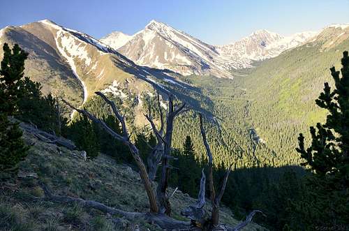
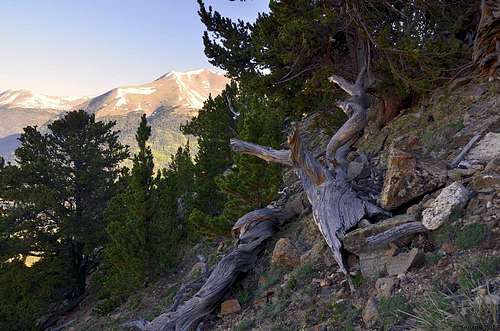
View of Kelso Mountain.
Almost to the top of Ganley Mt.
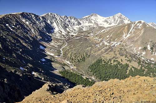 View os Stevens Gulch from Ganley Mt.
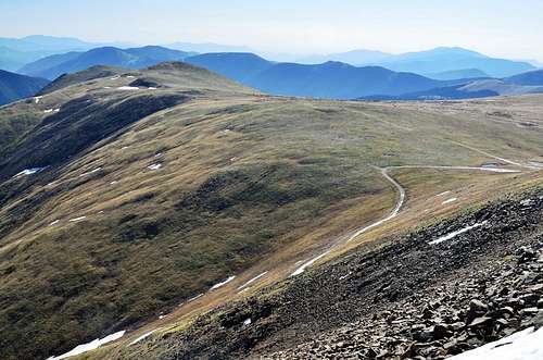
View toward Pendelton Mt.
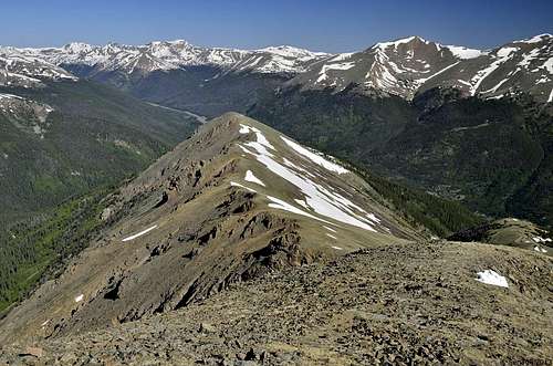
Looking back to lower ridge line.
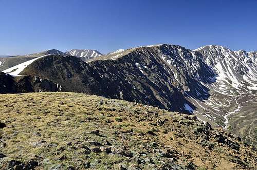 View from top of Ganley Mt.
Red Tape
<ahref="https: maps.google.com="" maps?hl="en&q=ganley+mountain+colorado&ie=UTF8&hq=&hnear=Ganley+Mountain&ll=39.668876,-105.776396&spn=0.055299,0.077162&t=p&z=14&source=embed" style="color:#0000FF;text-align:left" "="">View LargerMap</ahref="https:>