
-
 13923 Hits
-
 85.64% Score
-
 21 Votes
|
|
Mountain/Rock |
|---|---|
|
|
39.55028°N / 105.69326°W |
|
|
Park County |
|
|
Hiking |
|
|
Spring, Summer, Fall, Winter |
|
|
12335 ft / 3760 m |
|
|
Overview
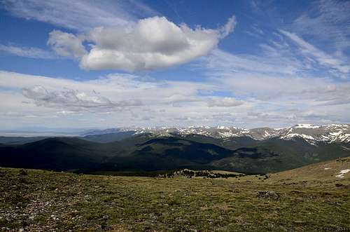
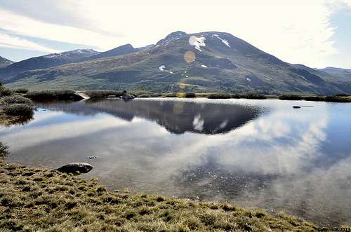
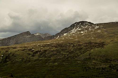
Geneva Mountain, view from the summit. (June 2013)
Trail Info:
Trailhead Elevation: 11, 669 ft
Round Trip Distance: 7 miles
Elevation Gain: 1636 ft
Summit Elevation: 12,335 ft
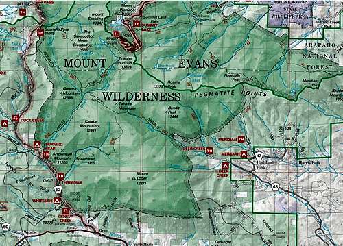
Local Maps: USGSMount Evans
Topo Map: Geneva Mountain Topographic Map
Guide Book: Colorado Summit Hikes for Everyone
Geneva Mountain is small mountain summit in Park County, Colorado, and this mountain is not to be confused with Geneva Peak, north of Webster Pass and farther southwest in same county.
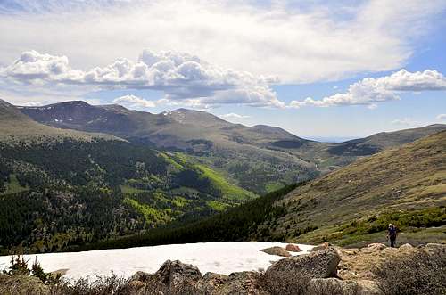
This hike is all above timberline and therefore affords extensive vistas over its entire lenght. You are likely to spot hikers scaling the nearby fourteener, Mount Bierstadt, as well as get a look at
its rugged Sawtooth Ridge. You are advised to arrive early, as the parking lot for this popular area fills up so quicly in the summer.
The area is critical to wildlife also.The thick stands of willows in the bottomland between Geneva Mountain and Mount Bierstadt attract large numbers of ptarmigan in the winter, seeking food and shelter.
Getting There
Directions:
From the North:
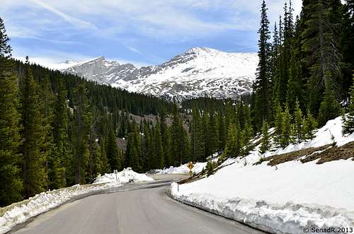
Take the Georgetown exit off of Interstate 70. Drive through Georgetown and follow the signs for the Guanella Pass Scenic Byway. Drive 12 miles to the top of Guanella Pass (11,700’) and park in one of the two large, paved parking areas on either side of the road. The Geneva Mountain trail starts near the parking area on the east side of the road. The upper parking area (on the west side of the pass) has restrooms.
From the South:
Take US 285 west from Denver or east from Fairplay. Drive to the town of Grant which is about 12 miles west of Bailey. In Grant, turn north on the Guanella Pass Scenic Byway and drive approx. 13 miles to Guanella Pass.
Winter access:
From the north: Usually only plowed to the campground approx. 3 miles below Guanella Pass.
From the south: Usually plowed to Duck Lake, approx. 1.75 miles below the pass.
Route
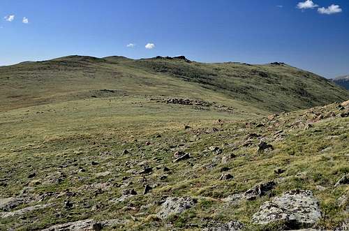
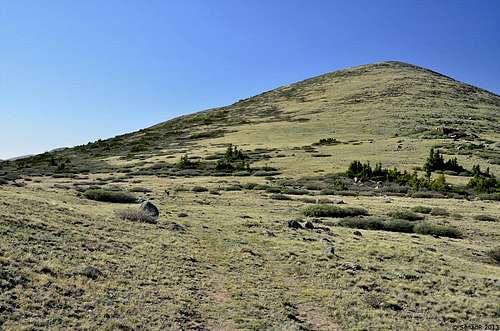
Begin hiking south-southeast on the trail from the Guanella Pass parking area. At first trail junction take left fork (Rosalie Trail) on Trail # 603.Within few minutes of easy hiking Geneva Mountain will appear with two very visible subpeaks to its right, real summit on third , the farthest looking peak. Continue on old road from the trailhead, and at next trail junction leave the road and ascend southeast(toward first subpeak), mostly over tundra. Skirt the first subpeak to the left(east) and cross directly over the second subpeak to reach the top of Geneva Mountain.Even Geneva Mountain is not much of mountain, vies from the summit are fantastic, if you like solitute and open tundra hiking above timberline with endless views this mountain is right fit for you.
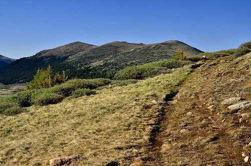
Geneva Mountain
Second Subpeak
 First Subpeak
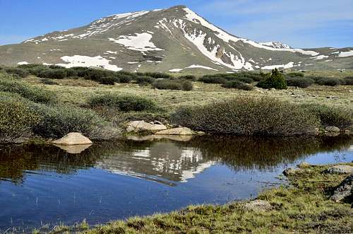
Square Top from the trail.
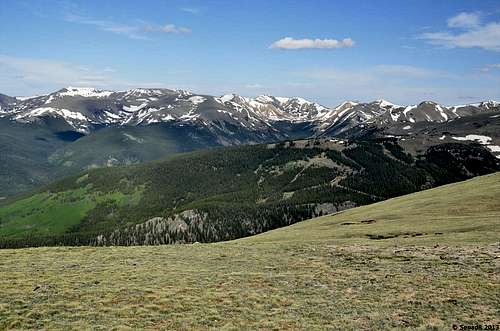
View of Mt. Bierstadt.
 Great views.
Images
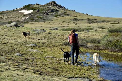
Beautiful Hike
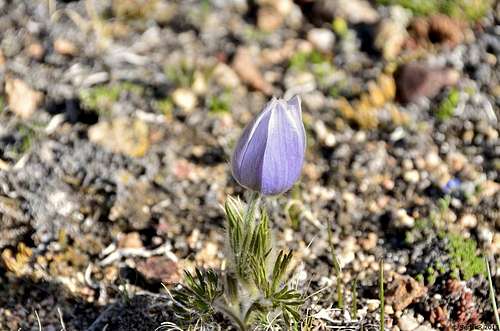
Pasque Flower
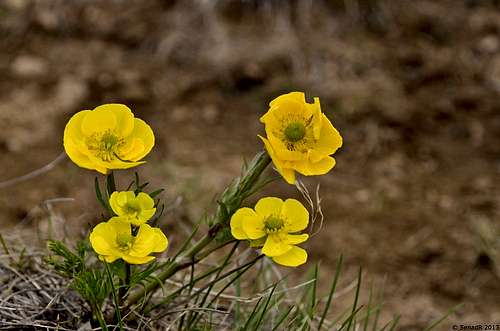 Butter Cups
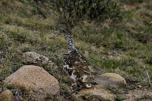
Ptarmigan
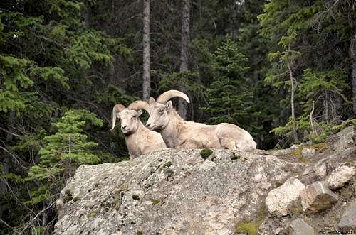
Bighorn Sheep
 Mt. Evans
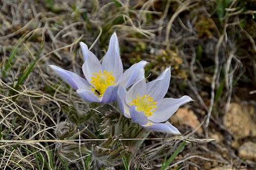
Wildflowers.
Mt. Bierstadt.
 The Views.
Map
View Larger Map
Camping
Campgrounds map
The campground is split into two loops by the county road and South Clear Creek. There are 18 sites in the campground.
Eleven are suitable for RV camping and seven are more suitable for tents. Most of the sites are in the open with some tent sites located among some spruce trees.
Each site has a picnic table and fire ring or grate. The maximum vehicle length that can be accommodated is 45 feet. The roads through the campground are gravel.
There is one water hydrant and one restroom in each loop. Both of the restrooms will accommodate disabled persons.
Reservations are accepted and can be made 5 - 240 days in advance.
The season for this campground normally runs from early June through mid September, depending on the weather. Check with the Forest Service for the current fees.
Features:
| 18 sites | Maximum spur length of 45 feet |
| Drinking water | Next to stream or lake |
| Two restrooms | Disabled facilities |
| Reservations accepted | Elevation: 10,900 feet |
External Links
Alltrails
rkymtn - Sep 9, 2013 1:36 pm - Hasn't voted
TH is south of the parking lotsThe Rosalie Trail may have once connected to the main parking area, but is now separated. It is located a short distance to the South of the parking lots and is on the east side of the road.
Senad Rizvanovic - Oct 10, 2013 2:25 pm - Hasn't voted
Re: TH is south of the parking lotsThanks for input, Happy trails!