
Viewing: 1-4 of 4

Dean - Feb 8, 2005 8:11 pm - Voted 10/10
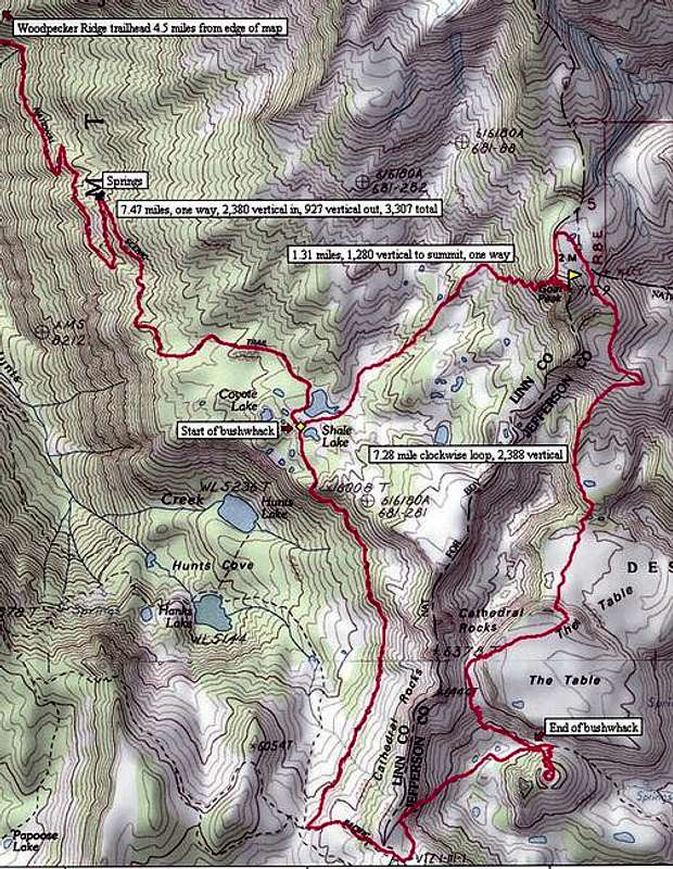
Great mapThis is one of the better ones I've seen posted at SP. Truly helpful and nicely done.

Don Nelsen - Feb 8, 2005 11:09 pm - Hasn't voted
Re: Great mapThank you Dean. I can claim little credit though, the NG Topo! software makes it all too easy!
dn

Saintgrizzly - Feb 8, 2005 10:58 pm - Voted 10/10
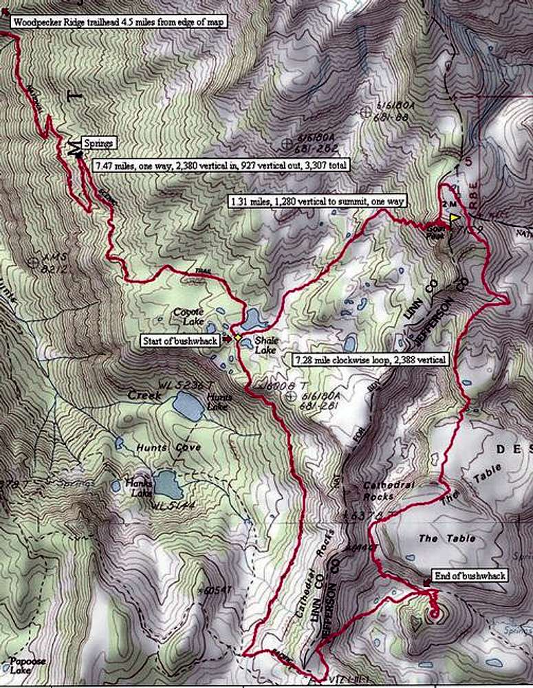
Don, your use of the GPS......is amazing! (Well, it is to me...!)
Don Nelsen - Feb 8, 2005 11:11 pm - Hasn't voted
Re: Don, your use of the GPS...Thanks Vernon! - but as I commented to Dean, the new software makes it all too easy (expensive, yes, but easy) :-)
Viewing: 1-4 of 4


Comments
Post a Comment