
|
|
Mountain/Rock |
|---|---|
|
|
34.62657°N / 112.07664°W |
|
|
Yavapai |
|
|
Spring, Fall |
|
|
6655 ft / 2028 m |
|
|
Overview
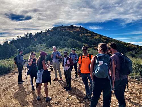
Goat Peak is a relatively unknown summit in the Black Hills within Prescott National Forest. It has very easy access and is just over five miles from a paved road. High clearance vehicles can easily get within nearly a half-mile from the summit. However, it is more often visited by hunters than hikers.
Goat Peak isn’t a hard mountain to hike. It is mostly on road. The last 250’ or so are pretty much off-trail, but that part isn’t very challenging.
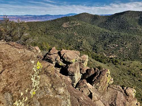
Despite being a named summit, Goat Peak only has a prominence of about 250’ or so. However, it still stands out in the area with excellent views from the summit. Peak 6959 is only two miles further west and can be done as a long day hike if driving further up the dirt road.
It is an excellent destination if wanting a nice road hike that won’t take all day. It is located not too far from the Phoenix metro area, while its higher elevation makes it considerably cooler than the Phoenix Valley. The best time to hike Goat Peak is March-May and late September-November.
Getting There
From the I-17 take the exit for AZ State Route 169. Head west for 5.5 miles and turn right on W. Cherry Creek Road. Continue north passing Powell Springs Campground and at 5.2 miles north of 169 there is a dirt road on the left. This is Federal Mine Road. There is parking on the right once you enter the road. For those who want to drive further up, the road isn’t too bad, but high clearance is recommended, especially further up closer to Goat Peak.
Route
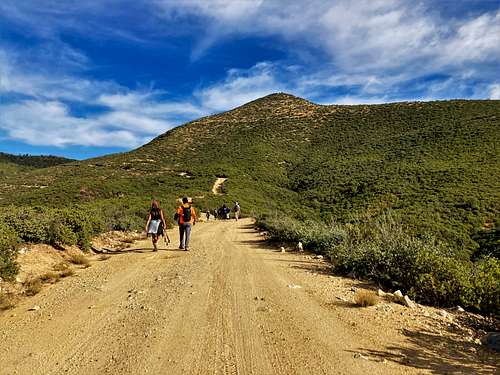
Take Federal Mine Road from the parking area. After about a mile there is junction with Forest Road 132. Continue to the left as the road heads to the west and then turns back to the north. Goat Peak comes into view. Pass by Goat Peak and after about 4.6 miles from the start of the road there is a road on the right that heads up towards Goat Peak. Take the road as it winds up to the base of the north side of Goat Peak.
There is a light use trail through some brush. This can be followed to get part of the way up. However, it isn’t a summit trail. Use your best judgement to find the path of least resistance. It is only about 250’ or so to the summit in about a third of a mile.
The total round-trip hiking distance is less than 10 ½ miles from the start of the road, gaining about 1,530’ on the way up, and another 100’ on the way back.
Red Tape
There are no permits needed to hike up to Goat Peak and no red tape.
External Links
Peakbagger information: https://peakbagger.com/peak.aspx?pid=56614