

Viewing: 1-5 of 5

Travis_ - Sep 12, 2006 1:50 am - Hasn't voted
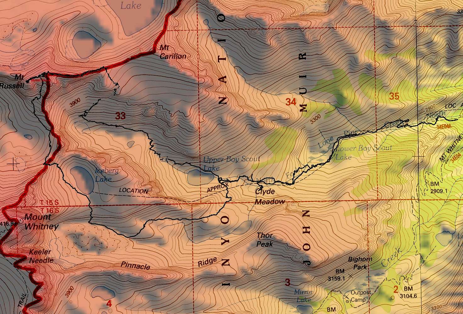
East Ridge / South FaceWe climbed up the Rockwell variation to the east ridge. You can see the section where I lost reception in the gully. I think the proper gully was to the west (per Rockwell Variation). Then we descended down the south face, and then down to Iceberg lake, picking up the Mountaineers route.

skotty - Aug 9, 2007 3:58 pm - Hasn't voted
How is the exposure?How was the exposure on your South-Face-Right-Side descent relative to the exposure on the East Ridge?
Travis_ - Aug 9, 2007 5:21 pm - Hasn't voted
Re: How is the exposure?the exposure on the south face right side was minimal, basically limted to that one section where there is a photo of me coming down. The east ridge exposure was excellent (as in a lot), I loved it! Highly recommend the east ridge. It will be a Slog ascending the south face.
skotty - Aug 10, 2007 2:50 pm - Hasn't voted
Re: How is the exposure?Excellent! Thanks.
Viewing: 1-5 of 5


Comments
Post a Comment