
-
 13069 Hits
-
 84.14% Score
-
 18 Votes
|
|
Mountain/Rock |
|---|---|
|
|
39.70165°N / 105.67389°W |
|
|
Hiking |
|
|
11558 ft / 3523 m |
|
|
Overview
Introduction:
Mount Griffith is named after two early Clear Creek miners, the Griffith brothers, Davis and George. Georgetown was named after the later. There are several mines on the mountain, mostly on the Georgetown side. As opposed to gold mining in nearby Idaho Springs and Central City, the mines around Georgetown were among the first in the state to be developed on silver ore.
This hike passes by a large aspen forest carpeting the south slope of the peak and involves one mile of bushwhacking to and from the top.
The views are from the summit are best to the south, southeast, southwest, with many trees obscuring vistas in the other directions.
Griffith Mountainis a mountain summit in Clear Creek Countyin the state of Colorado (CO). Griffith Mountain climbs to 11,575feet (3,528.06 meters) above sea level. Griffith Mountainis located at latitude - longitude coordinates (also called lat - longcoordinates or GPS coordinates) of N 39.701654 and W -105.673892.
Anyone attempting to climb Griffith Mountain and reach the summit should look for detailed information on the Griffith Mountain area in the topographic map (topo map) and the Georgetown USGS quad. To hike and explore the Colorado outdoors near Griffith Mountain,check the list of nearby trails.
Source: Mountainzone.comColorado Summit Hikes for Everyone (Colorado Mountain Club Classics)
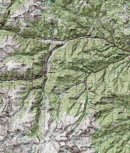
![Mount Griffith]() Map of the area.
Map of the area.
 Bellow summit. Bellow summit. |
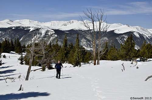
 First view from the summit. First view from the summit. |
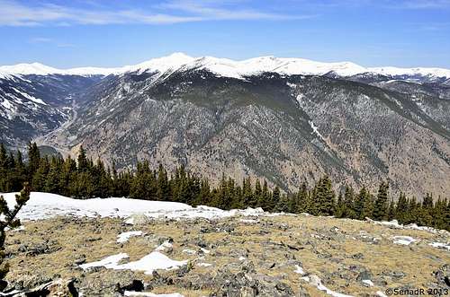 View from the summit. View from the summit. |
Activity Type: Hiking
Nearby City: IdahoSprings
Length: 5 total miles
Elevation Gain: 2,568 feet
Trail Type: Out-and-back
Skill Level: Moderate
Season: YearAround
Trailhead: Elevation:9,100feet
Top Elevation: 11,558 feet
Getting There
Driving Directions:
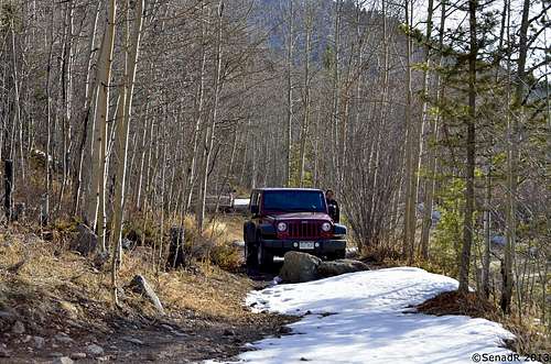
From Exit#240 of I-70 at the town of Idaho Springs, drive southwest on CO-103 for 6.7 miles. At sharp bend in the road, a dirt road leads southwest up West Chicago Creek.
Drive up this road for 1.1miles to an area on the right (north), just before a group of houses and a creek flowing under the road to the southwest. Being carefull to avoid private property, park off the road in this general area.
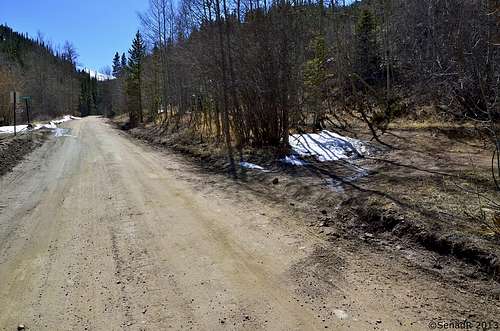 Road Junction. Road Junction. |
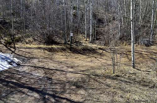 Trailheadl Trailheadl |
 Road Block Road Block |
Route
 Trail finding Trail finding |
 Mining remains Mining remains |
 Sparce area Sparce area |
 Above saddle Above saddle |
The Hike:
Continue on foot up the public road, about 200yards southwest of the creek crossing. Just past some houses on your right,leave the road and ascend steeply northwest. Within one hundred feet, gain anabandoned mining road passing to the west.
Take this road, continuing your ascent to thewest. Stay on the road, which crosses a ridge and descend a bit, beforeresuming its upward, west-northwest direction.
Eventually anold cabin is reached in a clearing, to the left of the road. Leave the road atthis point and enter a relatively sparse area of the forest on your right,ascending northwest over many decaying tree fragments, all the way to the top.
The summit lies on a small natural rockformation and has no identifying markers. Return by the same route,bushwhacking southeast about a mile until you reach the trail.
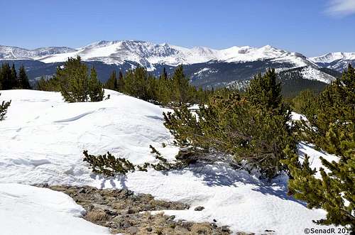
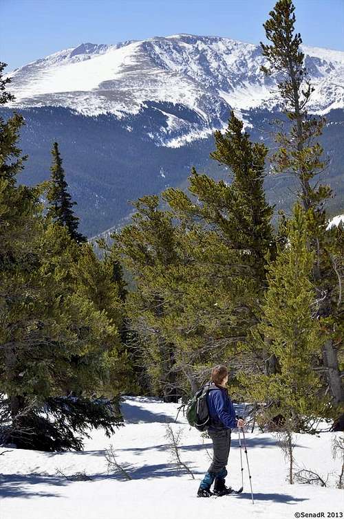 Views. Views. |
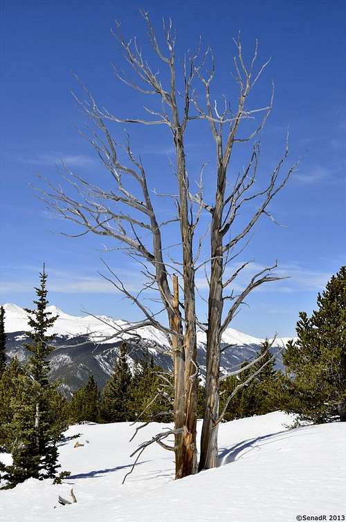 Beautiful scenery Beautiful scenery |
Red Tape
 Map of the area.
Visit: Arapaho National Forest
When to Climb
Year around.
Camping
CAMPGROUND NAME:Clear Creek
NEAREST CITY/TOWN: Idaho Springs
RESERVATIONS: 1-877-444-6777 or make on-line reservation
DIRECTIONS: From Idaho Springs, CO, take State Rt. 103 south 6.3 miles to an intersection and a small campground sign. Continue straight onto W. Chicago Cr. Rd. (dirt) and go 2.8 miles to another campground sign. Turn left at sign into campground.
GENERAL COMMENTS: The elevation is 9,600 ft. The campground, convenient to the Mt. Evans Wilderness, is a tightly configured "D" shape with sites along the main road in a stand of Lodgepole pines. Closeness of camping sites and trees having been thinned provide little privacy. Young Aspen trees provide a pleasant lacy shade for some sites. The understory is grass. Taking a drive up State Rt. 5 to Mt. Evans, the highest auto road in North America (14,265 ft.), is a must day trip. View the distant mountains and watch for wildlife, particularly mountain sheep. Firewood is available from the host for a fee. This is bear country; practice safe food storage techniques.
SEASONS Open Seasonal: Yes Open All Year: No Seasonal Comment: Open May 18 through September 30 NOTE: Opening may be delay for hazard tree removal; contact ranger district office for status.
RATE AND MAXIMUM STAY PERMITTED Rate: $14 per day. Maximum Stay Permitted (days): 14
CAMPGROUND SITE CONFIGURATION No. RV Sites: 0 No. Tent Sites: 0 No. Combined Sites (Tent or RV): 15 Total Sites: 15 Tent Pads: No Open Sites: Yes Wooded Sites: Yes Equestrian Camping: No No. Tables on Sites: 15 No. Grilles on Sites: 15
RV INFORMATION Hookups: None No. RV Pull Throughs: 1 Waste Station: No Average Parking Apron Size: 12' X 47' Comments: The parking aprons are dirt and gravel. A RV waste station, no potable water, is available at the Visitor Center in Idaho Springs, CO.
FACILITIES Vaults: Yes Flush Toilets: No Hot Showers: No Wheelchair Friendly Toilets: Yes Public Phone: No Playground: No No. Water Spigots (non-site): 2 No. Threaded: 1
WATER SPORTS - None
HIKING Hells Hole Trail #53 (foot) - 3.5 miles; access to Mt. Evans Wilderness
FISHING - No