Toggle navigation
Mountains
Routes
Images
Trip Reports
Forum
What's New
People
Areas & Ranges
Articles
Trailheads
Canyons
Huts & Campgrounds
Albums
Logistical Centers
Fact Sheets
Lists
Custom Objects
Gear
Plans & Partners
WELCOME TO SUMMITPOST
SIGN IN
REGISTER
Gunn Peak
Additional Parents
Image
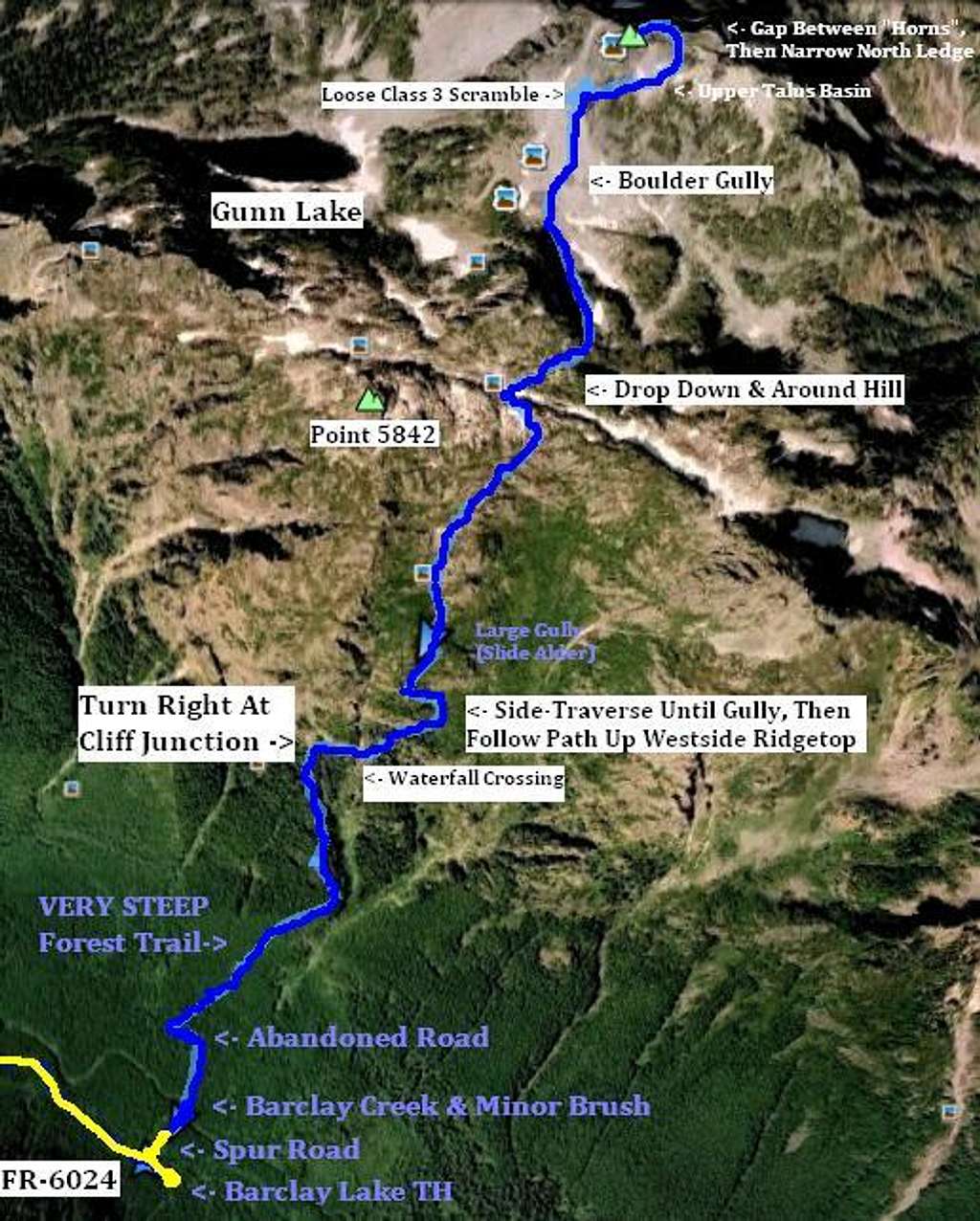
Gunn Peak - Aerial Of Route
View High-Resolution Image
Gunn Peak - Aerial Of Route
This satellite image shows the landscape and notable sections of the standard southern approach for Gunn Peak, using a track log created from my GPS.
« PREV
NEXT »
Redwic
on
Jun 17, 2011 1:42 am
Comments & voting
Other parents
Lat/Lon:
47.81615°N / 121.44802°W
Image Type(s):
Alpine Climbing
,
Hiking
Image ID:
722705
2880 Hits
72.08
% Score
2
Votes
Log in to vote
Comments
No comments posted yet.
to post!
Don't have an account?
Gunn Peak
(Mountain/Rock)
« PREV
Viewing
#86 of 110
GALLERY
NEXT »
Redwic's Image Gallery
« PREV
Viewing
#1403 of 3228
GALLERY
NEXT »
×
You need to login in order to vote!
User Name
Password
Remember me
Forgot your password?
Log me out when I close my browser.
Keep me logged in all the time.
sign in as a user
Don't have an account?
Register now for FREE
Rating available
Suggested routes for you
People who climb the same things as you
Comments Available
Create Albums
Register Here


