
|
|
Mountain/Rock |
|---|---|
|
|
4.50250°N / 102.32391°E |
|
|
Hiking |
|
|
Spring, Summer, Fall |
|
|
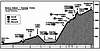
7175 ft / 2187 m |
|
|
Overview
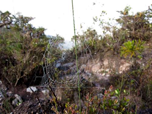
At 2187 meters, Gunung Tahan is the highest mountain on the Malayan peninsula and generally considered the most difficult summit in all of Malaysia. The mountain is located in the heart of Taman Negara, the premier national park of Malaysia, and thereby can only be reached after several days of jungle trekking. On the way you will have to ford several rivers, climb very steep rooted paths. You are likely to encounter blood-sucking leeches, torrential rains, and you may encounter monkeys, poisonous snakes, tapirs, wild elephants, and tigers.
The name 'Gunung Tahan' translates from Bahasa (Malay) to mean Mount Endure, which hints at the effort required to climb this peak.
Getting There

There are 2 approaches to the mountain. The traditional route is from Kuala Tahan in the south. It is a 55km trek. Guided trips generally advertise a minimum of 7 days for the round trip. The alternate approach is from Merapoh in the west. It is 46km from this direction although the first 14km is along a paved access-controlled single lane road. Guided trips on this route generally go at 5 days. Guides are compulsory from either direction.
Via Kuala Tahan

This route is supposedly the most scenic. Most tourists start from the city of Jerantut, take a taxi or bus to Kuala Tembeling, then take the 2-3 hour boat ride upriver to arrive at Kuala Tahan, the park HQ. The boat ride passes by a couple Orang Asli villages. I haven’t followed this route but several links below provide additional information.
Via Merapoh
At Kuala Juram, still 32 km to the summit]
At Merapoh, a sign marks the turn off the main highway for Taman Negara – Pahang. Drive 7km to Sungai Relau. This is where you park and register. You can also check out the visitor center in the new office (large building outside the gate), get a permit, and arrange for a guide. Basic accommodation is available with running water and showers.
The trail starts from here (46 km to the summit of Gunung Tahan), although most guided trips will take jeeps along the road to Kuala Juram. Along the road, you are likely to see elephant dung and tracks. The wide clearing of the road may also be your best opportunity to see elephants as well, but the chance is diminished as they are likely to clear out upon hearing any loud vehicle. You will also pass a bumbun or salt lick before finally arriving at Kuala Juram, the final staging point for the trek. Here there are restrooms with running water, a bunkhouse and a mosque.

Upon departing, you will immediately cross a suspension bridge over a wide stream. The trail starts relatively flat and will meander through dense foliage and cross the river 3-4 times. I made the trip at the end of the monsoon season (late January), just after a heavy rain and the fords were only knee to thigh deep. After 13.5 km past road’s end, you will arrive at Kem Kor which is easily the best campsite between the road and the summit.
The trail continues as before but starts to get slightly steeper with many roots (using hands will be necessary for balance). There are several more river crossings but I managed to stay dry by rock hopping. The most exciting crosses in the calm just behind the lip of a short but powerful cascade. There was even a rope strung up to ensure safety and balance. From here, the trail gets steeper and climbs steadily rather than the up-down you had been enduring. There is less running water, however, you are likely to remain completely soaked, if not from the rain or incessant drops falling from the canopy, then from your own sweat.
After reaching Bonsai, a mere 5 km to the summit, better views of the surrounding landscape are possible. Not only will you start following a ridge line, but the ground becomes rockier and you have successfully climbed above all the towering trees down in the watershed. If you are lucky, the clouds might dissipate too. There is a good campsite 2.4 km from the summit with a convenient water source. There are also a couple sites on the summit and some small trees provide good wind cover.
Equipment
Take all the usual fare for SE Asia jungle trekking. Outside the remote chance of a tiger or leopard attack, the biggest risk is probably from the rain or getting lost (serious note: the guides also warned me of the real threat of snake or wasp bites which can cause paralysis and death, recent cases have been recorded). Since the paths are well marked and guides are required, getting lost should be difficult but if you get off trail, it wouldn’t be pleasant. About the water, you will get wet and probably soaked, probably everyday – this is the rainforest so get used to it. Just try to keep your food and sleeping gear dry so all you need is a waterproof bag and tent. A real sleeping bag is probably overkill. A light weight bag would be more than enough.
I highly recommend poles or a hiking stick. Feet will be constantly exposed to moisture. Locals advise wearing rubber water proof shoes. I saw people wearing boots and gaiters to keep leeches off. Insect repellant is recommended although I didn’t use it and was only slightly inconvenienced (this is probably seasonal). Sunblock is probably not necessary unless you are very sensitive to tropical light. You won’t get much direct light as you are under tree cover most of the time anyway. If you do use sunblock, opt for the waterproof or sweat-proof variety.
I packed light so I went with runners and crossed the rivers barefoot. I took a light backpacking tent and no sleeping bag. At night, I was fine with just long pants and a sheet, though it would have been nice to have a ridge rest and a dry pair of socks. You will be jumping logs and ducking branches a lot so if you can pack light and/or consolidate your bags (I carried a 20L bag), it will be worth the effort. I only carried ½ L water bottle which was enough for me. There are ample places to find water though some sources look better than others. Remember to drink a lot to stay replenished. If it is raining, you might sweat a lot and not notice. Publications advise to treat the water.
The Park, Taman Negara

Fees (as of January 2010):
*Park entrance fee is 1 ringgit (3.5 RM = 1 USD)
*Camera fee is 5 RM per camera.
*Camping 1 RM per person per day
*Hostel overnight 10 RM per person per night
*Guide 150RM per day plus 100RM per night (cost can be shared by 12 people)

Failure to comply is punishable by up to 3 years jail time or 10,000 RM (or both). The park also offers fishing, fish feeding, kayaking. Exotic fauna within the park include elephant, tapir, barking deer, mouse deer, flat-headed cat, tigers and leopards, countless bird varieties as well.
The park is often bestowed the title, ‘world’s oldest rainforest’, since it is out of reach of all volcanoes and has dodged every ice age since 130 million years ago. As you might guess, it is a well developed ecosystem and the trees are BIG. Dry season lasts from February until September and high season is April to August.
External Links
My Mountain Goal
- http://mymountaingoal.com/mt_about_g_tahan_trip.htm
Local Newspaper Trip Report
- http://thestar.com.my/special/online/tahan/default.html
Local group outing
- http://www.calvary.org.my/RR/rr_tahan.htm
Trip Report for the Kuala Tahan route
- http://malaysiatrekking.blogspot.com/2007/01/gunung-tahan-kuala-tahan-pahang.html