
|
|
Route |
|---|---|
|
|
39.65410°N / 106.1894°W |
|
|
scramble |
|
|
A long day |
|
|
loose, easy class 3 |
|
|
Approach
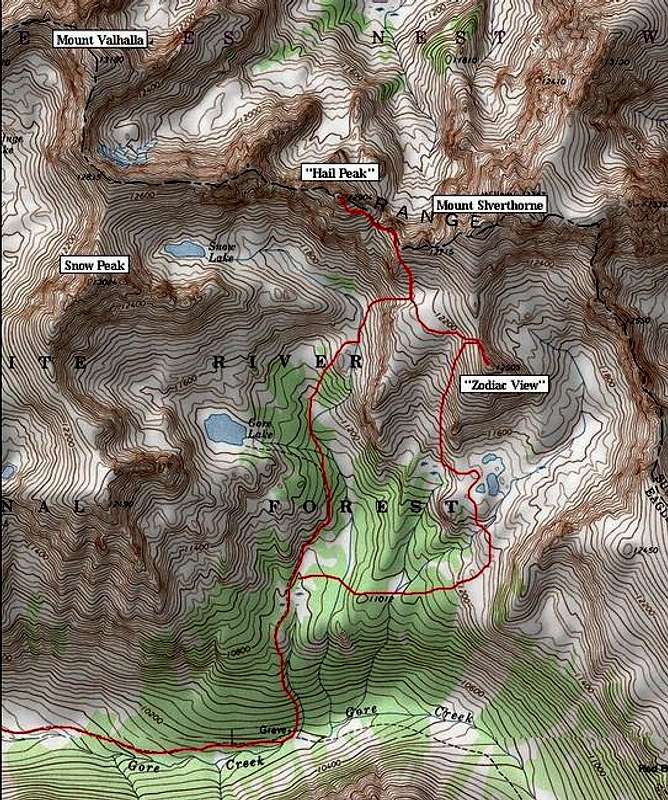
RT=14 miles and 4,500-ft
This route has southern exposure so it makes for a good early spring idea. Gore Lake Basin seems to melt out faster than other area basins.
From the Gore Creek TH (see Getting There on main page)at 8,700-ft, hike 3.93 miles on a good trail to a signed turn-off to Gore Lake. There are a few good campsites here next to Gore Creek. There is also a signed gravesite here-the grave is marked on the official USGS topo map.
Go north on the Gore Lake Trail and ascend a steep slope about a half-mile. From here the trail escorts you through some beautiful wide-open meadows with good views of “Hail Peak” and the pointy Point 11,180-not marked on TOPO. Once in the meadows I found it OK to leave the trail here and ascend the tundra-ridden slopes that eventually run up to Snow Lake. By now, “Hail Peak” looms directly above you.
Route Description
Next, leave your perfect meadows and hike east up steep slope that ascends to a big flat area under Point 12,715-see TOPO. Continue hiking talus and tundra to the ridge crest of “Hail Peak’s” east ridge at 12,500-ft. The closer you get to the southeast face of “Hail Peak” the more you will begin to notice what a loose mess it is.
Once at the base of the southeast face study it carefully. The best line is to traverse slightly out onto the face and pick your way up the teetering talus fields to the summit. Technically the face is easy class 3, however, it is dangerous.
“Zodiac View” is an easy mile southeast from “Hail Peak.” I would also recommend a visit to the nice lakes that reside south of “Zodiac View.” From the lakes it’s an easy one-mile stroll across more tree and tundra-laden terrain back to the Gore Lake Trail.