
|
|
Mountain/Rock |
|---|---|
|
|
46.38995°N / 121.60611°W |
|
|
Lewis |
|
|
Hiking, Scrambling |
|
|
Summer, Fall |
|
|
5772 ft / 1759 m |
|
|
Overview
So much fun with so little effort!!
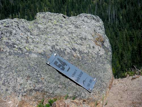 Plaque on the main summit | 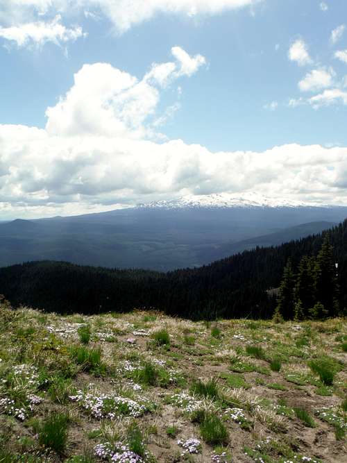 Mount Adams covered in clouds |
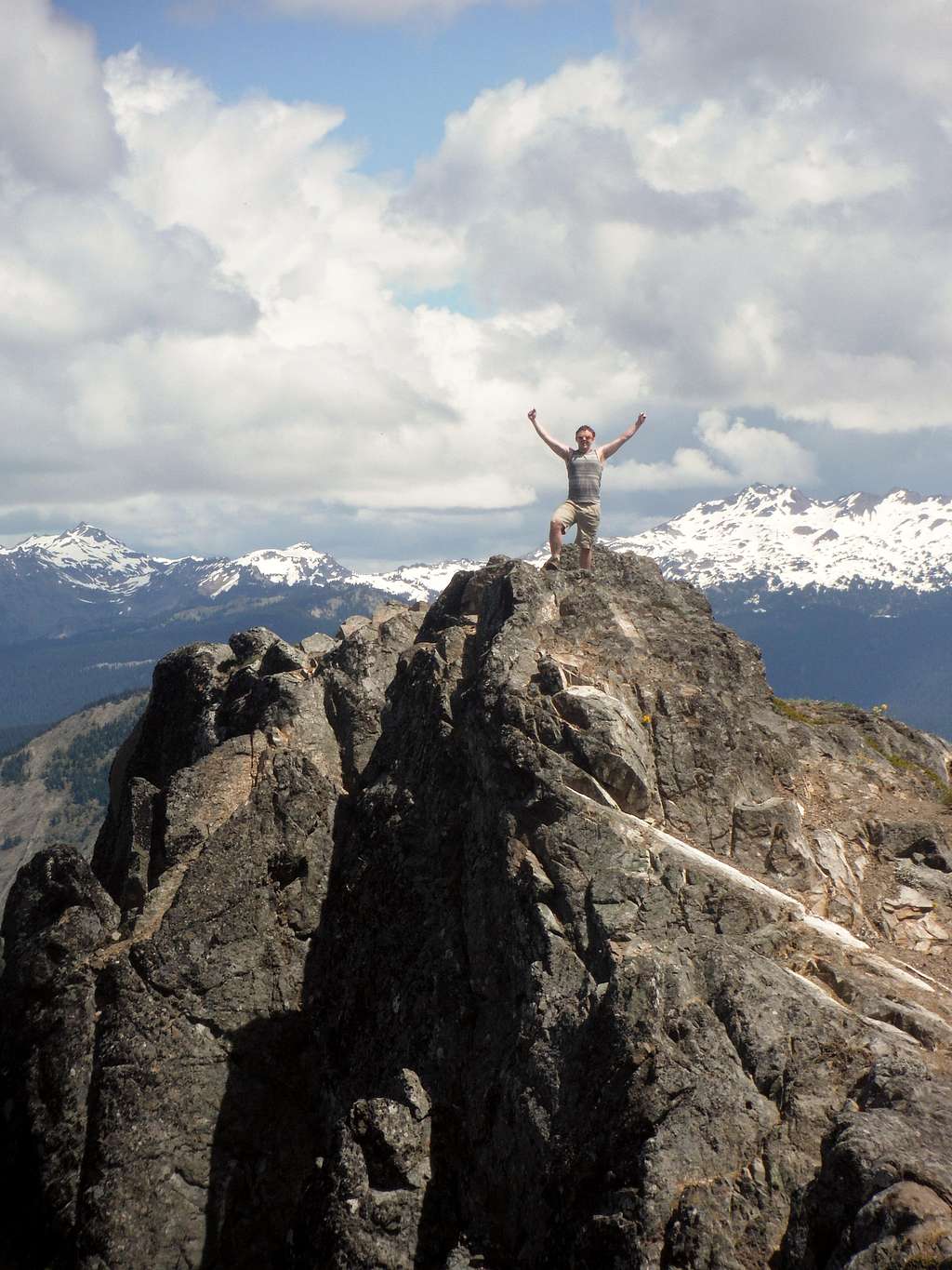
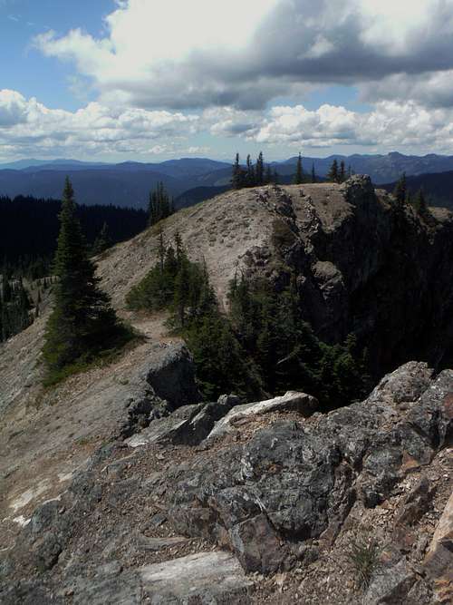
That is not a lot of effort considering that once you get to the summit of this peak you are granted stunning views of Mount Adams, Mount Rainier, Mount Saint Helens and even a distant Mount Hood. The northern cliffs from both the false summit and the main summit are especially impressive. Mount Adams and Goat Peaks are especially impressive because they practically are almost right up in your face. It should be noted that the trail goes all the way to the western false summit. The way to the true summit looks rather frightful from the false summit but it is actually not bad at all. It would be best described as a Class 2 (at worst) slightly exposed walk-up scramble to the top.
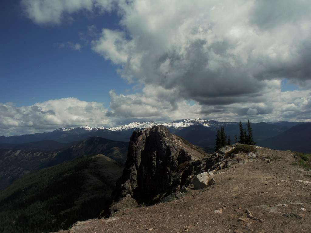
Looking over at the true summit of Hamilton Butte
Getting There
Head south from Randle on Forest Road 25 for about a mile. Make a left onto the Forest Road 23 and stay on it for 11 miles. Make a left onto Road #22 and take it 5.7 miles. Make a right turn onto Road No. 78 and take the road for 7.2 miles up to the pass. Make a left and drive as you feel comfortable. The road goes 1.8 miles to a Y but starts to deteriorate at about 0.5 miles. I stopped here but more sturdy cars and trucks can make it further. Go right at the Y and find the trailhead for Mud Lake. Most vehicles should park here because the road above is severely rutted. The trailhead is a half mile further but only high clearance vehicles will make it.Route
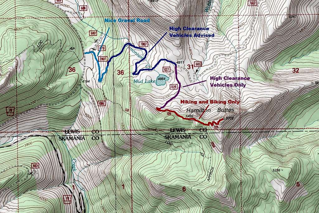
The map of the route
 The final ridge traverse | 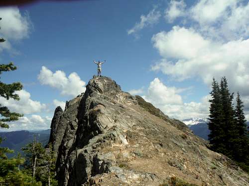 The final summit push. Josh standing on the true summit |
Red Tape
There is no red tape or parking passes need for this trip.When to Climb
Clearly the best time due to access to the mountain is from mid-June to mid-October depending on snow conditions. On very low snow years such as 2015 late May is very doable.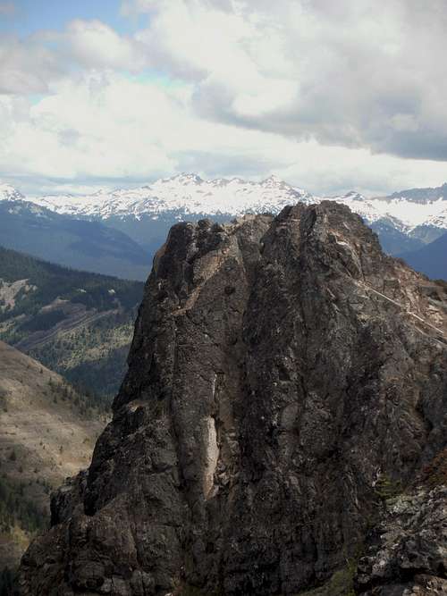
The true summit of Hamilton Buttes. The best time to go is in summer.
Camping
This is a very camping friendly area. There are a number of spots by Mud Lake for nice FREE camping. One can also bivy on the summit if they do not mind dealing with some of the glass on the summit.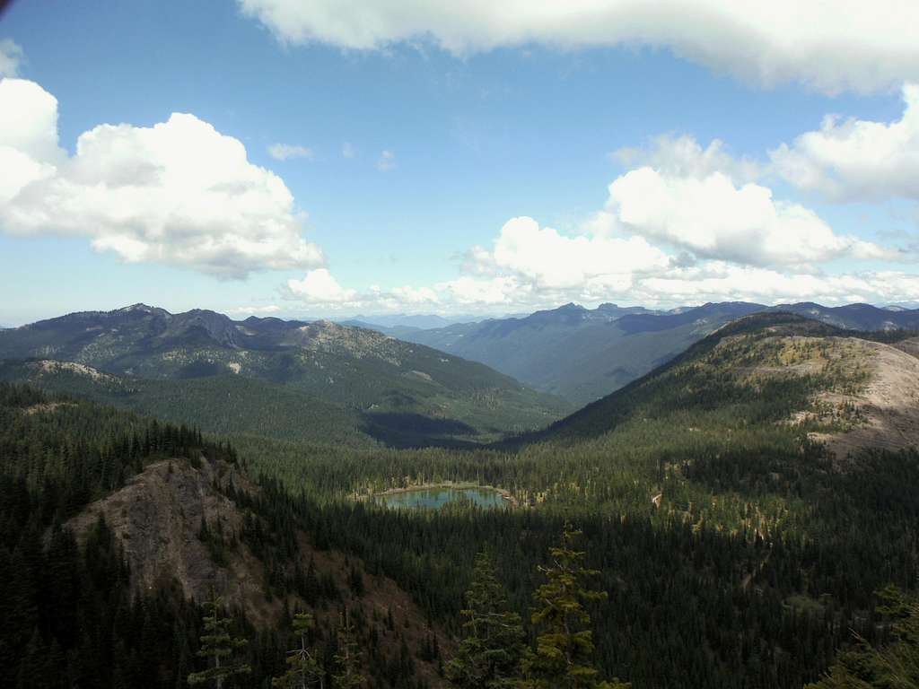
Mud Lake and Yazoo Butte. Mud Lake is a great place to do primitive camping.