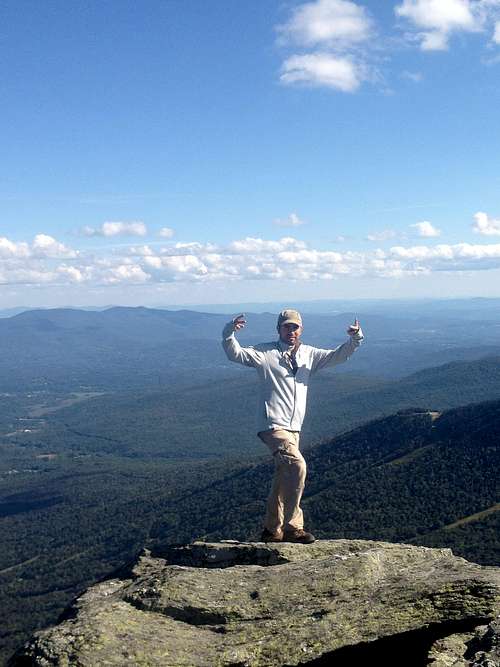
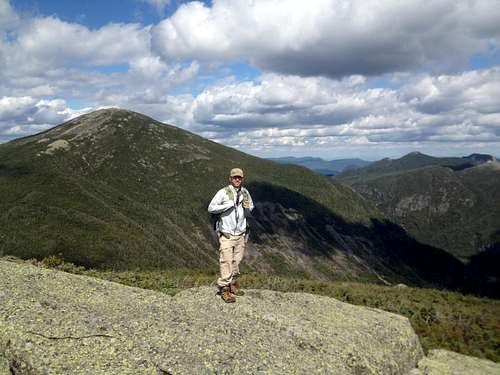
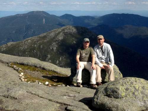
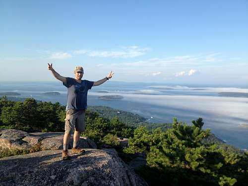
![Mansfield views]() Sweeping Mt Mansfield views
Sweeping Mt Mansfield views
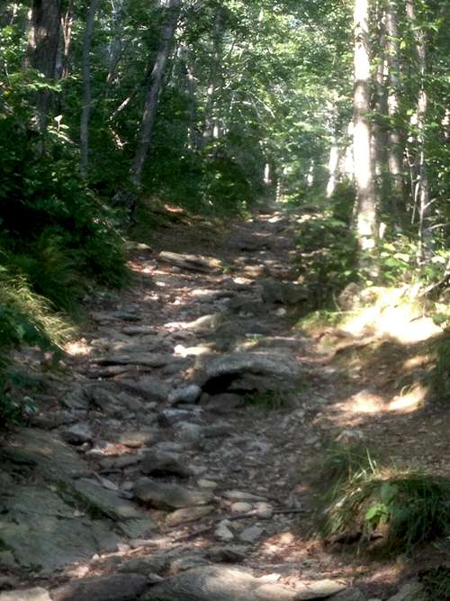
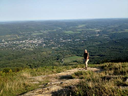
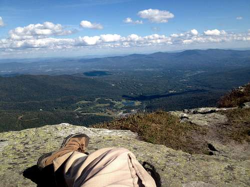
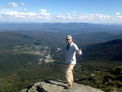
Once we passed the ledge area, it opened up onto the summit of Mt Mansfield, with amazing, expansive views in all directions. We could see Lake Champlain in the distance on one side, and the Adirondacks behind it. On the other side, we could see Mt Washington and the White Mountains in NH, as it was a mostly clear day. The summit was long, and flat, and there were many people coming up from another shorter trail from the top of the gondola. There were a lot of people on the summit on Labor Day, and as we just sat there and rested, we watched different groups pass by. The views were just so nice, and the town of Stowe was below us. We ate lunch, and took in some rays, for what seemed like an hour. Finally, we realized that the peak (Mt Washington) we saw far in the distance, was next on our hit list. It was hard to leave Mt Mansfield's summit that day, with near perfect weather . We took the Long Trail back again, and the last ledges we mentioned earlier, were even a little scarier on the way down. Once past them, we barreled down the rest of the trail in no time. It was rocky, and tough on our knees, and after reaching the parking area, it was nice to take off the boots again, and let our feet air out a bit. It was about 4pm, we hit the road, and navigated towards our next stop, the town of North Conway, NH, near Mt Washington. We would be staying there for the next 2 nights.
![Resting atop Mansfield]() Taking a rest atop Mansfield
Taking a rest atop Mansfield
![Mt Mansfield summit]() On top of Vermont
On top of Vermont
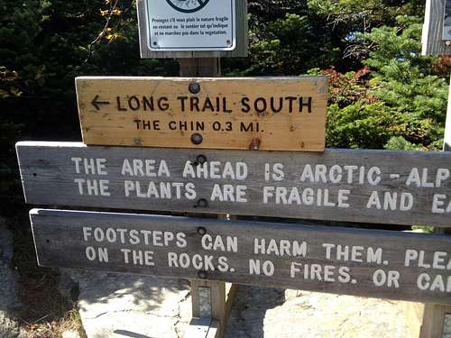
Mt. Washington, New Hampshire - State HP #13
The drive from Stowe area towards New Hampshire was very scenic, and one i wish i wasn't so tired for. I was the driver, and we stopped off to grab coffee, snacks and Travis navigated us though the mountains into the Mt Washington valley. The town of North Conway, is a neat little town, in between several New Hampshire ski resorts, and of course Mt Washington, which looms in the distance. We arrived there in the evening, to the first clouds and rain of our trip. We had researched and heard how awful the weather on and around Mt Wasihngton was, compared to the rest of New England. I grew up in NY, but had never been up to this area of New Hampshire. We were monitoring the weather on Washington the couple days before, and it called for overcast, cool weather, with potential rain. Before going to sleep that night, we decided that if it was clearly raining in the morning, we would rest a day and hang out around the town of North Conway and wait out any storm.
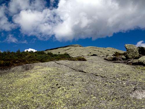
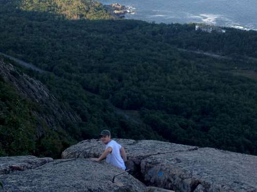
![Bad weather day, Washington]() Looking up Tuckerman Ravine
Looking up Tuckerman Ravine
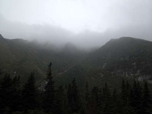
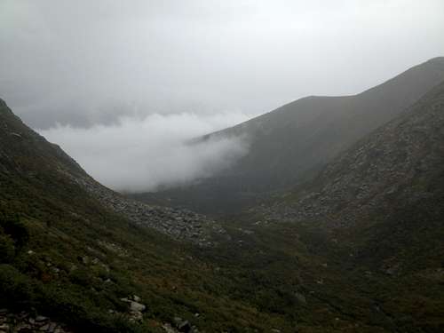
We rose around 6am, to find the skies still overcast, not welcoming, with drizzle in the air. It was not what we were hoping for, yet we got changed and geared up, filling our daypacks, and taking extra clothing. It was in the 50's around the base, and we knew it was near freezing at the summit, with winds and potential rain. And this was the beginning of September, still summer conditions on all other peaks. We had absolutely beautiful weather till this point. I wasn't exactly happy the day, but we knew that we had a window to climb Washington, and more plans after this. If we decided to put it off for another day, then Katahdin and Acadia would be in danger, so we decided to climb on as planned. We drove to the lodges, and the trailhead for Tuckerman/Hungtington Ravines. The initial plan was to hike Huntington Ravine trail, which supposedly has a really steep climb up a class 4 area towards the summit. It was something we couldn't wait to do all trip, however, everything was so slick already, we figured it could be dangerous. Due to the fact that it was drizzly, and really cold, we decided to just take the Tuckerman trail up. It was probably a smart decision, as we had lots of rock/boulder hopping right from the beginning of the trail, before we had to make our decison as to which trail we would take. It was the 3rd day in a row of serious hiking, after we hit Mt Marcy on Sunday, and Mt Mansfield on Monday. I had my headphones blaring in my ear, as i yelled at myself with each step over more rocks and boulders on the lower portions of the trail. I feel im in pretty decent shape, but again, this was the 3rd day of steep trails. It started to rain on and off, and it made us just walk faster. The first 2.5-3 miles were just constant rock hopping. It was getting foggy, and the trail seemed to wander on and on. After what seeemed like an eternity, it leveled out, and we hit the stretch where there were a couple shelters below the ravine. There was a bridge, and we got our first glimpses of the ravine, the steepest part up Mt Washington. Again, we didn't decide to take Huntington Ravine Trail due to the weather, but Tuckerman was no slouch. It seemed like a straigh shot up a boulder field on the ridge of this imposing peak, one i couldn't believe we were about to conquer in this crappy weather.
![Clouds below, Mt Washington!]() Clouds below us on Mt Washington!
Clouds below us on Mt Washington!![Foggy Trail, Mt Washington]() Whiteout conditions, on the upper reaches of Tuckerman Ravine, Mt Washington
Whiteout conditions, on the upper reaches of Tuckerman Ravine, Mt Washington![Unnamed Image]() Daaaamn
Daaaamn
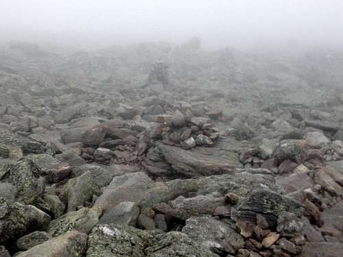
The boulder field seemed immense, and we started on it foot by foot. They were large and small, and we followed the blazes up ledges at points, and over running streams at others. There weren't many hikers on the trail at this point, as the weather seemed to worsen the farther we went. We slipped a couple times, and it probably wasn't so safe. The couple people we did pass were all descending, and we seemed to be the only people still climbing in these clouds. Our foot placements were important in the slick conditions, and it became somewhat of a challenge. Tuckerman Ravine was all around us, and we were determined to rise through. It was in getting colder and foggier at this point too. The tough section of boulder was about a mile long. Finally we made it up through, and hit a moon like landscape of smaller rocks and scree on the upper portion of the trial. It was totally whiteout fog here, and the temps were below 40! That's pretty crazy, considering it was 60-75 the rest of the trip to this point. We were fully layered, with undershirts, a light shell, over shell, and a hoodie north face jacket! Who cares, it was almost humorous how it was still summer, and could be snowing up here! The blazes were further apart, and we wandered off course a little, but not too far to see a blaze in the distance. I mean, it was really foggy, check the pics, just eerie!! I was the most tired of any part of the trip at this point, as it was the third day in a row. Had my headphones on, yelling at myself, keep stepping and move!! The fog surrounded us, the trail was still steep, and seemed to go on foreeeeeeeever! It is Mt Washington, right! Well, after hopping, and stepping, and side stepping, and slipping over slick rocks for a while, we just seemed to step out of it onto the Mt Washington auto road, and what was basically the summit. Actually, a car almost ran us over. It was almost upsetting, to see people driving past us, after we grinded for 6 miles through rocks, and terrible weather up to this point! However, it was also the most rewarding yet.
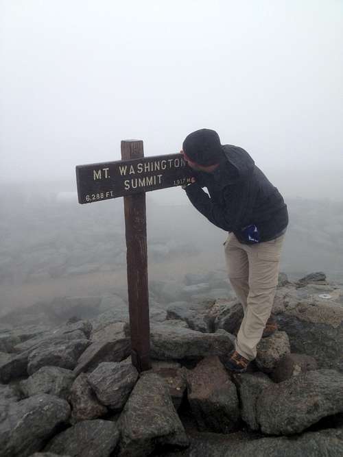
![Foggy Summit]() Kiss The Summip
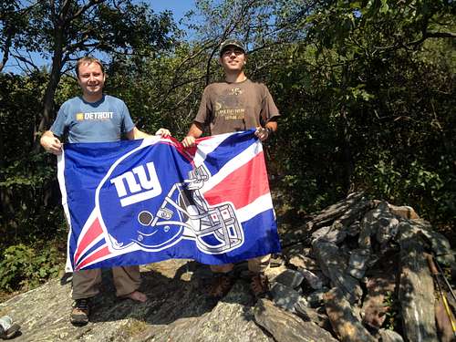
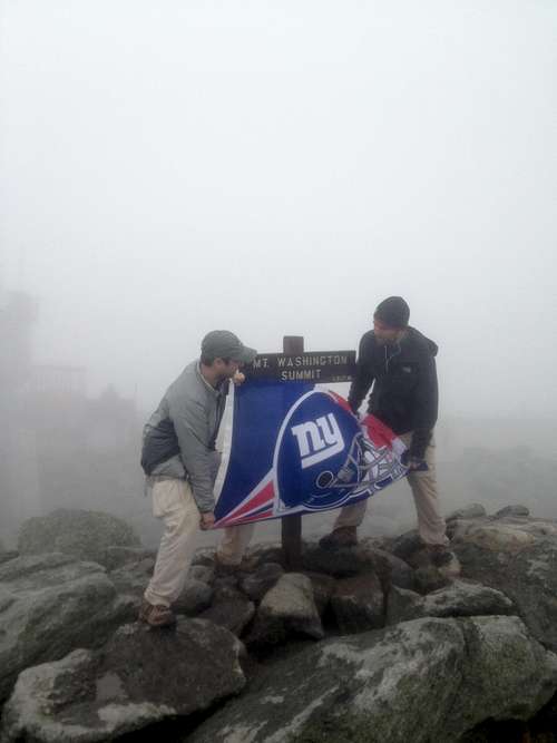
Kiss The Summip ![Unnamed Image]() Windy, foggy, and wet summit. Let's Go GMen!
Windy, foggy, and wet summit. Let's Go GMen!
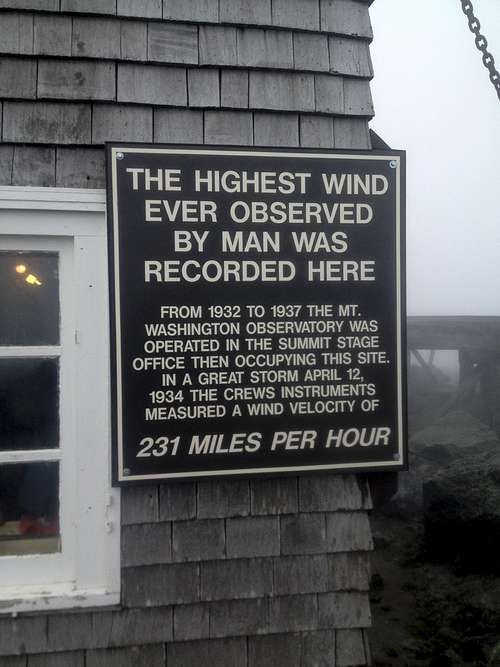
If you haven't been to the top of Washington, there is a lot going on. There is a huge cafeteria building, with shops, lockers, and a museum. There are also observatories, which on this day were useless, and a historical house. There are labs, and this is obviously the place that has the highest wind recorded ever! The place was so foggy, that it was hard to even see what was going on in front of us. We just wanted to find the infamous sign and survey markers to prove our conquest! After we found those, and took tons of pics/video, we headed inside the cafeteria for chile and hot chocolate! So what, let us have our glory, lol! There were AT thru hikers huddled up in the main building, with their huge packs, and gear. They were all actually enjoying hot cocoa too, an d just napping. It was a mix interesting people up there on that day. It was around the 32 degrees outside, and winds were blowing pretty good, maybe 40-50 mph. Not the most appealing weather, yet, just what we expected after reading lots of tales! I am actually happy we climbed Mt Washington in these conditions, as it makes me more confident about seeing further peaks out west. Well, we ended up staying in the lodge for over an hour, just relaxing from the elements. Eventually, we put our wet gear back on and made our way back down the trail.......i was not enthused for this. The hike back down was uneventful, but cold and wet! It started to rain harder on the way down, and we had to be careful through the rock/boulder fields. We were not happy campers but eventually made it all the way back down to the lodges and the car. PHEWWWWWW!
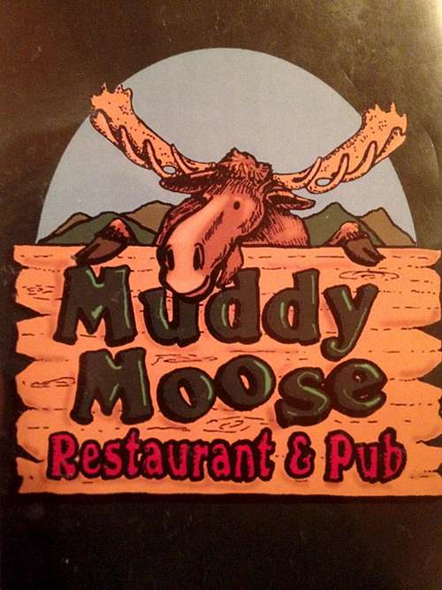
It felt like an accomplishment to finish Mt. Washington in such crappy weather. As a reward, it was time to hit up the Muddy Moose in town for some food and a few local brews. The Moose was inviting, as we met a bunch of locals and exchanged stories. Several beers later, full and drunk, time for sleep. The next day was just a travel day, so we didn't have to wake up so early for any hiking. Our next stop was Maine, and the town of Millinocket. Katahdin was next on our agenda, and the final steep hike of the trip.
Katahdin, Maine - State HP#14
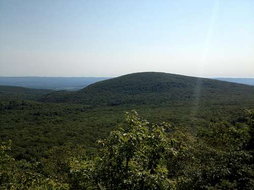
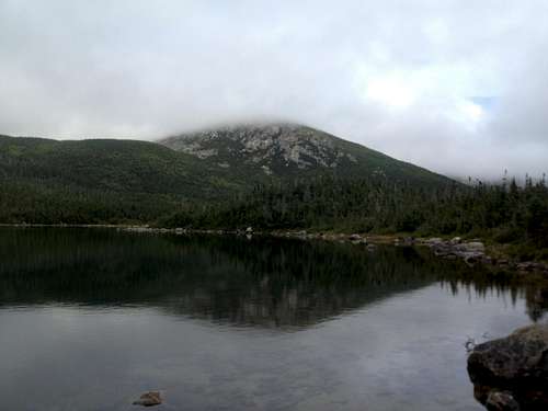
The travel day was a much needed day of relaxation, as we had just hiked Mt Marcy, Mansfield and Washington three days in a row. We took our time driving through the Whites of New Hampshire, and up into central Maine. We found the small town of Millinocket, which is the closest to Katahdin. The town looked like we stepped back in the 1970's, i'm just saying. We stayed up just enough to watch the Giants-Cowboys opening NFL game. The Giants actually lost, but i was too excited for the next morning's hike to be upset. Katahdin was calling, and this was the day i was looking forward to the most. We were going to hike up to the Chimney Pond, then pass the Ranger Hut and on to the Cathedral Ridge trail up to the summit. After that, we were going to make our way along the famed Knife's Edge trail and back down Helon Taylor. It was roughly a 12 mile loop hike, that we chose purposely for the difficulty, and great views. The Cathedral Ridge trail is class III, and though short, very steep and fun.
![Chimney Pond mist]() Chimney Pond in the morning
Chimney Pond in the morning![Chimney Pond reflection]() Chimney Pond relection
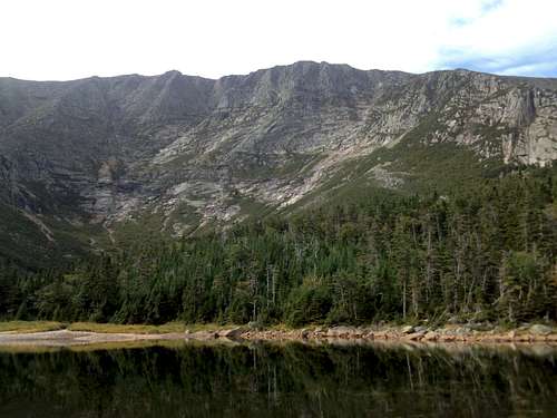
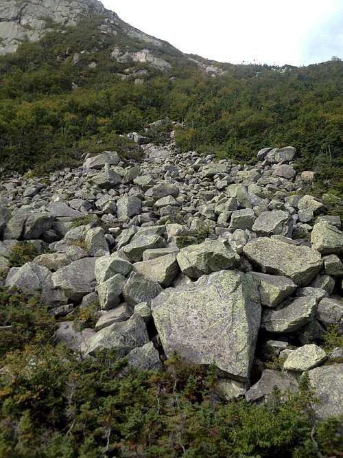
Chimney Pond relectionWe started out around 7am at the Roaring Brook Campground. The weather was chilly in the morning on this early September day, though we knew it was going to warm up into the 70's and not have a cloud in the sky all day long. This was the best day of hiking i've ever had, granted i've only hiked the eastern seaboard to date, but still it was crystal clear. The Chimney Pond trail up to the hut was relatively calm, with no real steep sections. I believe it was 3 miles or so to the campground and the Hut. The pond itself was very picturesque, and we relaxed for a snack there. It was already warming up nicely by this point, and we shed our outer layers for the tough sections to come. We had to see the ranger at the Hut, and after getting "clearance", we started up for the Cathedral Ridge section of our ascent. We hit the boulder field at the bottom of the trail, which already had huge boulders to hop on, and around. As we looked up, it was like a playground for hikers, with gigantic boulders and ledges for a mile.
![Cathedral Ridge approach, Katahdin]() Approaching boulder field, Catherdral Ridge
Approaching boulder field, Catherdral Ridge
l
![Base of Cathedral Ridge]() Base of Cathedral Ridge
Base of Cathedral Ridge
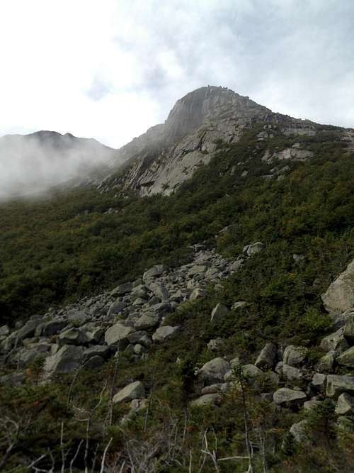
This was our hardest high point trail to date, but not beyond our capabilities. We had to be careful at points, and use our hands in many different moves. There were some ledges where we had to balance our feet, while pulling ourselves up. Let me repeat, some of these boulder were HUGE! Hopping was necessary, and you wouldn't want to slip in between two of them. Like i said earlier, a playground of fun. It was never too scary that we would turn back, more of a fun challenge. There were three "humps" in the trail, where it flattened out momentarily and we could sit out on the ledge and snap a couple great pics.
![WHOOOOOO, Cathedral trail]() What a view, climbing up Cathedral Ridge
What a view, climbing up Cathedral Ridge
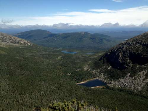
As we climbed higher, the views became more spectacular. We could see chimney pond, and the other lakes in the distance. The weather was picture perfect as we had lucked out yet again.
![Regal views high up Cathedral Ridge, ME.]() Spectacular views high atop Katahdin!
Spectacular views high atop Katahdin!
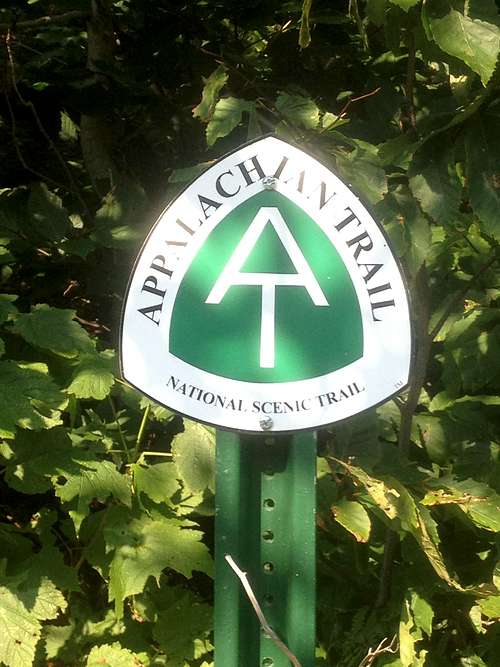
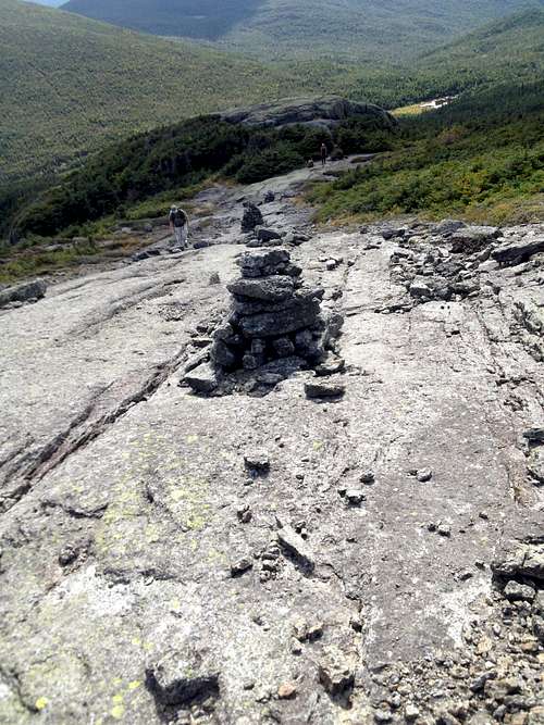
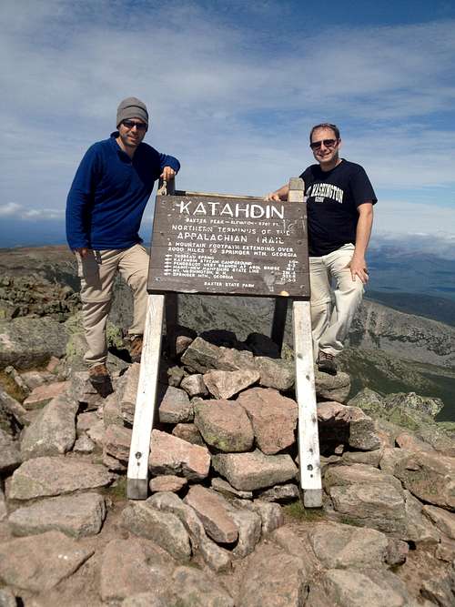
We eventually achieved the upper reaches of the trail, where it flattened out a bit, and there were plenty of cairns. Here, it met up with other trails, including the most famous in the states, the A.T. The summit had unreal beauty in all direction. Did i mention that it was the most beautiful weather day eeeeever! Just being able to see the famous sign signifying the northern terminus of the Appalachian Trail was cool!
![Katahdin Summit]() Famous summit sign!
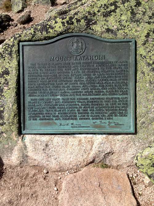
Famous summit sign!![Katahdin summit plaque]() Katahdin summit plaque.
Katahdin summit plaque.
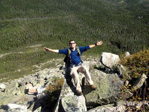
As we were taking all of our necessary pics and videos at the summit marker, we saw a group guys who had just finished the Appalachian Trail. They took out a cigar that they had been carrying the whole way, just for the occasion. I think they had tears and were all soaking in their accomplishment. It was a special moment, and one that actually gave me much more motivation for our future goals........Back to our climb, so after all those pics, we walked the summit area for a while and glanced over at our "escape" route. It was the famed Knife Edge. The Knife Edge trail was something i had been looking forward to all summer during planning and talking to other hikers online. It looked even more fun, and scary in person.
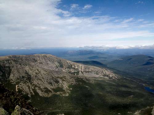
![Summit views Katahdin]() Views around the summit of Katahdin.
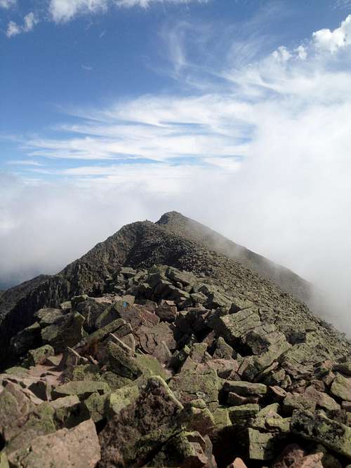
Views around the summit of Katahdin.![Knife Edge Katahdin]() Knife Edge ridge
Knife Edge ridgeThe summit of Katahdin is a horseshoe, with many spines accessing the summit ridge. The Knife Edge is basically one half of the horseshoe ridge of the summit area of Katahdin. It runs for roughly 1 mile, encompassing a very rocky, trek. It has many up and downs, with seriously steep ledges on both sides of you. In fact, at one point, the width of the ledge was little more than the length of both my feet.
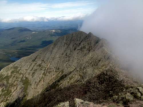
![Start of Knife Edge]() Start of Knife Edge, with clouds rolling in.
Start of Knife Edge, with clouds rolling in.The Knife Edge trail was nervewracking, yes, however it was one of the most entertaining trails ever. There was an eerie fog rolling in from the west side of the trail. It was a cool breeze that enveloped us, like a scene from a scary movie! There were many smaller rocks in the beginning of the trail. It was very uneven, and awkward to walk on. As we progressed through the hike, it was gradually more difficult. The smaller rocks turned to larger boulders. The terrain was no longer flat, and we had to maneuver over those big humps on the ridge line. At some points, we had to climb a little bit, and the ledges got narrower and narrower. Small climbers gloves may be recommended for this portion of the trail. There was an insanely narrow ledge midway through the trail, less than two feet wide! I have a great gopro video of the ledge, that i'll try to include below! Also, there was another drop-off towards the end of the trail, that you had to actually down climb as if on a ladder, otherwise you would need to let your body hang down and jump. I don't want to scare anybody from doing the knife edge, as it was really just a lot of fun. Just make sure you keep your concentration and wits about you. It isn't a race here, and it's an amazing place to just take frequent breaks and snap great photos and videos.
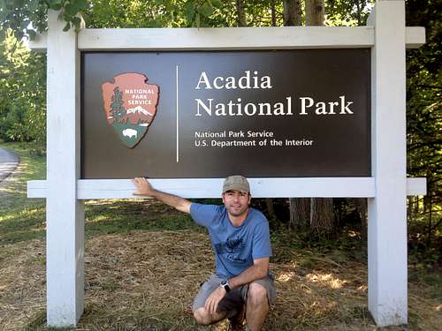
When you finally reach the end of the ridge, the trail descends into the valley and below treeline. It reconnects eventually with the Chimney Pond trail near the Roaring Brook campground and back out to the trail head. We were back out to the campground by 5pm, after a full day of hiking and fun. Katahdin was truly a great place to see, and an excellent experience. I will return to the hills of Maine one day soon, and tackle Katahdin again. This was my favorite peak of our Northeast trip! After finishing Katahdin, we made our way back to the coastline of Maine, and the resort town of Bar Harbor, near Acadia Nat'l Park. It was our way of celebrating all the successful climbs, and getting to see a Nat'l Park we hadn't visited yet.
Acadia National Park
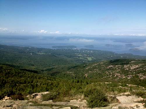
Acadia is beautiful!! I had read to much about it, but getting to see the picturesque coastline of Maine was special. We woke up in our beautiful hotel in the town of Bar Harbor, which is surrounded by Acadia Nat'l Park. First order of business was to do the drive up to the famous Cadillac Mountain. We could've hiked it but were worn out from the week on our feet. It was still sweet to spend some time up there and have a 360 view of the coast.
![Cadillac Mountain]() View from Cadillac Mountain
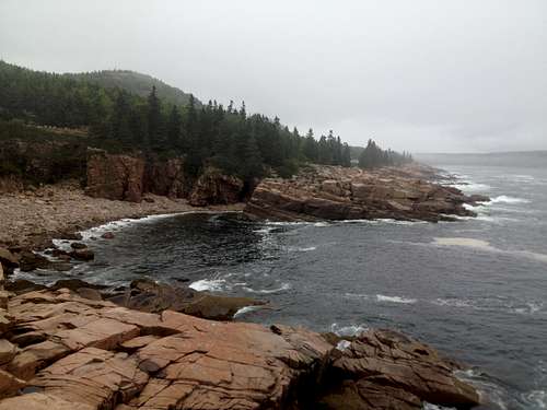
View from Cadillac MountainAfter that, we took the drive up the coast by Sandy beach, and to see the Thunder Hole. These are some of the more noteworthy attractions in Acadia.
![Thunder Hole, Acadia]() Thunder Hole, Acadia
Thunder Hole, Acadia![Beautiful coastline]() More Maine coastline
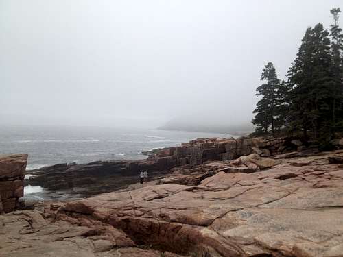
More Maine coastlineAfter a day to drive around and see the sights, we wanted one more hike before our return trip to Connecticut and home. So, on our final day in Maine, we decided to hike Acadia's toughest trail, the Precipice. It takes you up to the top of Champlain Mountain, a tall peak located on the coastline. The Precipice Trail climbs up the peak, via many iron rungs and ladders bolted into the cliffs. It was recommended to us by other visitors to the park. Precipice was an amazing trail, but unnerving and definitely not for those who are afraid of heights. It started by hopping over huge boulders at the base of the trail. The trail took us directly to the base of this large cliff, and we had to climb vertically up to the summit. It was scary at points. It was basically ladder after ladder, taking you to the next ledge. Each new ledge we would pause and take a couple more pics. At points, our bodies were suspended in mid-air while climbing these iron rungs. I would test them out before putting all of my weight on each one just to make sure. A fall could be fatal on much of the climb. I don't want to scare you away from hiking it, as it was a lot of fun for the both of us. Again, just be careful and take it slow, as it goes directly up the cliff to the summit. I got to snap some great pics and vids from this trail, and the view of the coastline from the summit was just spectacular! Once we hit the summit of Champlain, we hung out for a long time taking more pics, and chatting with other hikers who had braved this trail.
![Mt Champlain summit]() Champlain's summit, right on the coast, with low lying clouds! Sweeeet....
Champlain's summit, right on the coast, with low lying clouds! Sweeeet....![Precipice Trail, Champlain Mt.]() Buddy descending back into the Precipice Trail.
Buddy descending back into the Precipice Trail.After finishing the Trail, we returned back to the hotel and had one more night out on the town of Bar Harbor to celebrate our exhausting week of hikes and successful summer! It wasn't over yet, though, as we were heading back to CT the following day, and would make a stop off at Rhode Island's high point of Jerimoth Hill, and our 15th state HP.
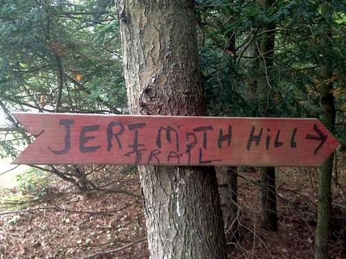
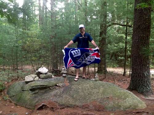
Jerimoth Hill, Rhode Island - State HP #15
The drive down from Maine through NH, MA, and into Rhode Island was uneventful. It finally rained on our trip, and was gloomy the whole day. Luckily we hadn't any more hiking to do, and Jerimoth was just a mere roadside stop off to check off of our list. Jerimoth used to be on private property, but now the state of RI owns it and grants access daily. It sits just down the road from the state border with CT. The summit is really just a huge rock about 200 yards from the road in the forest. We were quiet and respectful as there are house nearby. There is now a sign on the road too, and it well marked through the trees too. We quickly dodged the raindrops and made our way to the "summit".
![Jerimoth sign]() Sign
Sign![Jerimoth summit]() Jerimoth Hill "summit"
Jerimoth Hill "summit"After snapping our requisite pics, we made our way back to the car and finished the drive to lower CT and my buddy's family. The following day we flew home to Florida. This trip brought my total to 15 State High Points, and completed a majorly successful summer. The Northeast was great to us, as we only had 1 bad weather out of 9. The peaks were all beautiful, and all had their own unique qualities. I personally have to say i had the best day on Katahdin, and enjoyed the combination of trails we took there. But, that is just an opinion. Hopefully many more will get to see all of these great peaks, and towns we visited along the way. Until Spring of 2013, signing off.................


Comments
Post a Comment