Closest to Rudolph Mtn; Very close to Bishop's Castle
Davenport
8,500 ft.
12
$13
Late May to early September
Close to Ophir CG; next closest to Rudolph Mtn.
Oak Creek
7,600 ft.
16
Free
Year-Round
Lowest elevation; Closest to Cañon City; No water
La Vista
8,600 ft.
27
$15-$19 (RV)
Mid-April through Mid-October
Only CG in San Isabel NF with electric hookups
South Tarryall Table
Route
Approximate Mileage
Approximate Elevation Gain
Special Note
Driving Directions
Spruce Grove
8.5 miles roundtrip
2,700ft.
Begins beautifully by crossing the Taryall Creek on a footbridge
From Lake George on Hwy 24 turn north on Park County 77 and travel for approximately 16 miles.
Twin Eagles
9 miles roundtrip
2,600 ft.
A nearby option to Spruce Grove trailhead
From Lake George on Hwy 24 turn north on Park County 77 and travel for approximately 16 miles.
Goose Creek
9 miles roundtrip
3,200 ft.
More even grade to Hankins Pass than western side; intimate view of Hayman Burn
From US Highway 285 turn south at Pine Junction on to Jefferson County Road 126. Take Jefferson County 126 south for approximately 22 miles to Forest Road 211, also known as the Matukat Road. Travel west on Matukat Road approximately 14 miles to the trailhead.
Spencer Peak
Route
Mileage
Elevation Gain
Special Note
Driving Directions
Molas Lake Direct
5 miles roundtrip
2,044 ft.
The shortest, most direct route with least elevation gain
From Silverton, Hwy 550 south to signed turnoff for Little Molas Lake (turn right/west-northwest). Continue 1 mile to lake parking.
Bear Creek
9 miles roundtrip
3,474 ft.
Includes a loss of 150 feet; greatest overall elevation gain
From Silverton, Hwy 550 north about 1.5 miles to gauging station. Parking may be questionable.
Via Lime-Bear Basin
9 miles roundtrip
2,246 ft.
Includes a loss of 521 feet en route; might make nice loop with Molas Direct
From Silverton, Hwy 550 south to signed turnoff for Little Molas Lake (turn right/west-northwest). Continue 1 mile to lake parking.
Mount Deception
Route
Mileage
Elevation Gain
Special Note
Driving Directions
Summer Eastern Slopes
.6 miles roundtrip
416 ft.
The shortest, most direct route with least elevation gain
From Rampart Range Road, go west on Hotel Gulch Road about 1.5 miles to a non-descript turnoff to a casual camping area and park. (Campsite turnoff is at the highpoint of the road between 2 streams indicated on the map.)
Shoulder Season from Rampart Range
3.6 miles roundtrip
Net loss of 19 feet (includes 352 feet of climbing and 371 feet of descent to reach summit)
A good option when Rampart Range Road is open but Hotel Gulch is impassible due to snow/mud.
From Rampart Range Road, go west on Hotel Gulch Road.
Winter from Hwy 67
4.7 miles roundtrip
1,602 ft.
Longest route with most elevation gain; suitable when roads to other routes are impassible
From Woodland Park, follow Hwy 67 about 5 miles north to Rt 79 turnoff. Turn east. Hotel Gulch Road will be on your right.
Photo strip, no frame -- to FULL enlargement
Click on images to enlarge.
Photo strip, no frame -- to MID enlargement
Click on images to enlarge.
"Windy Peak" Table
Route
Approximate Mileage
Approximate Elevation Gain
Special Note
Driving Directions
Burro Trail from Bridge Creek
3.3 miles one-way
1,100ft.
Includes initial elevation gain then loss before beginning the real climb
From the visitor's center, travel 2 miles east-northeast. Trailhead on the left.
Burro Trail from Nott Creek
3 miles one-way
1,200 ft.
Ascends the southeastern slopes of the peak, perhaps avoiding the worst of the summer heat
From the visitor's center, travel 2.75 miles east-northeast. Trailhead on the left.
Buffalo Trail from Rifleman-Phillips Trailhead
3 miles one-way
150 ft.
Though this route starts high, it begins by losing considerable elevation prior to climbing north then east.
From the visitor's center, follow Mountain Base Road approximately 8 miles to the Rifleman-Phillips Campground.
"Cupid" Route Overview
Route
Mileage
Elevation Gain
Seasonal Note
Driving Directions
From Loveland Pass
3 miles roundtrip
1,203 ft.
High ridge route provides relative avy safety in snow season
From I-70, Exit #216 to Hwy 6 south about 4 miles to summit of pass.
Via Grizzly Gulch
7 miles roundtrip
2,565 ft.
Not recommended during snow season due to avalanche danger
From I-70, Exit #221 to Rt. 321 (Stevens Gulch Road) south about 1 mile to turnoff on the west.
Bighorn Sheep bachelors and autumn color. Click on images to enlarge.
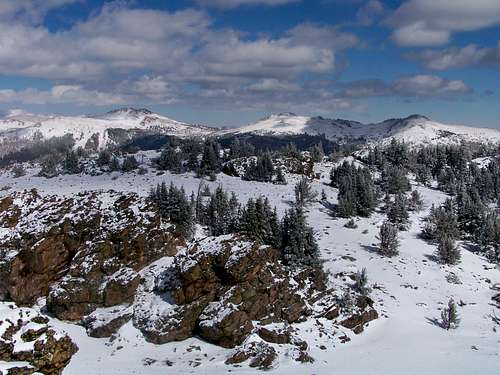
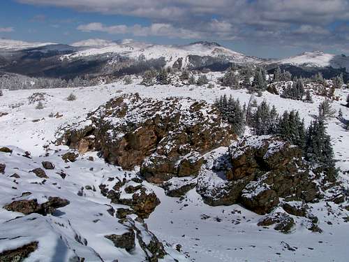
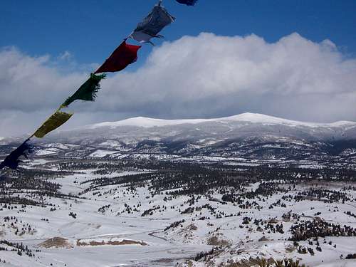
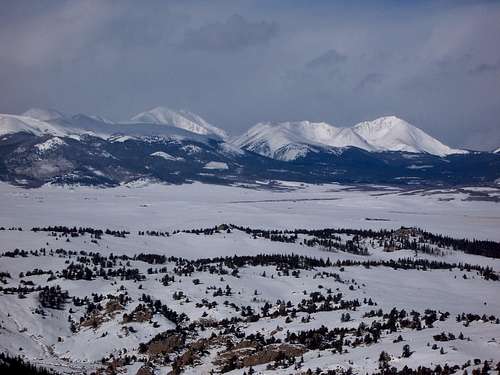
Snow Season in the Tarryall
Snowseason is a magical time in the Tarryall. Click on images to enlarge.
Centennial Cone
Access Point
Special Note
Driving Directions
North Access
Equestrian parking; latrine
From Golden, take Colorado Hwy. 93 north approximately 1 mile to Golden Gate Canyon Rd. Go west about 8 miles to Robinson Hill Rd. Travel west approx. 8 miles to Robinson Hill Rd. and turn left. Continue to Camino Perdido, which is the north access road into the park. The trailhead is approximately one mile to the south.
West Access
Limited automobile parking; latrine
From West U.S. Hwy. 6 and State Hwy. 93 west of Golden, travel west on Hwy. 6 about 11 miles. Turn right at Hwy. 119, and travel about 1/2 mile. Turn right onto Douglas Mountain Road and travel about one mile to Centennial Cone Road. Turn right and go about 1 mile to Centennial Cone Rd.
South Access
Currently closed for construction
From West U.S. Hwy. 6 and State Hwy. 93 west of Golden, travel west on Hwy. 6 about 9 miles. The parking area is on the north side of Hwy. 6
Centennial Cone Film Strip
Late summer ladybug swarms on Centennial Cone Click images to enlarge.
Mount Esther Table
Route
Approximate Mileage
Approximate Elevation Gain
Special Note
Driving Directions
Mount Esther Trail
5 miles roundtrip
1,500 ft.
Easier Steeper approach and better workout, but tougher to locate the trailhead.
Mt. Esther TH on Mountain Rd. in Chipita Park, just south of the intersection with Picabo Rd.
Crow Gulch Routet
4.25 miles roundtrip
900 ft.
Easy to locate trailhead with plenty of parking and mile elevation gain.
Take Highway 24 to Cascade, Colorado. Follow the signs to Pikes Peak Highway, heading west at the traffic light.
Round Hill Filmstrip
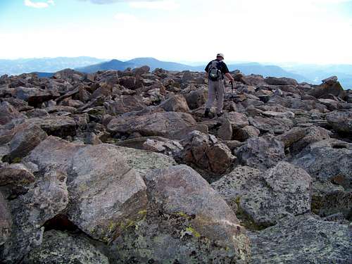
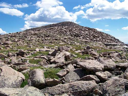
Summit cairn / Buffalo Peaks / View from the treed summit Click on images to enlarge.
Follow up a short little steep road (Hydro Street) to the gravel parking area
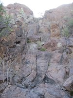
Rock Outcrop en Route 29 Mar 2009
UN 10245 B Filmstrip
Left to right: Pikes Peak, from east; Runs-Down-Fast, Almagre; Wind-blown snow, Pikes Peak. Click on images to enlarge.
Simple 2-Column
Road
Commentary
Rampart Range Road (FS 300)
This is a wide, graded dirt road suitable to almost all passenger vehicles. I have even seen road motorcycles (not dirt bikes) on this road. The worst objective hazard on this road will be drivers that are speeding, careless, drunk or some combination of these.
Mount Herman Road (FS 320)
This road is semi-graded with some rutting, chug-holes and wash-boarding. Most notably, this road is very narrow in places with steep drop-offs. Uphill drivers not only have the right-away but also have the benefit of being on the “inside/mountain-side” of the curves. Downhill drivers are exposed to the steep drop-offs on the “outside” of the road, meaning this can be a more pleasant drive from Monument to Rampart Range Road than in the reverse.
FS 300U
This is a rustic, un-graded road, probably a mining or logging remnant. Though not particularly rocky, the road gets extremely narrow in places, constricted by trees or rock outcroppings. Only a very narrow vehicle, ATV or dirt bike could make it to the base of Soldier Mountain.
Simple 2-Column, Different Orientation
From Florissant
From Lake George
Less than 1 mile west of Florissant on Hwy 24, turn left/south on CR 46.
Follow CR 46 3-4 miles to CR 98.
About 1 mile past the junction of CR 98 and CR 61, turn right on FS 244.
Follow FS 244 a little more than a mile as it begins ascending the west slope of Blue Mountain, parking in a broad, flattish area before the road steepens.
In Lake George, turn left/southwest on CR 96.
At a little over 1 mile, take CR 61 due south.
CR 61 circles Blue Mountain to its east.
About 1 mile past the junction of CR 98 and CR 61, turn right on FS 244.
Follow FS 244 a little more than a mile as it begins ascending the west slope of Blue Mountain, parking in a broad, flattish area before the road steepens.
Closest of the three approach roads to Lake City. Steep ascent requires low-end climbing gear ratio. Not a good descent route later in the day as narrow road has little to no pull-outs on steepest parts should another 4x4 be encountered.
Rambouilette Park Forest Service Road
7 miles
1,000 feet
Semi-Decommissioned by the Forest Service this road is very faint at times and the driver needs to be attentive to stay on-course. Lower sections near CO Hwy 149 are somewhat steep and rocky, but there are more opportunities to find pull-outs if an uphill vehicle is encountered.
Via Spring Creek Pass
6.5 miles
1,200 feet
We did not utilize this route, the furthest of the three from Lake City. Please send a note if you have commentary to share about this approach.
Old Black: Flowers
Touch-Me-Not
Astor
Goldenrod
Meadow Ridge Campground
Thunder Ridge Campground
• 19 campsites
• 9,200 feet elevation
• Season: Generally early May through September
• $15 per night, per site
• Amenities include tables, fire grates, drinking water, latrines, and trash collection
• 21 campsites
• 9,200 feet elevation
• Season: Generally early May through September
• $15 per night, per site
• Amenities include tables, fire grates, drinking water, latrines, and trash collection
Weather Test
2011-11-19T20:14:09-07:00current observations and forecastDenver-Boulder, COhttp://www.crh.noaa.gov/bouhttp://www.nws.noaa.gov/forecasts/xml/point1Loveland Pass, COLoveland Pass11018
http://forecast.weather.gov/MapClick.php?lat=39.68&lon=-105.88
k-p6h-n1-12011-11-19T21:00:00-07:002011-11-26T18:00:00-07:00k-p6h-n1-22011-11-19T21:00:00-07:002011-11-26T18:00:00-07:00k-p12h-n14-12011-11-19T18:00:00-07:002011-11-20T06:00:00-07:002011-11-20T18:00:00-07:002011-11-21T06:00:00-07:002011-11-21T18:00:00-07:002011-11-22T06:00:00-07:002011-11-22T18:00:00-07:002011-11-23T06:00:00-07:002011-11-23T18:00:00-07:002011-11-24T06:00:00-07:002011-11-24T18:00:00-07:002011-11-25T06:00:00-07:002011-11-25T18:00:00-07:002011-11-26T06:00:00-07:00k-p24h-n7-12011-11-19T18:00:00-07:002011-11-20T18:00:00-07:002011-11-21T18:00:00-07:002011-11-22T18:00:00-07:002011-11-23T18:00:00-07:002011-11-24T18:00:00-07:002011-11-25T18:00:00-07:00k-p24h-n7-22011-11-20T06:00:00-07:002011-11-21T06:00:00-07:002011-11-22T06:00:00-07:002011-11-23T06:00:00-07:002011-11-24T06:00:00-07:002011-11-25T06:00:00-07:002011-11-26T06:00:00-07:00Daily Minimum Temperature1516191519179Daily Maximum Temperature3031293736262412 Hourly Probability of Precipitation5030306030Weather Type, Coverage, IntensityConditions Iconhttp://forecast.weather.gov/images/wtf/nsn50.jpghttp://forecast.weather.gov/images/wtf/sn30.jpghttp://forecast.weather.gov/images/wtf/nsn30.jpghttp://forecast.weather.gov/images/wtf/sn60.jpghttp://forecast.weather.gov/images/wtf/nsn30.jpghttp://forecast.weather.gov/images/wtf/few.jpghttp://forecast.weather.gov/images/wtf/nfew.jpghttp://forecast.weather.gov/images/wtf/few.jpghttp://forecast.weather.gov/images/wtf/nfew.jpghttp://forecast.weather.gov/images/wtf/sct.jpghttp://forecast.weather.gov/images/wtf/nsn.jpghttp://forecast.weather.gov/images/wtf/sn.jpghttp://forecast.weather.gov/images/wtf/nsn.jpghttp://forecast.weather.gov/images/wtf/sct.jpgWatches, Warnings, and Advisories
http://forecast.weather.gov/showsigwx.php?warnzone=COZ034&warncounty=COC019&firewxzone=COZ212&local_place1=Loveland+Pass+CO&product1=Hazardous+Weather+Outlook
Watches, Warnings, and Advisories
http://forecast.weather.gov/showsigwx.php?warnzone=COZ034&warncounty=COC019&firewxzone=COZ212&local_place1=Loveland+Pass+CO&product1=Short+Term+Forecast
Text Forecast
A 50 percent chance of snow. Mostly cloudy, with a low around 15. Wind chill values as low as -1. Southwest wind between 15 and 17 mph, with gusts as high as 28 mph. Total nighttime snow accumulation of less than a half inch possible.
A 30 percent chance of snow. Partly sunny, with a high near 30. Wind chill values as low as -1. West southwest wind between 10 and 18 mph, with gusts as high as 30 mph. New snow accumulation of less than a half inch possible.
A 30 percent chance of snow, mainly after 11pm. Mostly cloudy, with a low around 16. West wind between 10 and 15 mph, with gusts as high as 24 mph. New snow accumulation of less than a half inch possible.
Snow likely, mainly after 11am. Mostly cloudy, with a high near 31. West wind between 6 and 9 mph. Chance of precipitation is 60%.
A 30 percent chance of snow, mainly before 11pm. Mostly cloudy, with a low around 19. West northwest wind between 6 and 9 mph.
Sunny, with a high near 29.Mostly clear, with a low around 15.Sunny, with a high near 37.Mostly clear, with a low around 19.Mostly sunny, with a high near 36.
A chance of snow. Mostly cloudy, with a low around 17.
A chance of snow. Mostly cloudy, with a high near 26.
A chance of snow. Mostly cloudy, with a low around 9.
Mostly sunny, with a high near 24.point1Copper Mountain (12,400 feet), CO12074http://www.nws.noaa.gov/data/obhistory/KCCU.htmlk-p1h-n1-12011-11-19T20:45:00-07:00271254Weather Type, Coverage, Intensity10.00Conditions Iconhttp://forecast.weather.gov/images/wtf/novc.jpg20029.952613

 5215 Hits
 74.92% Score
 5 Votes


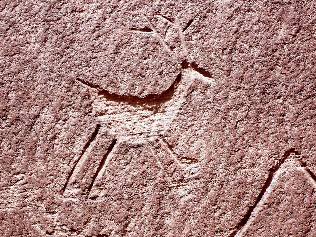


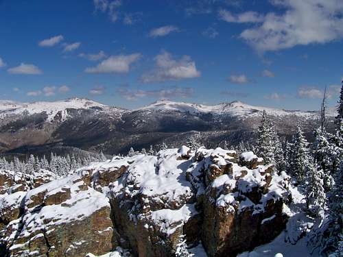


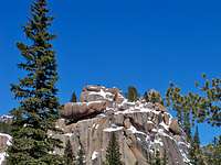 Closeup of a frosted rock outcrop
 Rock Outcrop en Route