
|
|
Mountain/Rock |
|---|---|
|
|
44.67783°N / 6.96306°E |
|
|
Piedmont |
|
|
Hiking, Mountaineering |
|
|
Spring, Summer |
|
|
9911 ft / 3021 m |
|
|
Overview
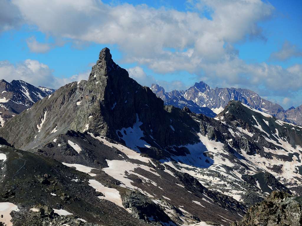
Il Pelvo aka Pic de Caramantran 3021 m
Il Pelvo 3021 m is also called Pic de Caramantran, probably with the aim of being able to distinguish it from the various mountains in the Western Alps called Pelvo. It is a minor mountain, anyhow exceeding the threshold of 3000 meters, belonging to the Alpi Cozie and located on the Italian-French border between the upper Val Varaita (Municipality of Pontechianale) and Queyras (Municipality of Ristolas). The mountain is located about a thousand meters away and south-west of Colle dell'Agnello and is close to another Threethousander, Punta dell'Alp, from which it is separated by a saddle at an altitude of 2,969 m. The French side of Il Pelvo is located within the Parco Naturale Regionale del Queyras.
The Normal route to climb Il Pelvo starts about 2 km below Colle dell'Agnello 2748 m, on the French side. It's an easy route, which doesn't present particular difficulties. In reason of its moderate elevation gain is suitable as a training climb at the beginning of the season.
Getting There
The starting point to climb Il Pelvo is a parking lot on the French side of Colle dell'Agnello 2748 m, a high road pass between Italy and France.
- Coming from Italy: from Pinerolo or Cuneo reach the entrance to Val Varaita and drive up it, passing Sampeyre, Casteldelfino and Chianale and reaching Colle dell'Agnello. Cross the Colle dell’Agnello, descend by car to the first wooden cabin located a few bends below, at about a couple of km. after the col, leaving the car in the adjacent parking lot to the right at an altitude of 2640 m.
- Coming from France: from Molines en Queyras follow the road to Colle dell'Agnello and a couple of km. before reaching the pass near a wooden cabin on the right park the car in a parking lot on the left at an altitude of 2640 m.
Route
Il Pelvo Normal Route
Difficulty: EE
Difference in level: about 400 m from the parking lot
Starting point: parking lot a couple of km below Colle dell'Agnello, on the French side
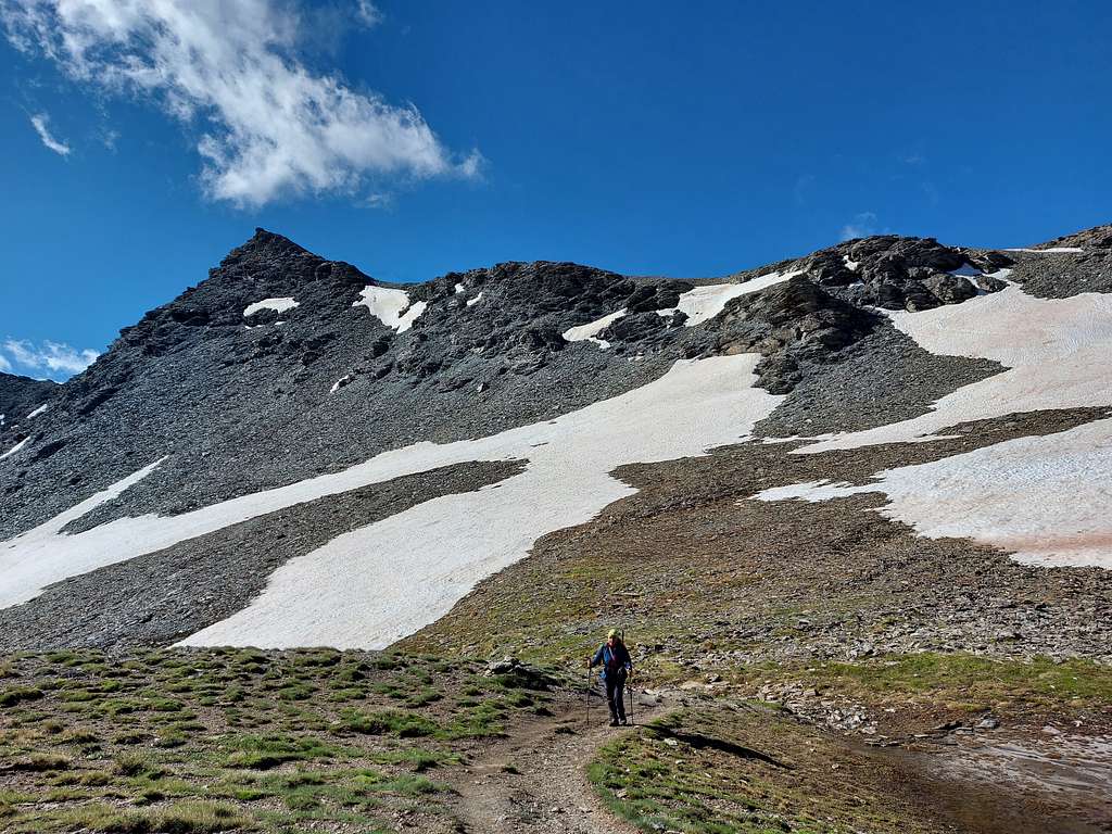
The standard route up to the summit climbs across the Col Chamoussiére in French territory and doesn't present particular difficulties.
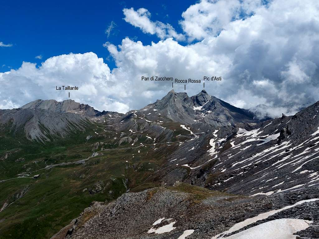
From the car park, cross the road and take the path in front, joining shortly after the start the main path GR 58 to the Col de Chamoussière 2882 m. You initially lose a bit of altitude, then you begin to climb up along the southern side of the valley, where some snow fields remain at the beginning of the season, making a wide semicircle to finally reach Col de Chamoussière (2884 m) with some hairpin bends. Here it opens a fine view to the Roc della Niera or Tête des Toillies.
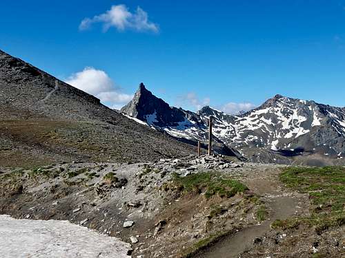
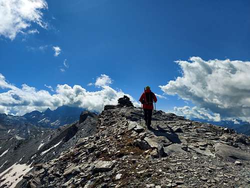
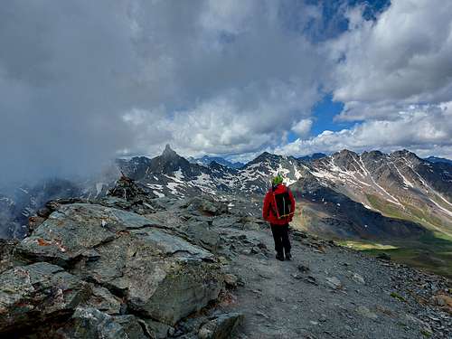
From the col the path GR58 descends on the right to the Tour del Queyras. A second path leads to Col di San Veran. Some tracks on the left head instead high towards the ridge. We take these tracks turning left, climbing up to the NW ridge of debris until we reach the top where there is simply a little cairn with prayer flags. From the top of the Pelvo it is possible to reach in a short time also the top of Punta dell'Alp.
Descent: reversing the same itinerary
Red Tape
No fees no permits required. Punta dell'Alp is located within the Parco Naturale Regionale del Queyras.
Please respect the rules provided for within natural parks and protected areas. Fires are strictly forbidden and the whole fauna and flora is protected. Don’t disturb fauna and other mountaineering and hikers’ peacefulness with every kind of noise.
Hiking and scrambling grades
T - Turistico (Tourist): Itineraries on wide, clear and well worn paths, sometimes on mule tracks or gravel roads. The routes are never exposed, don't give any orientation problems and don't exceed 2500 meters of altitude. Suitable also for children.
E - Escursionisti (Hikers): Itineraries on marked trails, even narrow and with possible steep and impervious sections. They are never exposed and don't give any orientation problems. They can tread different kinds of ground, such as forests, gravel, meadows, pastures, easy rocks, etc.). They form the majority of the trails that wind up in the mountains and require a certain habit to walk; you need equipment suitable for the altitude and resistant footwear with soles suitable for rough terrain.
EE - Escursionisti Esperti (Experienced Hikers): Itineraries for hikers with experience and good knowledge of the mountain. Some of these paths may have exposed sections, however brief, which require firm foot and no dizziness. They require the ability to adapt to particular terrain, such as steep grassy slopes or stretches of rocks with difficulties that can reach the 1st degree of the UIAA scale. They can also reach high altitudes (3000 m or more). Sometimes they may include unmarked sections, requiring a good sense of orientation. Snow slopes are possible, however which can be overcome without specific mountaineering gear (rope, harness, crampons, ice-axe).
EEA - Escursionisti Esperti con Attrezzatura (Experienced Hikers with equipment - The same as EE, in addition these routes require the use of via ferrata equipment (lanyards, harness, carabiners, heat sink, helmet). This kind of itineraries range from the trails with short easy and not much exposed sections, previously equipped with fixed ropes and iron pegs, to the true and more difficult Via Ferratas climbing on rocky walls or on aerial ridges and ledges, previously equipped with long stretches of iron ropes, iron steps, ladders without which proceeding would constitute a real climbing. It is necessary to know how to use the technical equipment and have a certain habit of exposure and mountaineering terrains.
When to Climb
Mountaineering: the best period goes from middle June to the end of September
Ski mountaineering: from March to May
Where to stay
There are different possibilities both on the italian and the french side: B&B, huts, apartments, camping, hotels.
Huts on the Italian side
Rifugio Alevè 1600 m
Rifugio Savigliano 1743 m
French side
Refuge Agnel 2580 m
Bibliography
“Monte Viso – Alpi Cozie Meridionali” by Michelangelo Bruno – Collana CAI-TCI Guide dei Monti d’Italia
Maps
"Monviso-Valle Varaita-Valle Po-Valle Pellice" -IGC sheet 106 1:25000
"Mont Viso" IGN 3637 OT
Meteo forecast
Meteo Regione Piemonte
Meteo France