nomad - Apr 24, 2006 7:44 am - Voted 10/10
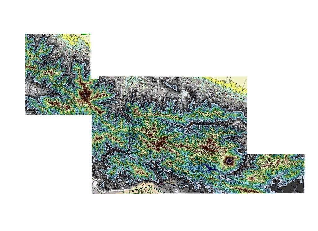
hey !Looks great, you can see everything in a view. I feel I want to print o large one and stick it to my room wall. It's too late to say it but I feel my color definition looks creepy, maybe using a palette of only one or two colors would look better, but the first time I did it I choosed the colors randomly not using my senses just because I couldn't understand the white maps :) sure I would like to have the map, if no problem, mail it to my gmail, if it's to big cut it into pieces, I will paste them.
reza - Mar 3, 2009 12:33 pm - Hasn't voted
Great mapsGreat maps. They were really helpful, very detailed.
Reza
nader - Mar 3, 2009 12:39 pm - Hasn't voted
Re: Great mapsThank you Reza
Took me almost a year to make this map and then stitch together all the 50 odd pieces of it.
Yazdani - Aug 4, 2009 3:00 pm - Hasn't voted
Yazdani AbdolaliAghaa Naader e Aziz
dast marizaad
in aksaay e shoma maro vel nemikone
emrooz aks hay e Aazaad kouh ro mididam
man az roostay e Nessen ta entehaay e abkhiz e rood kahne nessen ke az gharb e gholle miayad (Soutak) chandin baar rafte am va az in daarre namaay Aazaad kouh benazaram khaily ziba tar ast.
vali shoma az roostay e Naahieh va shomal e sharghi aan aks gereftid
in rood khane yeki az behtarin makan hay e zaad aavary e maahi e Ghezel Aalaa (Brown Trout) ast, albate chand saal ast narafte am agar chizi baghi gozashte bashand.
nader - Aug 5, 2009 3:14 pm - Hasn't voted
Re: Yazdani AbdolaliAzad Kooh albateh az hame taraf ghashange. Shazdeh hast dige vali shoma rast migin, az darreye Nessen hatman bayad kheyli ghashang bashe.
viewfinder - Feb 15, 2014 4:35 pm - Voted 10/10
Very well doneThis is a really helpful map. It shows many more summit heights and names than any other maps of the area that I have seen. If, as the author states, it is based on 1:50,000 maps, then these heights and names are likely to be accurate. It gives a height of 5628 metres for Damavand. Unlike the traditional height of 5671 metres, which still appears on far too many websites including the summitpost Damavand main page, 5628 metres is compatible with GPS observations and SRTM data.
nader - Feb 16, 2014 11:40 am - Hasn't voted
Re: Very well doneThank you for voting and commenting,
The 1:50000 maps give accurate elevations. Names come from schematic maps (drawings) that are often used by climbers in Iran.
I checked out your web-site. Very interesting.
michi.ammergauer - Dec 27, 2018 9:06 am - Hasn't voted
attempt to load failsHi there! how can I zoom into the map? I have tried Chrome and Safari, neither one works ... thanks! Michael
nader - Dec 27, 2018 2:38 pm - Hasn't voted
Re: attempt to load failsHi Michi
On the right upper side, you will see "size". Click on "original". A plus sign appears on the image. click the plus sign and the big map should become visible.
Sorry about that. How things on Summitpost work seem to change from year to year.
nader - Jan 4, 2019 2:10 pm - Hasn't voted
Re: attempt to load failsHi Michi,
There was a problem with Summitpost. This was corrected. You should be able to zoom on the map now.


Comments
Post a Comment