
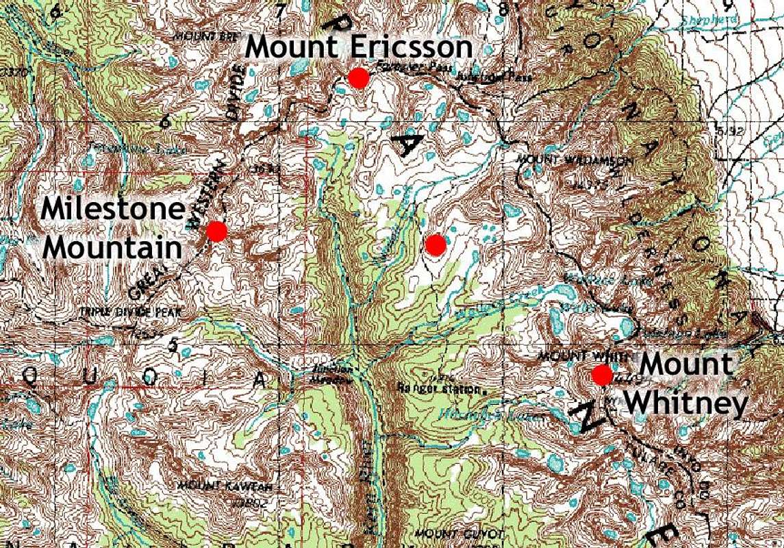
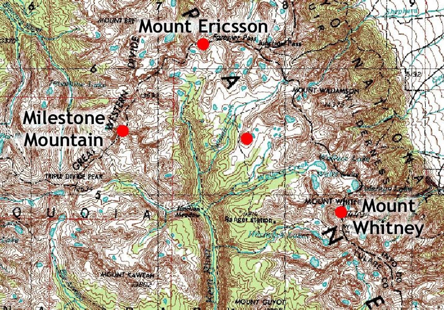
Map of Upper Kern River Basin
An overview map of the Upper Kern River Basin, showing the following summits (clockwise from lower left): Milestone Mountain, Mount Ericsson, Bighorn Plateau, Mount Whitney (Sequoia and Kings Canyon National Park, Sierra Nevada, California, USA)


