
-
 6875 Hits
-
 81.02% Score
-
 13 Votes
|
|
Mountain/Rock |
|---|---|
|
|
50.26727°N / 126.28982°W |
|
|
Mountaineering |
|
|
Summer |
|
|
5604 ft / 1708 m |
|
|
Overview
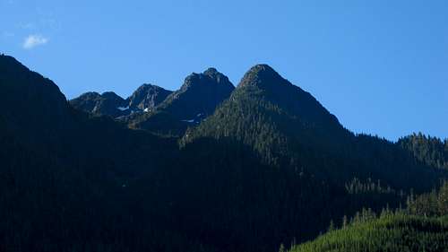 Jagged Mountain NE Aspect
Jagged Mountain comprises of a series of impressive rocky pinnacles situated above the Eve River in the eastern reaches of the Sutton Range on northern Vancouver Island, British Columbia. The mountain may be clearly seen from several points along the Island Highway 19 near the Eve River rest area and looks enticing enough. It’s somewhat surprising therefore that the tattered summit register contains only a handful of entries, only 2 or 3 of which date from the last 5 years.
To reach the summit requires a long-ish walk on very rough roads as well as the usual Vancouver Island cocktail of logging slash, bush and loose rock. Rewards for the effort are plentiful, however, from near neighbours such as Hapush Mountain and Mt Eden and beyond to Victoria Peak, Warden Peak and the more distant members of the Sutton Range. And, unusually for the Island, you can even look down on a paved road, the Island Highway, far below.
 Jagged Mountain West Aspect
Getting There
Vancouver Island can be reached directly by air from many destinations including Toronto, Vancouver, Seattle, Calgary, Edmonton and San Francisco to either Victoria, Nanaimo, Comox or Campbell River and by ferry from Port Angeles to Victoria on The Coho and on BC Ferries from Vancouver to Victoria or Nanaimo. Public transport on the Island is notoriously poor and anyone arriving by air would be advised to rent a car.The approach from the highway to Jagged is entirely on gravel roads. A normal sedan might be OK on these, depending upon how willing you are to beat one up a little. To be on the safe side, take a high clearance vehicle – although you can probably get away without 4WD.
Approach
Approach the mountain from the south on the Inland Island Highway 19 from Victoria or Nanaimo. Note that map references are on the NAD27 datum.Drive Highway 19 north of Campbell River. Pass through Sayward Junction and drive a further 27 km to South Main, just after Rooney Lake. Turn left and drive South Main past Kunnum Main 6.5 km to spur S65. To this point you’ve been driving parallel to the highway on the opposite side of the Eden River.
Turn left at S65 and drive as far as you can up the hillside. The best spot to reach is at N 50 15.880 W 126 19.409 at an obvious high point in the road. Providing you reach this spot, park here and prepare to walk the rest of the way. Elevation at the start is 670 metres.
Summit Route
From the parking spot above, walk down the hill, across the bridge and turn left across the ditch and up the spur beyond.Walk the “road” for 3.2 km to a shallow valley on the right filled with recent logging slash and new growth. This isn’t the easiest of walks. Where the road isn’t completely de-built, it’s festooned with tank-trap like water bars every few metres. It’s clear that the logging company isn’t keen on you coming this way.
Leave the road at N 50 16.009 W 126 18.630 and an elevation of 975 m. Don’t be tempted to walk further on the road. This puts you higher up the approach but above the gully the base of which you will need to reach to access the upper mountain.
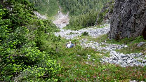
Enter the slash/new growth and make your best route due east. The best option is to deek up into the old growth above as soon as you can and then contour above the slash until you reach a wide and open gully – see picture.
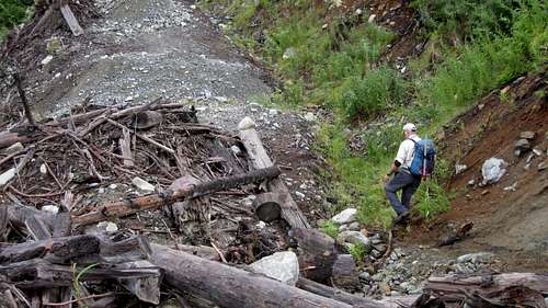 Jagged Access Road Jagged Access Road |
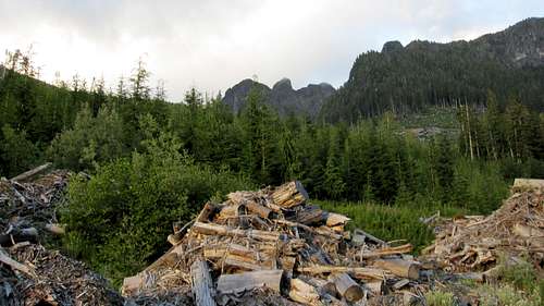
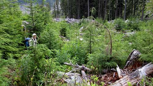 Initial Logging Slash Initial Logging Slash |
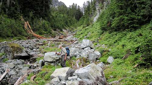 Lower Access Gully Lower Access Gully |
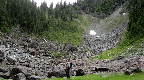 Sub Alpine Bowl Sub Alpine Bowl |
Don’t be tempted by the easy slopes and obvious col to the southeast. Instead turn northeast from the tarn and head for the tight col you can see from there. Prepare for steep (300 m vertical in 450 m of travel) and loose boulders/scree and finally heather.
Drop down northeast from the tight col, contouring across the mountainside rather than down to the bowl below and find the summit access gully at N 50 15.950 W 126 17.502.
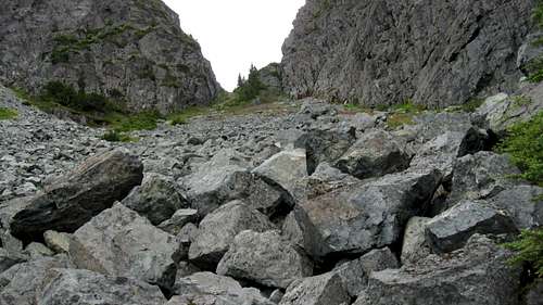 Upper Gully Upper Gully |
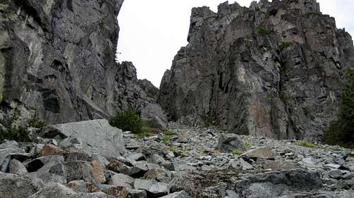 Summit Access Gully Summit Access Gully |
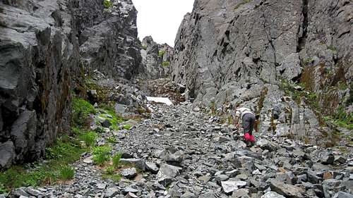 Climbing the Summit Gully Climbing the Summit Gully |
 Descending the Upper Gully Descending the Upper Gully |
Retrace your steps to your vehicle.
Note: Garmin maps indicate that the summit of Jagged is the pinnacle to the left after reaching the summit ridge. We could see that this was a clearly lower summit, although within the same contour as the true summit.
Approximate route data
Total return distance: ~ 13.6 km
Net elevation: ~ 1,050 metres
Total elevation: ~ 1,150 metres
Ascent Time: ~ 7-8 hours
Descent Time: ~ 5-6 hours
As always a MapSource/Garmin tracklog is available for the asking for the approach and summit routes. Just send me an email or PM.
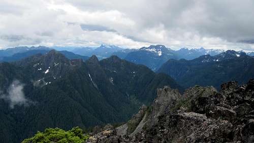 Summit View SE Summit View SE |
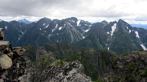 Summit View S Summit View S |
Red Tape/Safety Considerations
Absolutely no red tape.There’s nothing resembling a formal trailhead and an intentions system simply doesn’t exist in this neck of the woods. Make sure, therefore, that you have left a detailed trip plan with someone responsible. The RCMP and the appropriate SAR agency will respond in an emergency but it is up to you to have the mechanism in place that will initiate the call-out process if it becomes necessary.
This is a very remote location. There is no cellular service anywhere after leaving Campbell River.
Camping
There’s not much in the way of a flat surface to camp on at the start point indicated above. We camped in one of several pullouts on the way up S65 with nice views across the valley to the east and drove back 10 minutes to the start point the following morning.Or, if you don’t mind a longer drive – say 30 minutes or so – camp at the well equipped Eden River rest area which has toilets and spots for tents and even RV’s.
Useful Links
For more information refer to Island Alpine – A Guide to The Mountains of Strathcona Park and Vancouver Island, Philip Stone, Wild Isle Publications, 2003, ISBN 0-9680766-5-3For general backroad information and directions get hold of a copy of Backroad Mapbooks: Vancouver Island, Victoria and the Gulf Islands v7