
|
|
Route |
|---|---|
|
|
31.34022°N / 35.28090°E |
|
|
Hiking |
|
|
Winter |
|
|
Half a day |
|
|
Overview
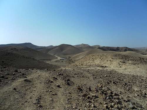
Jodeaen desert. Route № 3. Upper Tseelim. The Southern ring
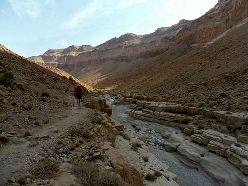
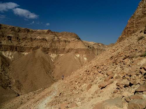
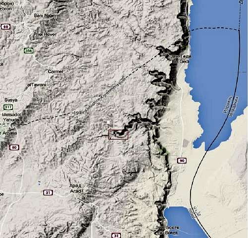 | The route is located in the depth of the desert. At the same time it is not far from Arad town. The way by car from Arad to the starting point takes about an hour. The route passes on a bottom and coast of one of the biggest canyons of the Jodeaen desert Nahal Tseelim. There are many other routes and trails in Nahal Tseelim but most of them are much longer and more hard. This route is the best choice for the first visit to Tseelim. |
Getting There
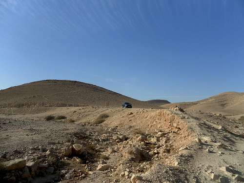
| 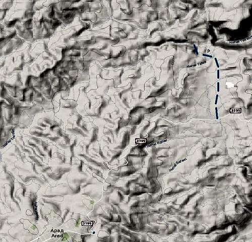 |
|
Route Description
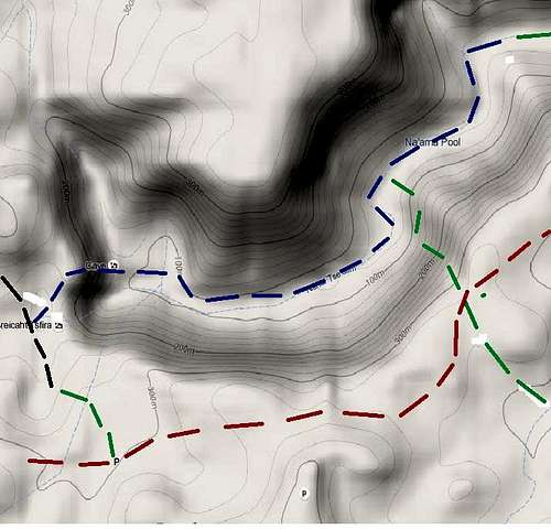 |
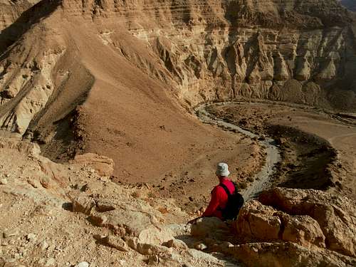
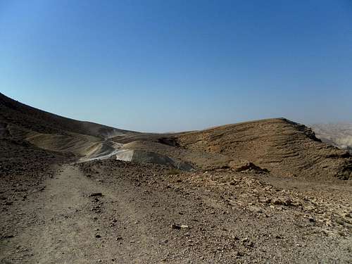
From the camping ground start descending by the “green” trail, then by “black” trail tol the junction with the “blue” trail. Ascent the cliff by the “blue” trail and look for the descending trail on the top of the cliff. About 30 min from the camping ground. Descend to the bottom of the canyon and continue by “blue” trail to the junction with “green” trail. About 2 hours from camping ground. Tern to the right and ascent the bank of the canyon by the “green” trail. On the plateau look for the “red” trail, tern to the right and by the “red” trail return to the camping ground.
|
General information
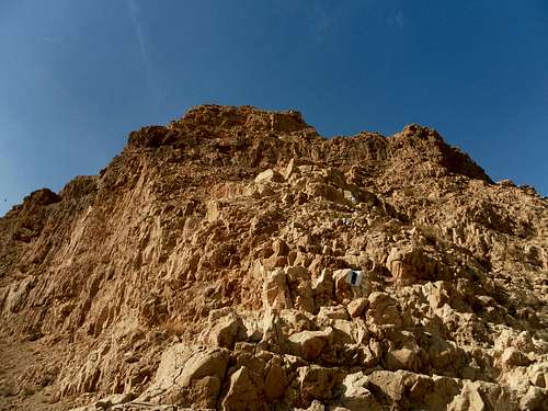
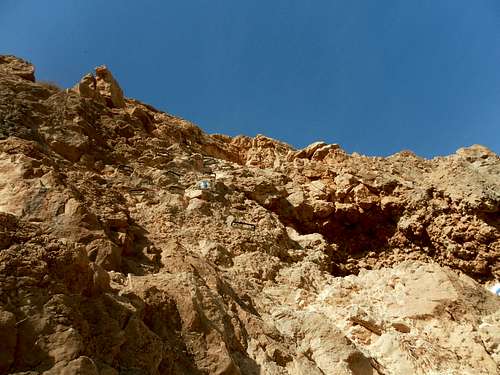
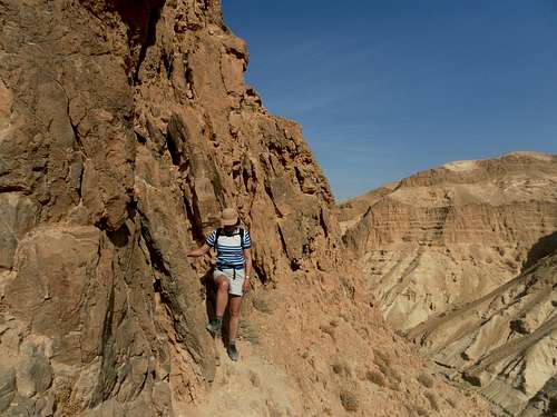
Difficulty:It is a medium hard hiking route. The most difficult part of the route is the descending trail to the bottom of the canyon which is laid on the 30 m long rocky wall equipped with cramps and rocky ridge. If you travel with kids or somebody in your party don’t feel good on abrupt rocks use a short rope for safety. The sun radiation is very strong especially on the way back so start as early as possible and have not less then 2 l of water per person and 5 l per person in your car as emergency supply. Orientation: it is quite easy. The route is all the time well marked. The elevation of the route from the bottom of the canyon to the highest point: 350 m Time for the route: 4-5 h Starting point: camping ground 13 km from Arad town. | 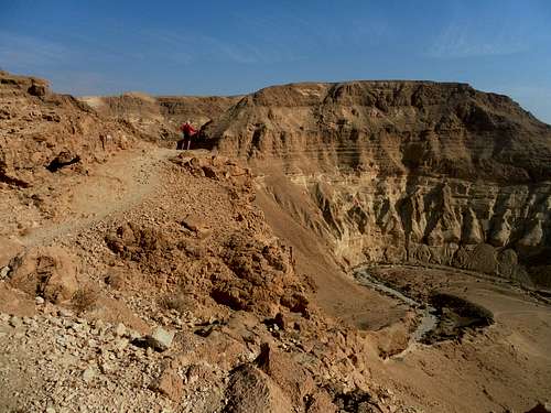 Jodeaen Desert. Upper Tseelim |
 |  |
 |  |
 |
 |  |