
|
|
Route |
|---|---|
|
|
31.16349°N / 35.35279°E |
|
|
Hiking |
|
|
Winter |
|
|
Overview
Up through Nahal Yizrah
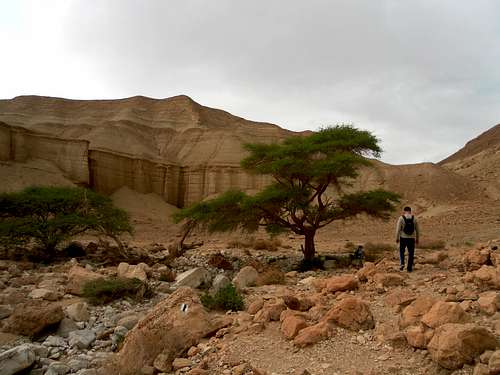
Short (5-6 hours) exclusively picturesque route in the Judaean Desert in Ein Boqeq area. The route is laid through three valleys Nahal Zohar, Nahal Yizrah and Nahal Rom. It begins and ends practically on the Dead Sea coastline (-450 m from a sea level).
The total elevation of the route is about 350 m. The high point of the route is the unnamed top (-100 m from a sea level). Despite small extent on the way there are two canyons, wide valley, mountain pass and even a small top. Ideal route for a party with kids. The route is marked all through, however there are no any information signs on the starting points.
Getting There
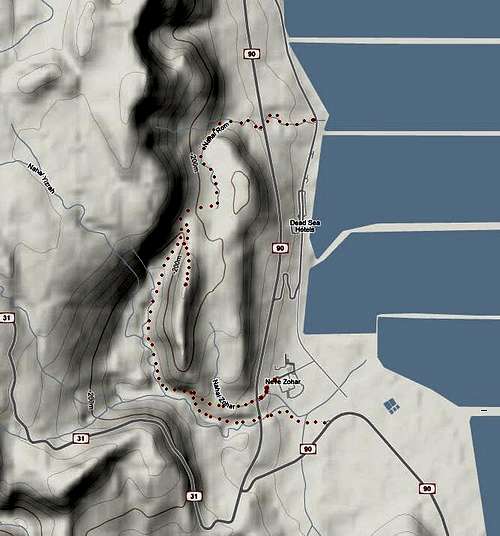
Dead Sea - Nahal Zohar - Nahal Yizrah - Nahal Rom - Dead Sea
Starting points
1. Neve Zohar junction on road 90. The track begins on the opposite side of the road 90. At the Neve Zohar entrance there is a place for parking.
2. Gas station on road 90 about 500 m from the junction with road 31 in the direction to Eilat. From gas station move in the direction of the bridge on road 90. The trail goes under the bridge.