
-
 398 Hits
-
 79.04% Score
-
 10 Votes
|
|
Mountain/Rock |
|---|---|
|
|
48.58512°N / 14.66979°E |
|
|
3517 ft / 1072 m |
|
|
Topographic isolation: 4 km
Nearest higher peak: Viehberg (1112 m)
Prominence: 153 m
Overview
Have you ever heard about Gratzener Berglands? Or about Novohradské hory? Likely not. It is a small mountain range along the Austrian-Czech state border, as called in German and in Czech languages. The Czech side of the mountain range covers an area of 160 km2. The highest peak of the Czech side of the mountain range is Kamenec, with its 1072 meter altitude. The German name of Kamenec is Steinberg. Both Kamenec and Steinberg mean "Rocky Hill". All geographical objects have German names here. Not only due to the proximity of Austria, but also because this area of Czechoslovakia was populated mainly by German people until 1945.
Looking around with a wider perspective, we can see that this small mountain range is part of the Bohemian Massif, at its southern part.
But let’s return to Kamenec. Its peak is very near to the Austrian-Czech state border. Only 390 meters far from it, on the Czech side. Since a mountain doesn’t consist of a peak only, but also mountain slopes, here the situation is that the peak is in the Czech Republic, while its southern slopes are stretching into Austria.
As I said, the state border doesn’t cross the peak. Nevertheless a kind of border does. It is the main European watershed, stretching from Gibraltar to Russia. In our case it means that the streams running to the south get to the Black Sea, while the streams on the north get to the North Sea. More precisely:
- South slope: Flammbach → Schwarze Aist → Waldaist → Aist → Danube → Black Sea
- North slope: Pohořský potok → Černá → Malše → Vltava → Elbe → North Sea.
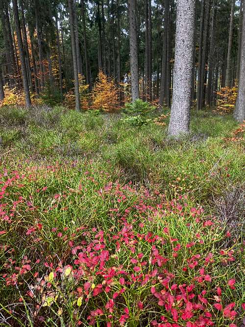
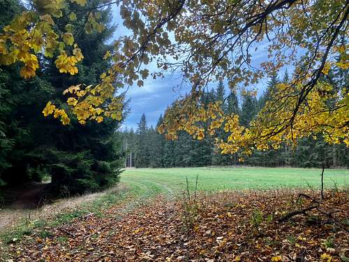
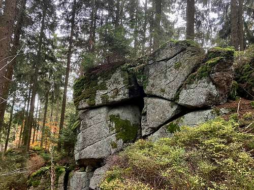
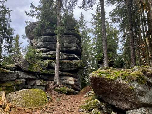
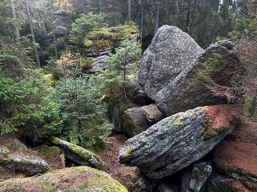
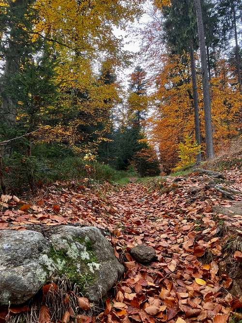
The mountain is made from granite. It can be seen very well on the peak, since it is a spectacular granite rock. Near the peak there are some other smaller granite cliffs, too. The peak is forested, so unfortunately it doesn’t offer any panoramic view. And anyway there wouldn’t be a chance to see deep valleys and sharp nearby mountains: this mountain range is a friendly countryside, without sharp forms - apart from the granite cliffs emerging here and there.
Routes
There are two evident routes to Kamenec: from the Czech side or from the Austrian side. I tried the Czech approach, but looking at the map for the Austrian trail it must be equivalently nice. Let’s see the details.
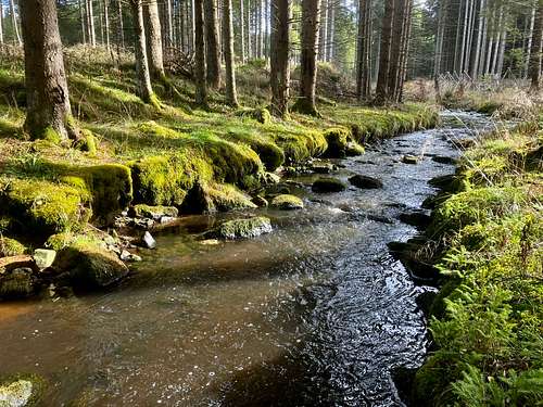
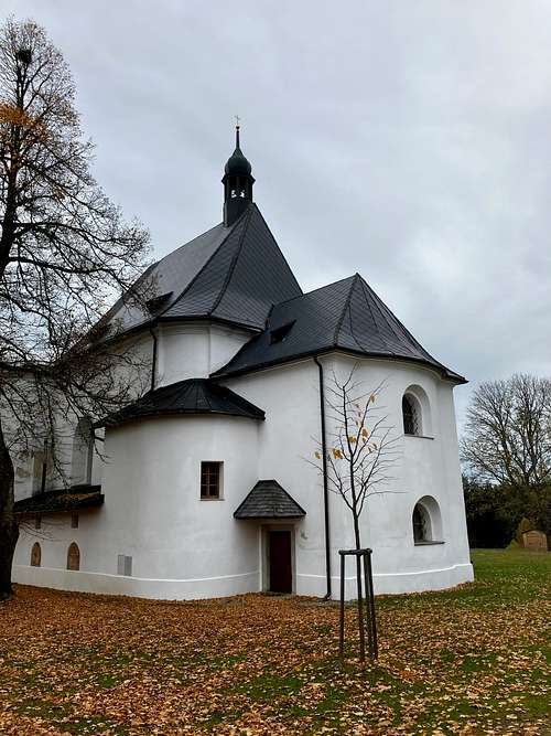
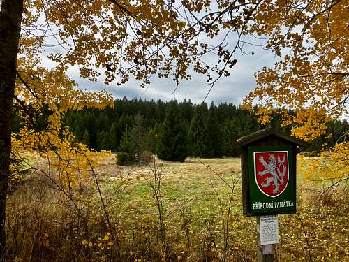
Route from the Czech side, starting from Pohoří na Šumavě: The trail starts from the parking place at the end of the village. It’s forbidden to stop anywhere else in the village - but at least the parking place is free. The village is very beautiful. You must walk from one end of this small village to its other end where the trailhead of the trail to Kamenec is. It is a marked trail. It’s easy to find this place: it is at the church of the village (Church of Our Lady of Good Counsel). The nave of the church is in ruin, while its sanctuary is excellently renovated. The church was built in 1791. So, from this point we are on the dirt road that will lead us to Kamenec. After 800 meters we cross the creek that is called Pohořský potok. The source of the creek is near here, and it is a nature protection area. The next notable location is where the hamlet Pavlina/Paulina was. The location of the hamlet can be identified only by a huge Thuja. The hamlet itself has disappeared since 1945. This borderzone area was not accessible between 1945 and 1990. Here nature has won over civilization. A further 1 km ascend, and you are at the peak.
Route from the Austrian side, starting from Sandl: Either you start from one of the parking places of Sandl, or you start from the little bit nearer Kohlstatt. I personally would start from Sandl, and if ever I’m there, I would hike also to the nearby peak of Viehberg that is the highest peak of Gratzener Berglands. But now we aim for Kamenec! We must follow trail 105. After walking 1 km from Kohlstatt, we get to Schloss Rosenhof. It’s a quite big privately owned castle that was built in 1760. Here the trail turns to the north and soon we get to a lake called Oberer Rosenhofer Teich. After 2 km walking we get to a junction. Here we must choose the left branch (trail V11). After 600 meters we get to the Austrian-Czech border. Both countries are in the Schengen zone, so normally the border can be crossed without any control. After a further 500 meters walk we can get to the peak of Kamenec.
When to Climb
In any season
Camping
These are the nearest campings:
- Camping Rosenberg at the Chech side, in 41 km distance
- Ruck Zuck Camping Mühlviertel at the Austrian side, in 53 km distance
External Link
You can find an excellent map of the mountain here: https://en.mapy.cz/turisticka?source=base&id=2026309&ds=1&x=14.6693128&y=48.5848979&z=14