
Viewing: 1-1 of 1

ryananderson - Feb 27, 2022 7:16 pm - Hasn't voted
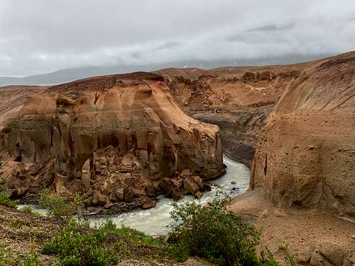
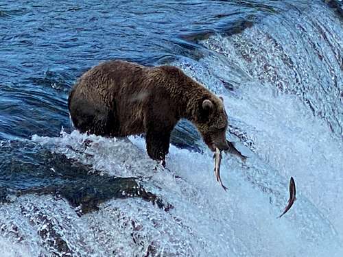
Shallow WaterDam that's kind of crazy how the water levels were pretty shallow.
Viewing: 1-1 of 1
|
|
Trip Report |
|---|---|
|
|
57.99766°N / 155.0499°W |
|
|
Aug 13, 2021 |
|
|
Hiking |
Two sixty somethings and two twenty somethings adventure into an Alaskan unknown
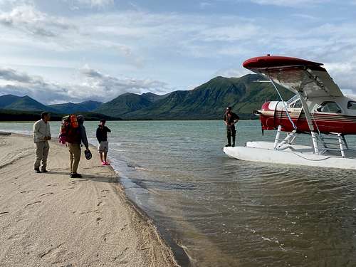
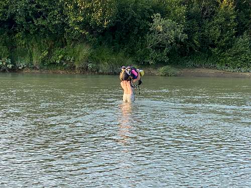
Day 1- A tidally determined drop off by beaver onto the sand of western Katmai Bay amid grazing brown bears. What started as a lovely beach walk turned into a five hour swampy slog through sedge grass to make it to high ground. Several intimidating river crossings provided unintended excitement.
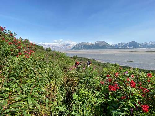
Day 2 - Staying on the high ground we hiked up valley for 4-5 hours in waist high grasses and shrub before encountering unpenetrable alder. The only option was now upriver inriver which turned out to be ankle to calf deep and reasonably easy going until there was sand or mud. This route would not have been possible if river levels had been significantly higher.
We found a lovely grass covered island for our campsite with views out over the entire Katmai delta. Moose, bear and wolf tracks abounded but we saw no wildlife.
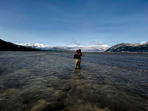
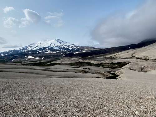
Day 3- Ascending the shoulder of Obervation Mt. we hit 50 + knot katabatic winds which lasted until we crested into the Mageik valley. Walking on ash/tuff for the first time was a relief as footing was solid and we made good time. Crossing the Mageik river we followed a century wildlife path upriver to the base of a giant lava flow to camp with a breathtaking view of Mageik, Trident, Katmai and Observation peaks.
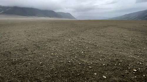
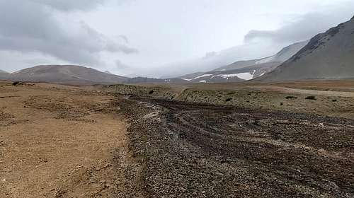
Day 4- with deteriorating weather we rounded the lava flow to head north and up to Katmai Pass. The footing was good, slope gentle and several shallow river crossings. Crossing the pass the winds whipped up and the rain started. The pumice and tuff we were now hiking on became airborne in the winds and pelleted us as we searched for the promised USGS shelter. The Valley of 10000 Smokes is desolate, lunar like and with no potable water or shelter must be entered with preparation and crossed with caution. The USGS shelter we later learned had be blown down several weeks earlier so seeking water and shelter we headed down valley towards the northern end of the Buttress Range. Finding a shallow and safe crossing point of the Lethe River is not an easy task but is demanded as the river is very dangerous to cross due to the soft ash banks. Water here is also very ash laden and not for consumption. We camped in the second of two valleys at the north end of the Buttress Range, finding a protected site and potable water running off the mountain.
Day 5 - A short 3-4 mile hike, now on a reasonably worn path, but with several shallow river crossings to us the the Brooks Lodge road. We were able to catch the tourist bus to the lodge and considering the weather was closing in we were happy to end our adventure at the lovely and other worldly adventure that is Brooks Lodge and it's brown bear population.
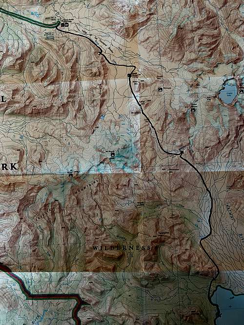
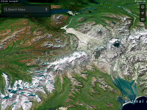
This is our route on Google earth and a Nat Geo map of Katmai NP.
Dam that's kind of crazy how the water levels were pretty shallow.
Comments
Post a Comment