
-
 360 Hits
-
 77.48% Score
-
 8 Votes
|
|
Mountain/Rock |
|---|---|
|
|
39.84754°N / 105.65124°W |
|
|
Gilpin County |
|
|
Hiking, Mountaineering |
|
|
Spring, Summer, Fall, Winter |
|
|
12147 ft / 3702 m |
|
|
Overview
Kingstone Peak
Elevation: 12147 ft / 3702 m
Starting Elevation: 10,470 ft
Elevation Gain: 1,677 feet
Juristiction: Arapahoe National Forest
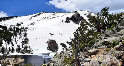
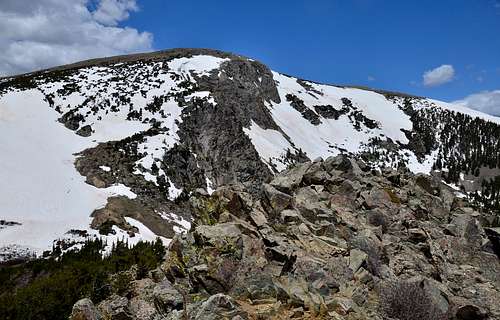
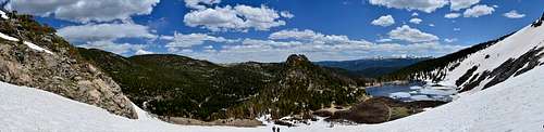
Kingstone Peak forms part of boundary between the Roosevelt and Arapahoe National Forest and between Gilpin and Clear Creek Counties. The best time for this hike is summer and fall when St. Mary’s Glacier is most easily traversed or bypassed. Kingstone Peak is also popular evening hike in the summer due to its easy access. St. Mary’s Glacier is not a true glacier but rather permanent snowfield. Crossing snowfield during the winter and spring time is consider more as climbing than hiking, use care while on it as some accidents occur here including occasional injuries.
 |
 |
Getting There
 |
 |
Directions to the trailhead:
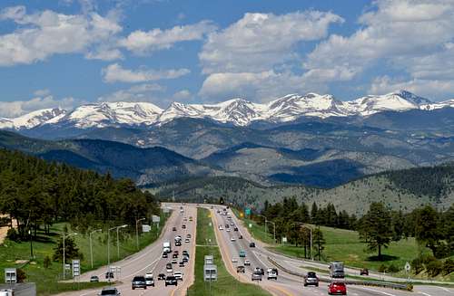
From Denver, take I-70 west and follow it past the town of Idaho Springs. Then take exit 238 which is marked “Fall River Road”. From there, take a right, (north), on Fall River Road. You’ll see the sign for St. Mary's Glacier and the town of Alice. Follow Fall River Road past the town of Alice until you see the sign on your left that says: Glacier Hike. This is your trailhead and it’s approximately a twenty-minute drive here from I-70. There are some hairpin curves on this road but there are also lots of aspen trees along the way, so it makes for a beautiful drive in the fall. Anyway, the parking area is just beyond the trailhead, on your left. The parking area has been expanded and now has 23 spaces. It can handle 30-40 vehicles when people who arrive in groups, double park. In addition, the owner of the parking area, (Paul Johnson), has opened a new and bigger parking area which will hold well over 100 vehicles. This new parking lot is located just before the trailhead, just before mile marker # 9, on the left side of the road. Both parking lots have 2 porta-potties, trash/recycle cans, dog waste bags, will be open year-round, and overnight stays are allowed. The parking fee is $20.00 per vehicle, per calendar day, and the accepted methods of payment are cash or check only. If you are paying cash, please have the exact amount since there is no place to get change.
 |
 |
Route
 |
 |
 |
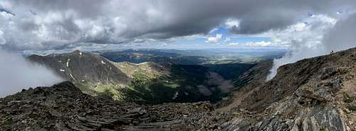
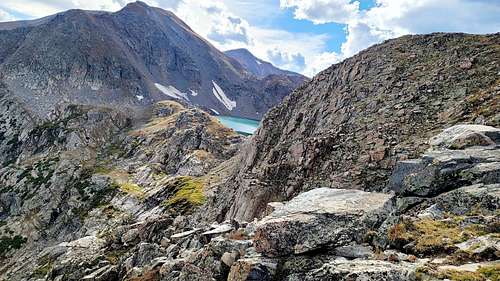
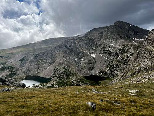
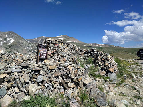
Kingston Peak is a high mountain peak in Colorado, situated within the Arapaho and Roosevelt National Forest. The trail here is often used for off-road driving and is one of the highest mountain roads in Colorado, at just over 12,000 feet above sea level. Whether you have wheels or you’re traveling with your canine companion by foot, you’ll mostly be above the timberline on your travels and have stunning 360-degree views. These include views of the massive surrounding mountains, such as Mount Evans to the south, James Peak to the west, and Longs Peak to the north. The trail begins just outside of the small town of St Mary’s, along Steuart Road. You will reach a gate at the start of the trail that is closed to off-road vehicles from approximately mid-October to mid-July due to snow drifts. Hikers are still welcome but need to use caution. One of the highlights along the trail is the Rock House, a large pile of rocks that has accumulated over many years from passersby. You can join in on the tradition by bringing along your own rock to add to the pile! Exotic rocks from faraway places are encouraged. From the top of the rock house there are great views of Loch Lomond. The trail may take well over 7 hours to hike round trip, so be prepared to spend most of your day in the wilderness. It’s very rocky and has a couple challenging portions that will give you and your doggo a workout. Since the trail is so high and exposed, being prepared for sudden weather changes is a must! These challenges are worth it though, as you’ll be rewarded with gorgeous views of mountains, lakes, and wildflowers along the way. Dogs are welcome of course, as long as they stay leashed. Remember to always pack out what you packed in and leave only footprints.
 |
 |
 |
Red Tape
When to Climb
This mountain can be hike or climb year around. During the winter Fall River Road is plowed to the Trailhead.
Camping
 |
 |
External Links
https://www.peakbagger.com/peak.aspx?pid=29688
https://listsofjohn.com/peak/1632