
-
 4040 Hits
-
 82.48% Score
-
 15 Votes
|
|
Mountain/Rock |
|---|---|
|
|
61.40109°N / 5.62580°E |
|
|
Sogn og Fjordane |
|
|
Hiking, Mountaineering, Trad Climbing, Big Wall, Scrambling, Skiing |
|
|
Spring, Summer, Fall |
|
|
3967 ft / 1209 m |
|
|
Overview
Kvamshesten 1209 m
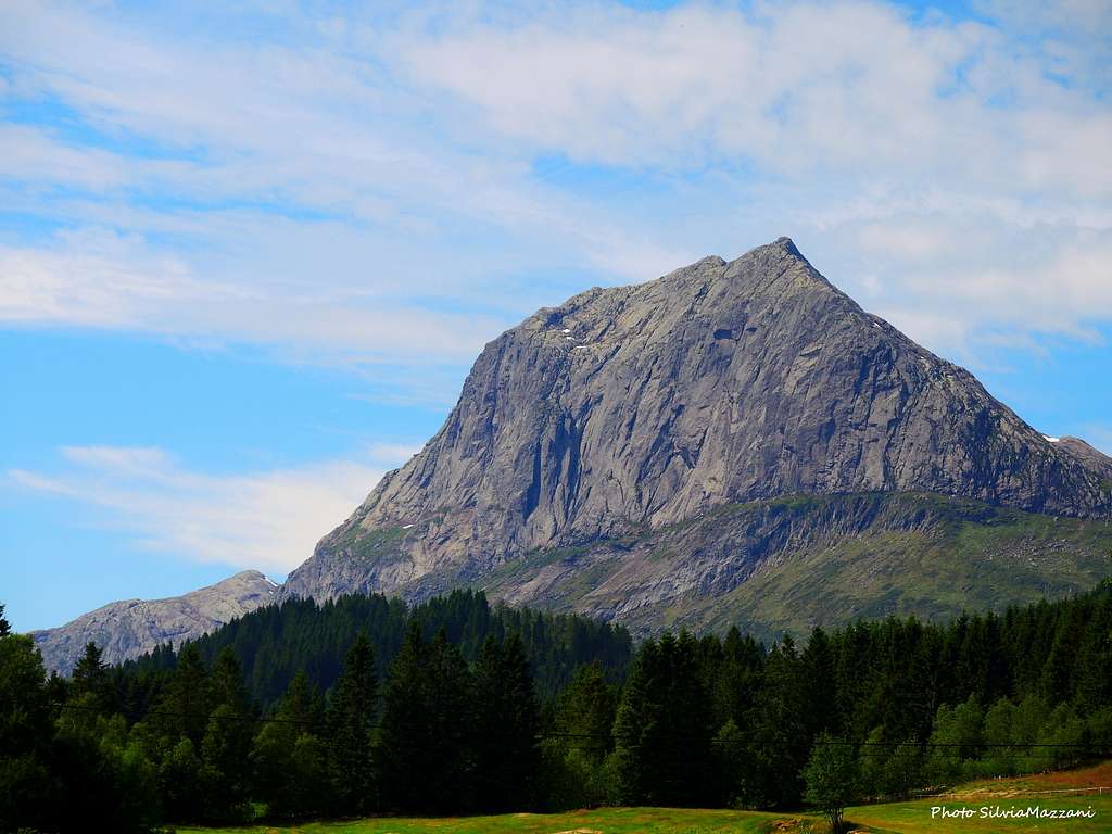
Kvamshesten 1209 m is the current name of a beautiful mountain, known locally as Storehesten - meaning the Great Horse - that lies near Bygstad in the Gaular municipality, Sunnfjord (Sogn og Fjordane county). This particular name is due to the fact that the profile of this mountain when observed by the surroundings could remember the body of a horse. Just East of Kvåmshesten, you will find Lillehesten or Little Horse 912 m. Kvamshesten is one of the finest and highest mountains in this region between the Førdefjord and the Dalsfjorden and for these reasons the mountain is a well-known landmark in Sunnfjord, striking for the imposingness and the harmony of its forms. It rises majestically above the village of Bygstad with mighty rocky walls: the South wall dominates Bygstad with its vertical and impressive structure, the North-East wall is more inclined and is formed by compact slabs. As soon as you look at the mountain, the desire to climb it arises spontaneously. There are several routes leading to the Kvamshesten summit, which gives extensive views in all directions. All except the standard West ridge route must be classified as advanced routes.
The Normal route which climbs up the West side by making a long tour around the imposing rock faces presents low difficulty and is a profitable itinerary in a spectacular environment. In the following paragraphs it will be described also the route along the East Ridge, an extremely advisable itinerary that involves a scramble with some easy climbing sections never exceeding the II grade UIAA.
Getting There
Road access
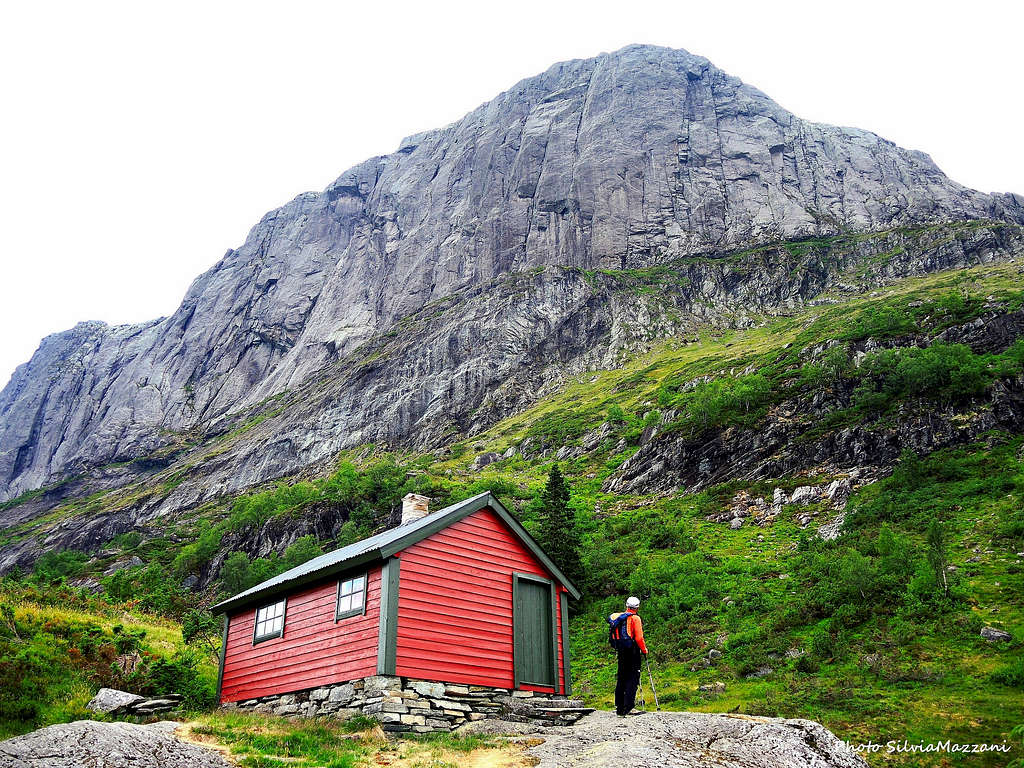
Coming from the town of Førde take the road 610 towards the Sognenfjord and at the junction to Bygstad leave the main road and turn right onto highway 57 (Bygstad). Follow this road for about 2,5 Km, pass Bygstad and after a few kilometers follow the signpost to Laukeland (signposted "Storehesten") for about 1,9 Km. Turn right onto a smaller road which will lead to the Rytnane farm, in front of which is located the Honesty Box for paying the road-toll (a fee is due). This toll-road leads to the car park about 400 meters above sea level. It's also possible to set off on foot along the road, obviously this choice takes several kilometers more.
Normal Route
Normal Route report
Summit altitude: 1209 m
Difficulty: Walk, some steep terrain
Vertical gain: 800 m from the car-park
Exposure: various
The Normal route is an advisable, fine and not difficult route across a fantastic environment. An itinerary with a certain development, as it makes a wide turn to reach the opposite side of the mountain (North) respect to the starting one and finally runs on the West ridge to get the summit.
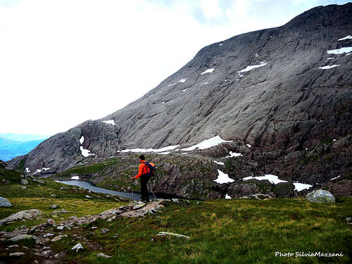
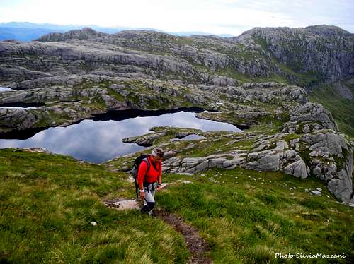
Take the excellent path to the Rabbane Cabin and the Skardavatnet 715 m, a lake located on the edge of the plateau behind the South wall. From here the itinerary goes West across the valley dotted with several lakes behind the mountain and up the West ridge to the top performing a semicircle. The path has the bottom of large stone slabs and starts right from the parking lot near a large granite stone, cutting the first turns of the road. In short, the itinerary (marked by T trail) always in view of the imposing Kvamshesten wall reaches the Rabbane Cabin and the Kårstadstølen pastures. Continue rightward and cross a stream just after a characteristic cliff up to your left. Here you have two option: you can either follow the main path which involves a largest trip on a marked path running Northward towards Kvamsskardet pass or leave the main route and take a branch to the left heading directly to a saddle located on the long rocky tail (horse tail), which is the continuation to the right of the East ridge of Kvamshesten.
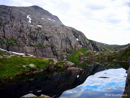
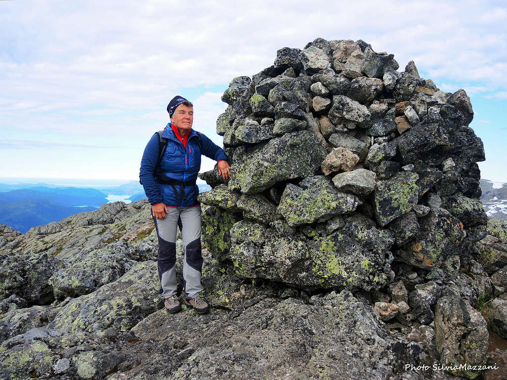
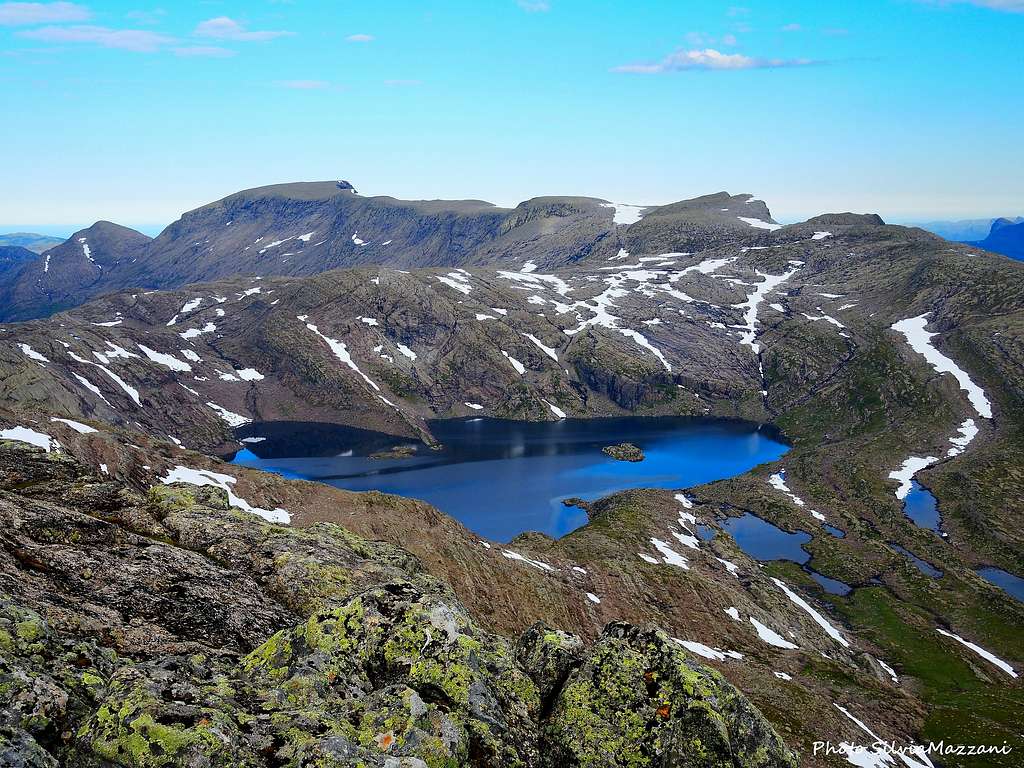
In this latter case head towards the saddle and reach it with the lake Skardavatnet nearby. Pass the lake on the right hand side, pass the next pond on the left before you continue on a ridge above lake Seltuftevatnet towards lake Grunnevatnet 785 m, where there is a small shelter. Pass this lake on the right hand side (North). The path is still visible. Above 900 m of altitude, the terrain gets rockier, anyhow the itinerary is obvious and there are several cairn in place. Head South-West towards the point 1114 m on the Kvamshesten Western ridge. From 1114 m, the route continues East towards Kvamshesten and you will see smaller cairns guiding you towards the summit plateau. A steep section runs from the west ridge towards the summit area. The summit is marked by a great cairn. The view from the summit is wonderful and quite extensive in all directions. From the Ålfotebreen to the north, the Jostedalsbreen to the east, Sognefjella to the south, and to the islands and the sea in the west. The enormous mountain plateau south of Sognefjorden, the Ålfotbreen/Gjegnalundsbreen glaciers in the north, the mountains near Jostedalsbreen in the east, to name a few viewpoints.
Descent: the descent is done reversing the same route
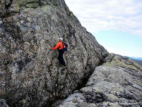
Østryggen (East Ridge)
East ridge report
Summit altitude: 1209 m
Difficulty: scramble, some climbing (up to maximum II grade UIAA)
Vertical gain: 800 m from the car-park
Exposure: East
An interesting scramble up a nice ridge, good alternative to the Normal route
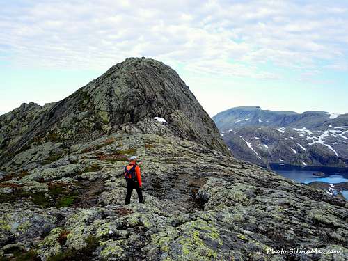
At the Skardavatnet 715 m, on the plateau behind the S wall, you can choose a more demanding route that goes straight up the East ridge to the top. From the lake take a thin trail that cuts the grassy slopes to the left to reach the base of the beautiful East Ridge of the mountain. The itinerary starts to climb up the rocks of the ridge with short and easy climbing passages along short slabs, grooves and small walls interspersed with traces of path, which in good condition do not require the use of the rope. The orientation along the route is facilitated by cairns and some red marks.
At the top of the ridge the terrain becomes less steep; follow an almost horizontal stretch already in sight of the summit marked by a large cairn. From the summit breathtaking view of the ocean, the nearby Blaegia, fjords, glaciers and mountains all around as far as the eye can see.
Descent: along the Normal route
Climbing
On the beautiful South wall there are some challenging routes, one of these is "The Corner - Kristine", named after the daughter of the first climber is located on the South face of Kvamshesten. It's a long route of 10 lengths, graded to Norwegian 6+ at most. The actual entry to "Kristine" starts where the wall is at the lowest, to the left of "Shirt".
More info about: Peakbook report South Wall
Red Tape
A toll is required to drive on the road from the Rytnane farm to the parking lot.
Geology
The area inside which the mountain is located represents a peculiarity from the geological point of view. In fact Kvamshesten is a towering landmark in the middle of a mountain area consisting of devonian sandstones and conglomerates. These rocks were deposited during the collapse of the Caledonian mountain range in Norway. It is demonstrated that the Kvamshesten area of continental Devonian rocks has been thrust over an older basement. The movements are correlated with the Svalbardian phase.
Architecture of the Middle Devonian Kvamshesten Group
When to Climb
Best period is from May to September
Accomodation
Accomodation in Bygstad and surrounding.