La montagna chiama i suoi figli, ed essi rispondono fedelmente al suo appello…
Osvaldo Cardellina, Diario alpinistico, 1964-65
Page texts: @ OsvaldoCardellina"Osva", passed away on May 2, 2022. Page owners: Christian Cardellina e Osvaldo Cardellina. Any updates from September 12, 2022: Antonio Giani, page administrator, friend and climbing companion.
Testi della pagina: @ OsvaldoCardellina "Osva", scomparso il 2 maggio 2022. Proprietari pagina:Christian Cardellina e Osvaldo Cardellina. Eventuali aggiornamenti dal 12 settembre 2022: Antonio Giani, amministratore della pagina, amico e compagno di salite.
102 Overview
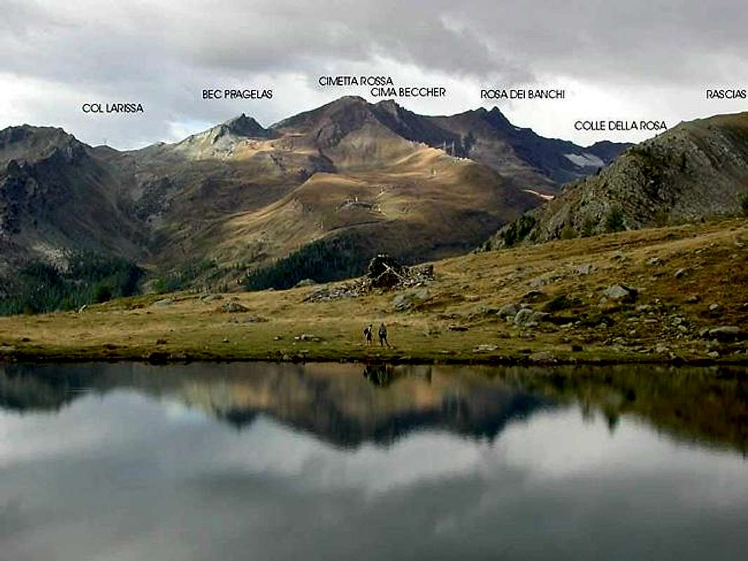
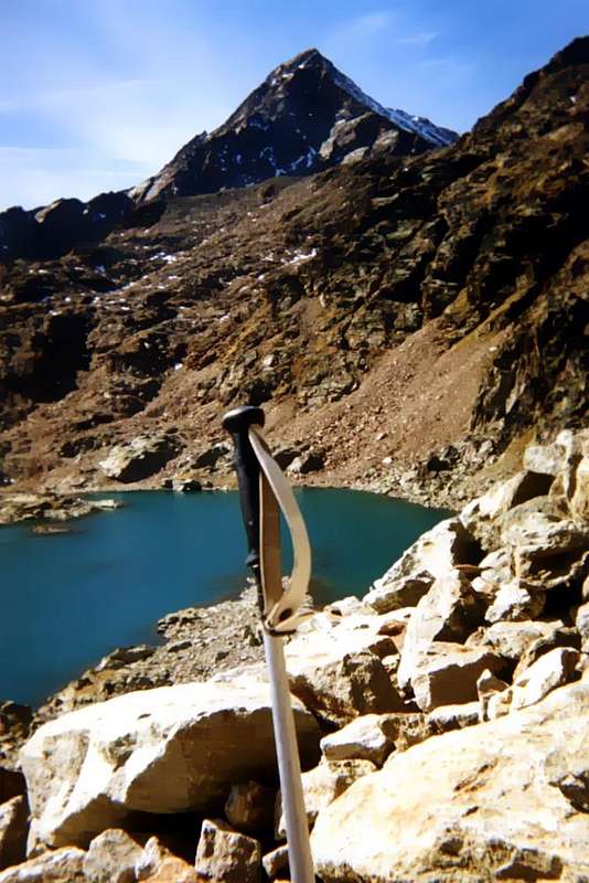
The Aosta Valley is crossed by two distinct High Routes (Alte Vie) and some trails Inter Valleys. The Number 1 runs from the Pont St. Martin to Courmayeur along the Nnorthern stretch, from East to West; with the same pattern, but in the South than in the course of Baltea, passes the Number 2. These two ways are indicated by the corresponding number in the black interior of a triangle of dark yellow. Other signals, with the same modalities, but included in a circle indicate the routes, described in a clockwise direction, into a single valley, while the paths between most valleys are marked with a triple number internally to a rectangle in similar mode. In addition to these are on the Maps and the poles signage of other acronyms indication as HRG (High Icy Route), TGP (Giro del Gran Paradiso), TMR (Tour of Monte Rosa), TGC (Tour of the Grand Combin), VA (Alpine Via), TVC Tour of Cogne), TDG (Tour or "Tor" des Géants), TSE (Tour de Saint Evançe) etc., in a set of directions that may seem puzzling and even create confusion, given the high number of suggestions made in kind by various Mountain Communities. But the signs "official" of the Autonomous Region of the Aosta Valley is based on the first three that went from 1987 to replace the old signs with white letters on a blue background scattered around the valley and often disappeared, destroyed if not removed. In this work, begun in 1987 and completed in the following years with the installation of the signs by the Guide of the Valley of Aosta, I participated personally in charge of the vast area between the Commons of Aymavilles and Pont St. Martin (Groups of Mont Emilius, Punta Tersiva, Grand Avert, Mont Glacier, Rosa dei Banchi and Mont Avìc), while four other experts covered other areas of the Valley (Guide Peter "Piero" Genola for Cogne and adjacent valleys, Alessandro Giorgetta for Valdigne-La Thuile-Mont-Blanc, the Guide Massimo Bragalenti for Gran San Bernardo and Valpelline, Help Peter "Piero" Giglio for Valtournanche, Val d'Ayas and Gressoney). On that occasion, each of the leaders, after a long work on Maps to 100.000, 50.000, 25.000, 10.000 and 5.000 and the visitation by the Guides of the area and its trails, proposed on the same drawing also of alternative routes to local trails. This gave rise to tracing paths inter valleys that, as the term "tying" two or more valleys. My proposal has been that, being rich area of lakes, to draw a trek through the same, starting from Champdepraz, arrived at the gates of Aosta through the Lakes Valley, the Val-Fénis Clavalité, that of St. Marcel, the high part of the Walloons of Grauson-Lussert south and of the Laures North to finish with that Arbolle and Pila Basin, before the descent towards the Pont-Suaz the outskirts of Aosta. A trek that, as we shall see, can last four to five days depending on the point of departure (by Champdepraz or Voella Hamlet or Champorcher la Cort), but nothing prevents you accomplish in a short period of time more or less. The same port signaling with n° 102, in the respective rectangular sign; on the side, in addition to time, it may appear in the respective club reporting a local path. In addition there is any impediment to fulfill the path to the contrary, that is starting from Aosta-Pont Suaz before falling to Champdepraz Champorcher, even if the truth should follow the original path. The other variants, coming from other points of departure, we have summarized in Getting There", but leave the time they find and, even if possible, do not give the rewards offered by the full path. Prepare for large scenarios with color contrasts between these ancient mountains. In this trek you can support four Refuges (Barbustel near Lake Bianco, Borroz-Rotary Clavalité in Clavalité, Ménabreaz at the Laures, Arbolle) and some Alpe (Mezove, Etsely Damon, Grand-Alpe, Grande Chaux), bearing in mind that the same are privately owned; you can usually ask for shelter in case of bad weather. It is also possible to split the different stages choosing intermediate locations (Great Lake, Lake Margheron in the Valley of Savoney, Lake Lavòdilèc, Leppe's Hill, Lake Gelato to Emilius, Lake Chamolé etc.), But in such a case must be equipped with tent and sleeping bag. A different way to move: more adventurous, but also more "risky" ...
La Valle di Aosta é attraversata da due ben distinte Alte Vie (Hautes Routes) ed alcuni Percorsi Inter Vallivi. La Numero 1 la percorre da Pont St. Martin a Courmayeur lungo il tratto Settentrionale, da Oriente ad Occidente; con lo stesso andamento, ma a Meridione rispetto al corso della Dora Baltea, transita la Numero 2. Queste due vie sono segnalate con il rispettivo numero in colore nero all'interno di un triangolo di colore giallo scuro. Altri segnali, con le stesse modalità, ma compresi in un cerchio indicano i percorsi, descritti in senso orario, dentro una singola vallata, mentre i percorsi tra più valli sono segnalati con un triplo numero internamente ad un rettangolo similare. Oltre a queste trovate sulla Mappe e sulle paline di indicazione altre sigle come HRG (Alta Via Glaciale), TGP (Giro del Gran Paradiso), TMR (Tour del Monte Rosa), TGC (Tour del Grand Combin), VA (Via Alpina), TVC (Tour de Cogne Valley), TDG (Tour o "Tor" des Géants), TSE (Tour de Saint Evançe) ecc., in un insieme di indicazioni che può lasciare perplessi e creare perfino confusione, visto il numero elevato di suggerimenti proposti in genere dalle varie Comunità Montane. Ma la segnaletica "ufficiale" della Regione Autonoma della Valle di Aosta si basa sui primi tre, che dal 1987 andavano a sostituire i vecchi cartelli con scritte in bianco su sfondo blù sparsi per la Valle e spesso scomparsi, distrutti se non asportati. A questo lavoro, iniziato nel 1987 e terminato nei successivi con la posa della segnaletica da parte delle Guide della Valle di Aosta, ho personalmente partecipato come responsabile della vasta Area tra i Comuni di Aymavilles e Pont St. Martin (Gruppi di Monte Emilius, Punta Tersiva, Grand Avert, Mont Glacier, Monte Avìc e Rosa dei Banchi), mentre altri 4 esperti ricoprivano le altre zone della Valle (la Guida Pietro "Piero" Genola per Cogne e valli adiacenti, Alessandro Giorgetta per la Valdigne-La Thuile-Monte Bianco, la Guida Massimo Bragalenti per Gran San Bernardo e Valpelline, la Guida Pietro "Piero" Giglio per Valtournanche, Val d'Ayas e Gressoney).
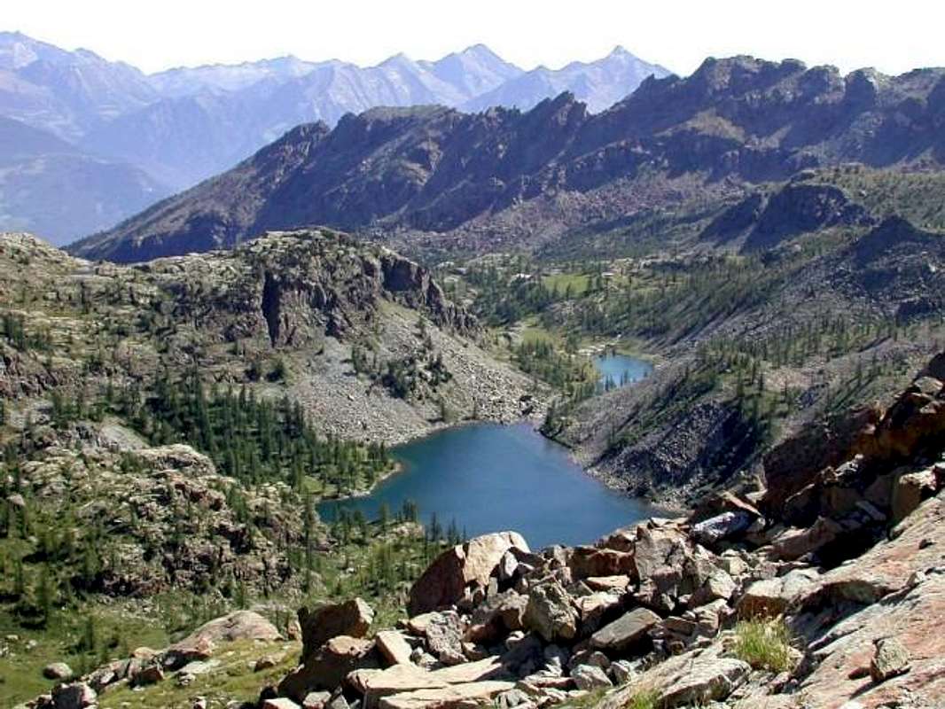
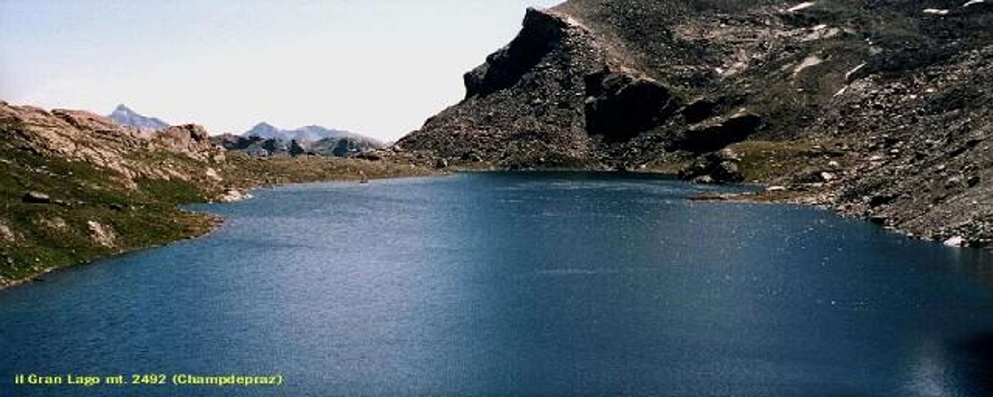
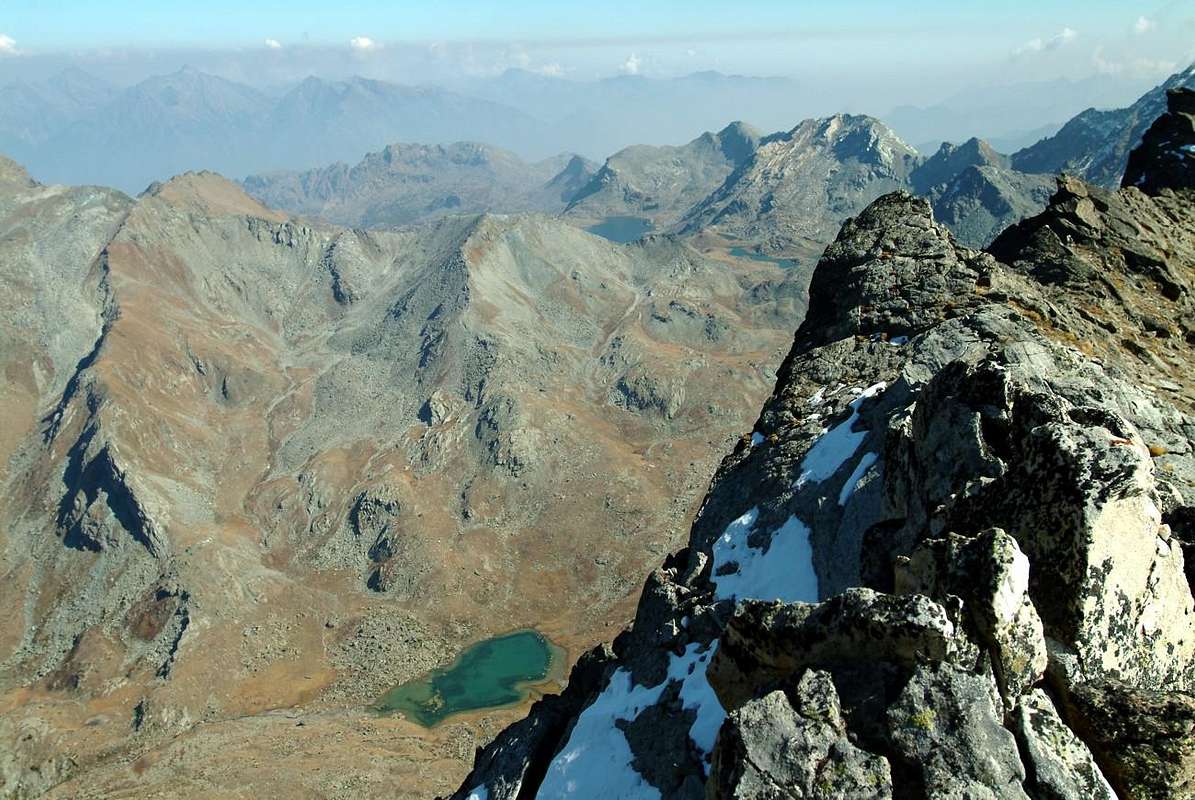
In quell'occasione ognuno dei responsabili, dopo un lungo lavoro sulle Mappe al 100.000, 50.000, 25.000, 10.000 e 5.000 e con la visitazione da parte delle Guide del territorio e dei relativi sentieri, proponeva disegnando sulle medesime anche degli itinerari alternativi ai sentieri locali; questo dava adito alla tracciatura di percorsi intervallivi che, come dice il termine, "legavano" due o più vallate. La mia proposta é stata quella, essendo ricca la zona di laghi, di tracciare un trekking attraverso i medesimi che, partendo da Champdepraz, arrivava alle porte d'Aosta attraversando il Vallone dei Laghi, la Val Fénis-Clavalité, quella di Saint Marcel, la parte alte dei Valloni di Grauson-Lussert a Sud e delle Laures a Nord per terminare con quello di Arbolle ed il Bacino di Pila, prima della discesa verso il Pont-Suaz allingresso di Aosta Città. Un trekking che, come vedremo, può durare da quattro a cinque giorni a seconda del punto di partenza iniziale (Champdepraz o Champorcher), ma che nulla vieta di compiere in un lasso di tempo maggiore o minore. Lo stesso porta la segnalazione con n° 102, dentro al rispettivo cartello rettangolare; a lato, oltre all'orario, può comparire nel circolo la segnalazione d'un percorso locale. Inoltre non vi é impedimento alcuno a compiere il percorso al contrario, ovvero partendo da Aosta-Pont Suaz per poi scendere a Champdepraz o Champorcher, anche se per la verità consigliamo di seguirne il percorso originale. La altre varianti, arrivando da altri punti di partenza, le abbiamo sintetizzate in Getting There", ma lasciano il tempo che trovano ed, anche se possibili, non danno le gratificazioni offerte dal percorso completo. Prepararsi, in ogni caso, a grandi scenari con contrasti di colori in mezzo a queste antichissime montagne. In questo trekking ci si può appoggiare a quattro Rifugi (Barbustel, Borroz-Rotary Clavalité, Ménabreaz, Arbolle) nonché a qualche Alpe (Mezove, Etsely Damon, Grand-Alpe, Grande Chaux), tenendo presente che le medesime son private; in genere si può chiedere ospitalità in caso di cattive condizioni meteo. Inoltre é possibile suddividere diversamente le tappe scegliendo località intermedie (Gran Lago, Lago Margheron nel Vallone di Savoney, Lago di Lavòdilèc, Colle di Leppe, Lago Gelato all'Emilius, Lago di Chamolé ecc.), ma in siffatto caso bisogna essere attrezzati con tenda e sacco a pelo. Un modo diverso di muoversi: più avventuroso, ma anche più "rischioso" ...
Getting There
BY CAR:
From TORINO, MILANO, etc: Motorway A5. Exit at Ivrea City, Quincinetto Common (PIEDMONT) or at Pont Saint Martin, Verrès Municipalities. By SS.26 from Ivrea Town towards: Quincinetto, Pont Saint Martin, Donnas, Hône-Bard, Arnad, Pont Bozet, Champorcher, Champdepraz, Fénis, Saint Marcel, Grand Brissogne, Pollein and Charvensod Municipalities.
Departure original: from Champdepraz(523m) to Lakes small Valley and Voella or Raye Chevrères Village (1.307m; by Regional Road). Barbustel Refuge with path from Voella.
Other possibilities of entering partially in the route starting from:Hône-Bard(364m, 566m), on SS.26, towards Pont Bozet(775m) to Champorcher Valley, Camporcher-Château (1.427m), Petit, Grand Mont Blanc, La Cort Villages through Royal Road and paths towards Barbustel Refuge in Champdepraz small Valley. Fénis (537m) to Clavalité and Grand'Alpe Pastures (2.129m; through dirt farms road), just below E. Borroz/Rotary-Clavalité Refuge (2.156m) at Cuneu Alp. Saint Marcel(630m) to Saint Marcel small Valley and Turati Reserve up to the Mulac & Grande Chaux Hunting Houses & Alp (1.937m, 2.370m). Grand Brissogne(827m) to L'Arp, dirt road, Les Laures small Valley and Ernesto Ménabreaz Shelter at Lower Laures Lake (2.546m, 2.544m), path-muletrack. From Pollein (575m; secondary road) or from Charvensod (746m; main road and connection) to Arpisson small Valley and Martsaouchy Damon (1.410m), through dirt farms road, and Arpisson Lower & Upper (1.951m, 2.010m) Alpages with ancient path. Federigo Zullo Bivouac through moraines on Western Arpisson Glacier. Charvensod to Dard-Comboé-Arbolle Gorge and small Valleys towards Ponteilles(1.697m) Alp & Waterfall, through dirt road, Comboé Alp & Saint Ours private Shelter (2.114m), through dirt road, and Arbolle Refuge(2.516m), nearby two Lakes (2.495m, 2.497m). Gressan (603m; alternative road) to Tivet, Les Fleurs Hamlets (1.292m, 1.414m) Pila Basin and Pila Resort (1.800m); upper parking 1.850m). Arno Shelter (2.660m), always open but unguarded, nearby Couiss Summit on watershed Pila/Cogne Valley. Jovençan(631m) to Pila Conca, exclusively through path-muletrack to Tourlin Dessous(1.466m) and by dirt road to Pila-Posse Tennis (1.776m). Aymavilles(646m) to Western Pila Conca, through Main Road to Cogne Valley, alternative to Ozein/Turlin Dessus Hamlets and dirt road to Pila-Posse. Aymavilles towards Cogne Valley with Regional Main Road: Vieyes (1.132m) Fraction; continue to Silvenoire, Epinel and Crétaz Hamlets, Cogne(1.534m) Resort, through Main Road. From Cogne towards Gimillan Village(1.785m): from this in North to Grauson-Lussert Vallon and Frog, Corona, four Lussert Lakes also in Northwest towards Arpisson Alp Franco Nebbia Bivouac, through path in Upper Arpisson Vallon to Garin Hill (2.815m) with descent to Arbolle Refuge.
From Arbolle Vallon final descent towards: from this to Chamolé Hill and Lake (2.641m, 2.325m), Chair Lift Chamolé Upper Station (2.309m), St. Grat Hermitage (1.773m), Pila-Resort (1.800m) and Pont Suaz-Aosta (567m, 583m).
From FRANCE: through the Mont Blanc Tunnel to Entrèves-crossroads to Vény/Ferret Valleys - Mountain Guides of Courmayeur - La Saxe Rock Gym - Courmayeur. By Little Saint Bernard Pass, closed since November until half May to La Thuile Valley - Pré Saint Didier - Courmayeur. It is not necessary to take Motorway A5: you can drive on SS.26, in the direction of AOSTA - IVREA - TURIN.
BY PLANE:
Aeroporto "Corrado Gex" Saint Christophe (Aosta).
General Description of all the 4 or 5 Laps
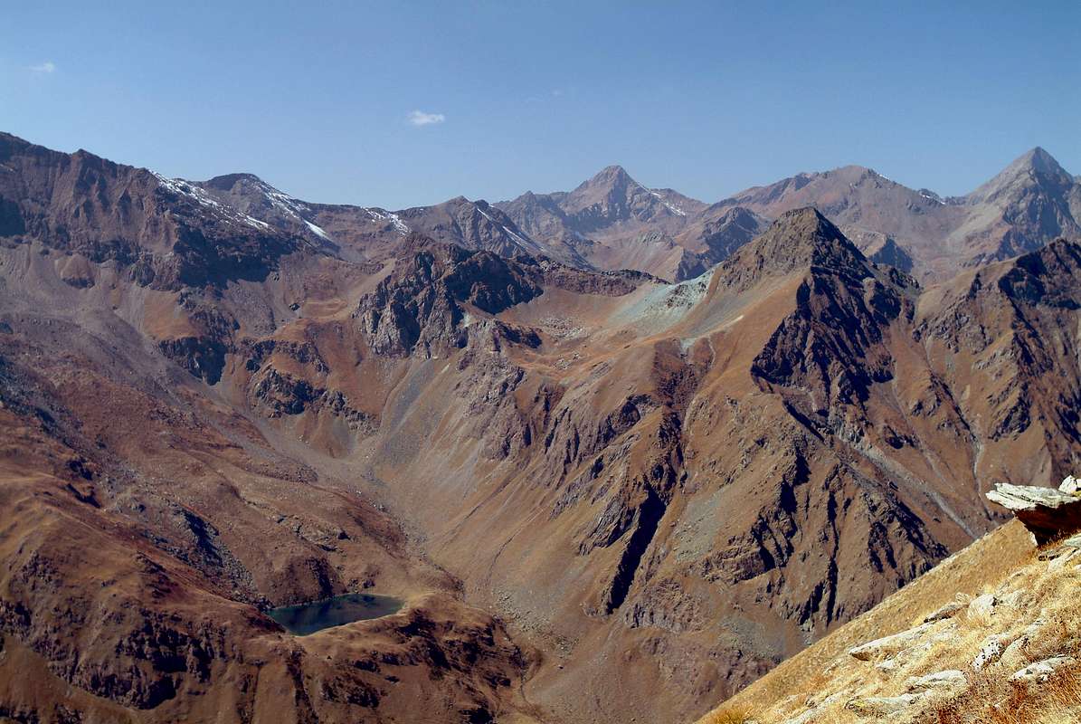
Starting from the Champorcher-la Cort (1.800 metres) at the Southern entrance of the Regional Park of Monte Avìc towards the Lake Muffé (2.079m) and, via the Col Lago Bianco (2.308m), you make a variation to the route of the path intervalleys n° 102, which allows you to shorten a day the trek. Indeed, while passing the Barbustel Shelter, you can continue up to the Grand Lake, Col Mezove, Lake Margheron, Col de l'Etsely and get off at Refuge Borroz-Rotary Clavalité, just above Grand-Alpe (2.120m).
Partendo da Champorcher-la Cort (1.800 metri circa) all'ingresso Meridionale del Parco Regionale del Monte Avìc al Lago Muffé (2.079 m) e, tramite il Colle del Lago Bianco (2.308 m), s'effettua una variante all'itinerario del sentiero intervallivo n° 102, che permette di accorciare d'una giornata il trek; infatti, pur passando al Rifugio Barbustel, si può continuare fino al Gran Lago, Col Mezove, Lago Margheron, Col de l'Etsely e scendere al Rifugio Borroz-Rotary Clavalité, appena al di sopra di Grand-Alpe (2.120 m).
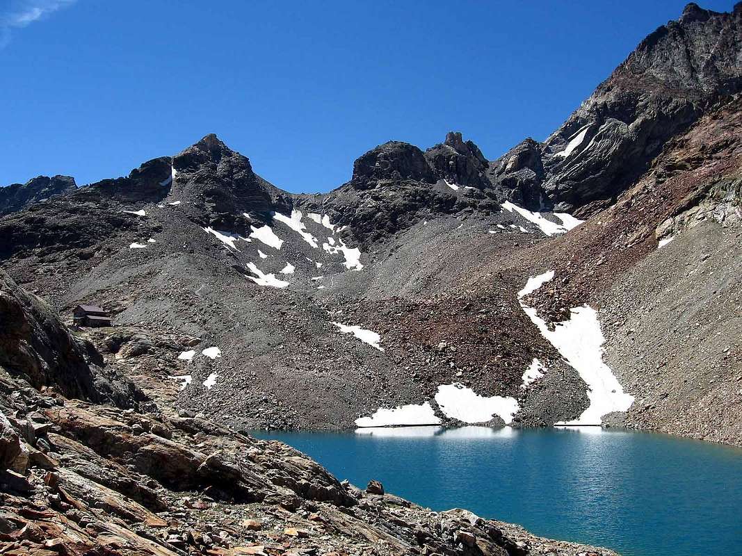
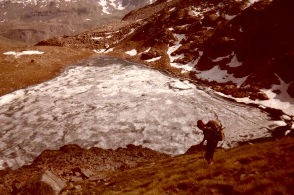
Starting from Voella or Chevrère (1.307m) towards the Barbustel Refuge (2.209m), it respects the route originally published, but lengthens the same of almost two hours than departing from Champorcher. in this case you should stop at the refuge or, wanting to do something different, go to the Lakes Nero Cornuto (Black, Horned; 2.166m, 2.168m) up to that of the Great Lake (2.485m), where bivouac (tent and sleeping bag, because the nearby Bivouac "Verthuy" by the Forest Rangers is private, always closed).
Partendo da Voella o Chevrère (1.307 m) verso il Rifugio Barbustel (2.209 m), si rispetta l'itinerario orginale di base, ma si allunga il medesimo di quasi 2 ore rispetto a quello con partenza da Champorcher-la Cort. In questo caso conviene fermarsi al rifugio oppure, volendo far qualcosa di diverso, continuare verso i Laghi Nero e Cornuto (2.166 m, 2.168 m) fino a raggiungere quello del Gran Lago (2.485 m), dove bivaccare (tenda e sacco a pelo, poiché il vicino Bivacco "Verthuy" della Forestale é privato e sempre chiuso).
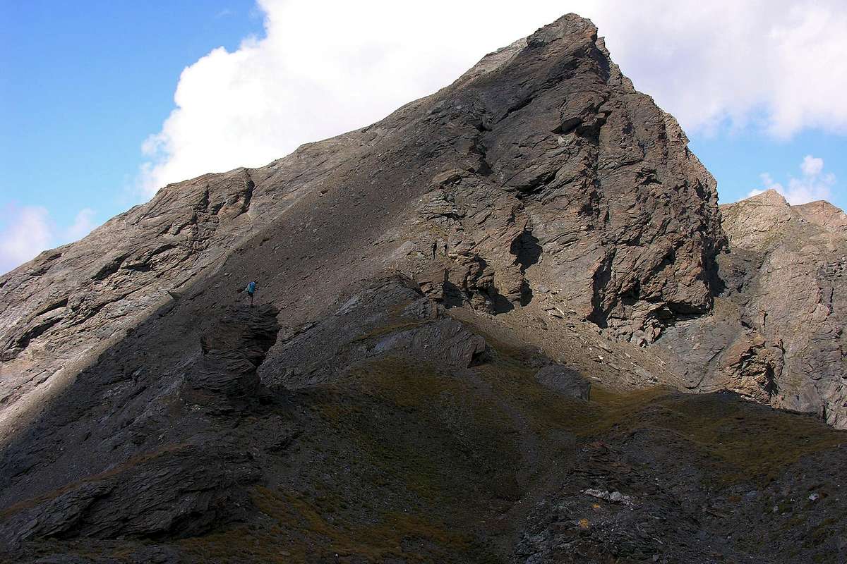
With departure from the Shelter also by Gran Lago, (In the latter case it gains almost 1 ½ hours) climb to the nearby Colle di Medzove or Mezove (2.614m) at the foot of the North Edge of Mont Glacier (3.186m); a short and easy downhill to the Lake Margheron (2.377m), below the Alpe di Medzove (2.396m) and near the end of the Vallon of Savoney. The subsequent ascent to the Col dell'Etsely or Etseley and still said the Echelly or of Eyèle (2.812m) is just over 1 hour, but the path is steep and tiresome. By contrast the descent is easy and manageable and at the same time reach first the Alpage de l'Etsely Damon (Superior; 2.437m) and then the Refuge E. Borroz-Rotary Clavalité to Cuneu (2.156m), just above Grand-Alpe (2.117/29m). This concludes the second stage or the first if you started from champorcher-la Cort: in any case is a nice "pull".
Partendo dal Rifugio Barbustel oppure dal Gran Lago, (in questo secondo caso si guadagna quasi 1 ora e mezza) si sale al vicino Colle di Medzove o Mezove (2.614 m), ai piedi dello Spigolo Nord del Mont Glacier (3.186 m); una breve e facile discesa conduce al Lago Margheron (2.377 m), sotto l'Alpe di Medzove (2.396 m) e quasi al termine del Vallone di Savoney. La successiva risalita al Col dell'Etsely o Etseley ed ancora detto dello Echelly o d'Eyèle (2.812 m) risulta di poco superiore ad 1 ora, ma il sentiero è ripido e faticoso. Per contro la discesa é facile ed agevole ed in pari tempo raggiunge dapprima l'Alpe de l'Etsely Damon (Superiore; 2.437 m) e poi il Rifugio E. Borroz-Rotary Clavalité al Cuneu (2.156 m), appena sopra Grand-Alpe (2.117/29 m). Qui si conclude la Seconda tappa o la prima se siete partiti da Champorcher-la Cort: in ogni caso una bella "tirata".
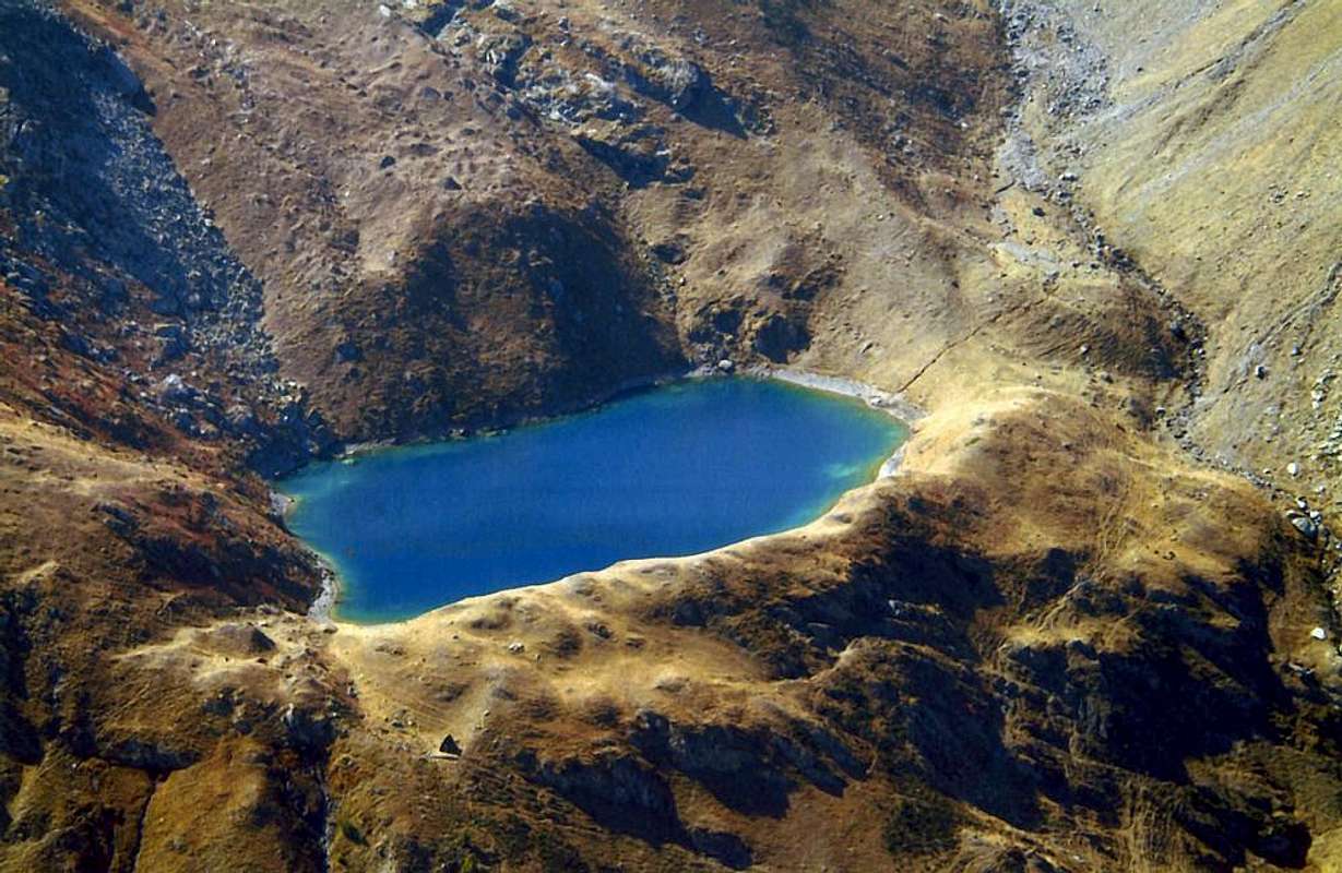
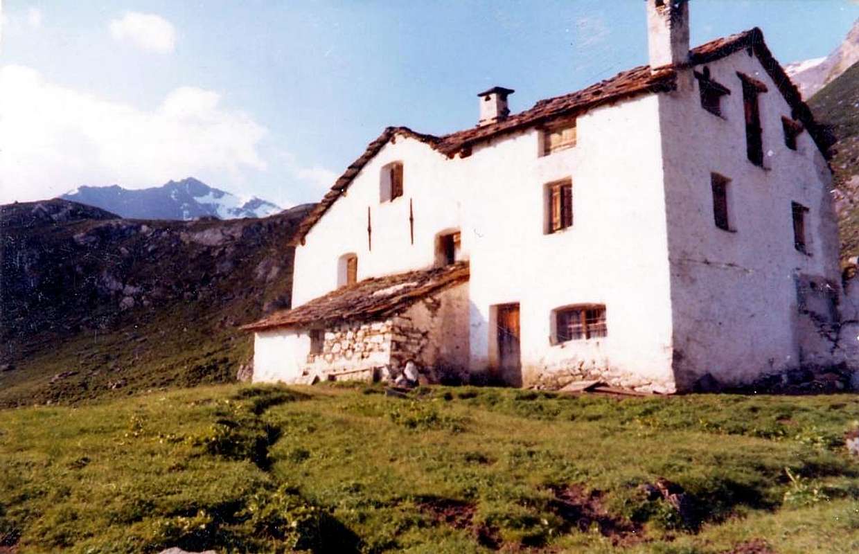
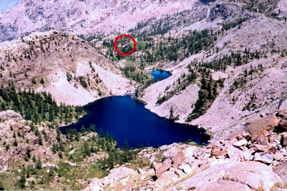
From Refuge Borroz or by Grand-Alpe to reach Grande Chaux "Turati's" Hunting House (2.349m), with a third or second stage definitely "quieter". A short descent leads to Grand-Alpe, where the path diagonally to the Northwest that reaches past the singular Refuge Attilio Turati called as "L'O de Pommier" (1.977m, private and always closed), first the old Alpage and then towards the Lavòdilèc (2.264m, 2.367m). Bending far to the west the trail reaches, after passing a promontory, the eponymous Hill (2.863m), located between Punta del Tessonet (3.266m) and Petit Avert (2.947m). The descent towards the Northwest to the junction 2.474 meters, where you should temporarily abandon the trail n° 102, where this has a connection with the n° 4 from Grande Chaux then climb to Colle Coronas or Saint Marcel Hill. Should instead go down briefly with a small path unnumbered towards Petite Chaux (2.419m), whence then navigate to Grande via the private farms dirt road. It also ends this stage, unless, of wanting to follow the full path, we continue through the above link and then climb to the Col Coronas or Corona (2.913m) and descend to the underlying namesake Lake (2.702m), Lake delle Rane (Frogs; 2.641m) and the Grauson New or Upper Pasture (2.540m), at the former Bivouac Tentori caught fire in June 2001. in doing so lengthens the stage of about two hours, but it shortens the rather long the next day. All in all, both are valid choices, although one night at the Hunting House of Grande Chaux in Natural Preserve "Marquis Turati", former Baron Beck Peckoz, of the Grand Avert has something suggestive and even "romantic". The complete choice is Yours ...
Dal Rifugio Borroz o da Grand-Alpe si raggiunge la Casa di Caccia di Grande Chaux (2.349 m), con una terza o secoda tappa sicuramente "più tranquilla". Una breve discesa porta a Grand-Alpe, dove parte il sentiero diagonale verso Nordovest che raggiunge, passando davanti al singolare Rifugio Attilio Turati detto "L'O de Pommier" (1.977 m, privato e sempre chiuso), dapprima la vecchia Alpe e poi il Lago di Lavòdilèc (2.264 m, 2.367 m). Piegando decisamente ad Occidente lo stesso raggiunge, superato un promontorio, l'omonimo Colle (2.863 m), sito tra la Punta del Tessonet ed il Petit Avert. La discesa verso Nordovest raggiunge il bivio 2.474 metri, ove conviene abbandonare momentaneamente il sentiero n° 102, dove questo presenta un collegamento con quello n° 4 proveniente da Grande Chaux per poi salire al Colle Coronas o di Saint Marcel. Conviene invece scendere brevemente con un sentierino non numerato a Petite Chaux (2.419 m), donde poi traversare alla Grande tramite la poderale. Termina anche questa tappa, a meno che, volendo seguire integralmente il percorso, si continui tramite il collegamento per poi salire al Col Corona o Coronas (2.913 m) e scendere al sottostante omonimo Lago (2.702 m), al Lago delle Rane (2.641 m) ed all'Alpe di Grauson Nuove o Superiore (2.540 m), presso l'ex Bivacco Tentori andato a fuoco nel Giugno del 2001. Sì facendo s'allunga la tappa di circa 2 ore, ma s'accorcia quella piuttosto lunga del giorno appresso. Tutto sommato, son valide entrambe le scelte, anche se una notte alla Casa di Caccia di Grande Chaux nella Riserva Naturale "Turati", ex Beck Peckoz, del Grand Avert possiede qualcosa di suggestivo e "romantico". A Voi la scelta completa ...
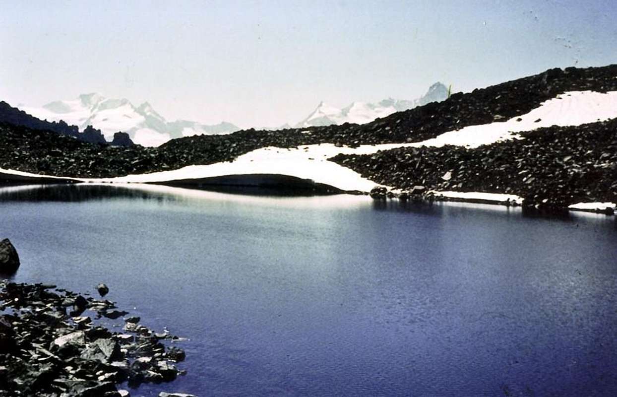
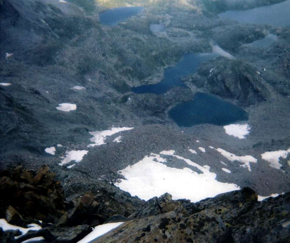
The next day, passing the Laures and Arbole Passes (3.035m, 3.154m) it reach the Refuge Arbolle (2.516m). Third or fourth stage, always with respect to the Variant of Departure, which, climbed the Col Corona (if you have not already done so with the hypothesis number 2 above), reaching in succession the three beautiful Lakes Lussert (2.713m, 2.790m, 2.906m, fourth or "d'En-Haut" 2.923 m, just departed to the South from its original location and the way of the Pas du Valaisan 3.210m, can be reached in a short time). The climb to the Col des Laures above is easy through an area of great "clapeys" (boulders piled wildly); the subsequent descent into the Laures Vallon leads to the junction 2.933 meters (here also comes the trail n° 4 from Refuge Ernesto Ménabreaz) and then up towards the Col d'Arbolle, with a short but steep final stretch. The crossing to the West on the ancient Glacier of Mount Emilius or Lac Gelé, at the foot of the Northern Faces of the three Punta Rossa, is easy if in the snow, but not simple in the case of "verglass". in this case we have to have caution and be alert to frequent rock falls from the wall immediately above. Then quickly, even through the track of an old path restored, you will reach that of the "Normal Route" to Emilius and immediately after Lake Gelato (2.957m). By here the descent to the Refuge Arbolle is simple along the namesake Vallon, but also a little monotonous and certainly influenced by the accumulated fatigue. However the new, beautiful shelter there predisposes last easy and short lap.
Il giorno successivo, passando i Colli di Laures ed Arbole (3.035 m, 3.154 m) si raggiunge il Rifugio d'Arbolle (2.516 m). Terza o quarta tappa, sempre rispetto alla Variante di partenza, che, scavalcato il Col Corona (se non lo avete già fatto con l'ipotesi numero 2 di cui sopra), raggiungono in successione i tre splendidi Laghi di Lussert (2.713 m, 2.790 m, 2.906 m; un quarto o "d'En-Haut" 2.923 m, appena discostato a Sud dal percorso originale e sulla via del Pas du Valaisan 3.210 m, é raggiungibile in breve tempo). La salita al soprastante Col des Laures é facile attraversando una zona di grandi "clapeys" (macigni ammucchiati selvaggiamente); la successiva discesa porta nel vallone delle Laures fino al bivio 2.933 metri (qui giunge anche il sentiero n° 4 dal Rifugio Ernesto Mènabreaz) per poi risalire verso il Col d'Arbolle, con un tratto finale corto ma ripido. La traversata verso Ovest sullo antico Ghiacciaio del Monte Emilius o del Lac Gelé, ai piedi del Versante Settentrionale delle tre Punta Rossa, é facile se in neve, ma non semplice in caso di "verglass". in questo caso bisogna avere cautela e stare attenti alla frequente caduta di pietre dalla parete subito soprastante. Poi in breve, anche tramite la traccia di un antico sentiero ripristinato, si raggiunge quello della "Via Normale" allo Emilius e subito dopo il Lago Gelato (2.957 m); da qui la discesa verso il Rifugio di Arbolle é semplice lungo lo omonimo Vallone, ma anche un pò monotona e sicuramente influenzata dalla fatica accumulata. Comunque il nuovo e bel Rifugio vi predispone all'ultima facile tappa.
The last stage leads to the Hermitage of San Grato (1.773m) and the Pont Suaz (567m). Definitely "more relaxed", becomes a walk though, came at the Hermitage, we decide to go through to Pila (1.800m) via the private road concomitant with the trail n° 14I. But this choice is leave the path n° 102 and you do not complete the course. Otherwise, as good "Purists", from San Grato follow the yellow pole and get off at the first Anvy (1.484m) and then to Péroulaz (1.359m) small Villages, on the Regional Road. But if you did you also 99 do 100; do not be overcome by fatigue and a desire to get concluding a nice downhill through the woods leads to the small Village Manzoud (1.228m), at the Shrine of Sainte Colombe (915m), the chief town Charvensod (810m) and finally Pont Suaz, whence, crossing the bridge over the Dora Baltea, towards Aosta City.
L'ultima tappa porta all'Eremitaggio di San Grato (1.773 m) ed al Pont Suaz (567 m). Sicuramente "più rilassante", diventa una Passeggiata se, giunti allo Eremo, si decide di attraversare verso Pila (1.800 m) tramite la poderale concomitante con il sentiero n° 14I. Però in questa scelta si abbandona il sentiero n° 102 e non si completa il percorso. Altrimenti, da bravi "Puristi", da San Grato seguite la palina gialla e scendete prima a L'Anvy (1.484 m) e poi a Péroulaz (1.359 m), sulla Strada Regionale. Ma se avete fatto 99 fate anche 100; non lasciatevi sopraffare dalla stanchezza e dal desiderio di arrivare concludendo: una bella discesa attraverso i boschi vi conduce al piccolo Villaggio di Manzoud (1.228 m), al Santuario di Sainte Colombe (915 m), al Capoluogo di Charvensod (810 m) ed infine al Pont Suaz, donde, attraversato il ponte sulla Dora, ad Aosta.
First Stage with Variant from Champorcher (to Gran Lago & Medzove Pass Grand-Alpe)
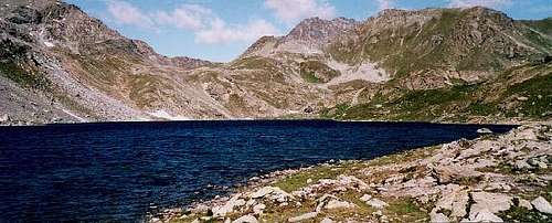
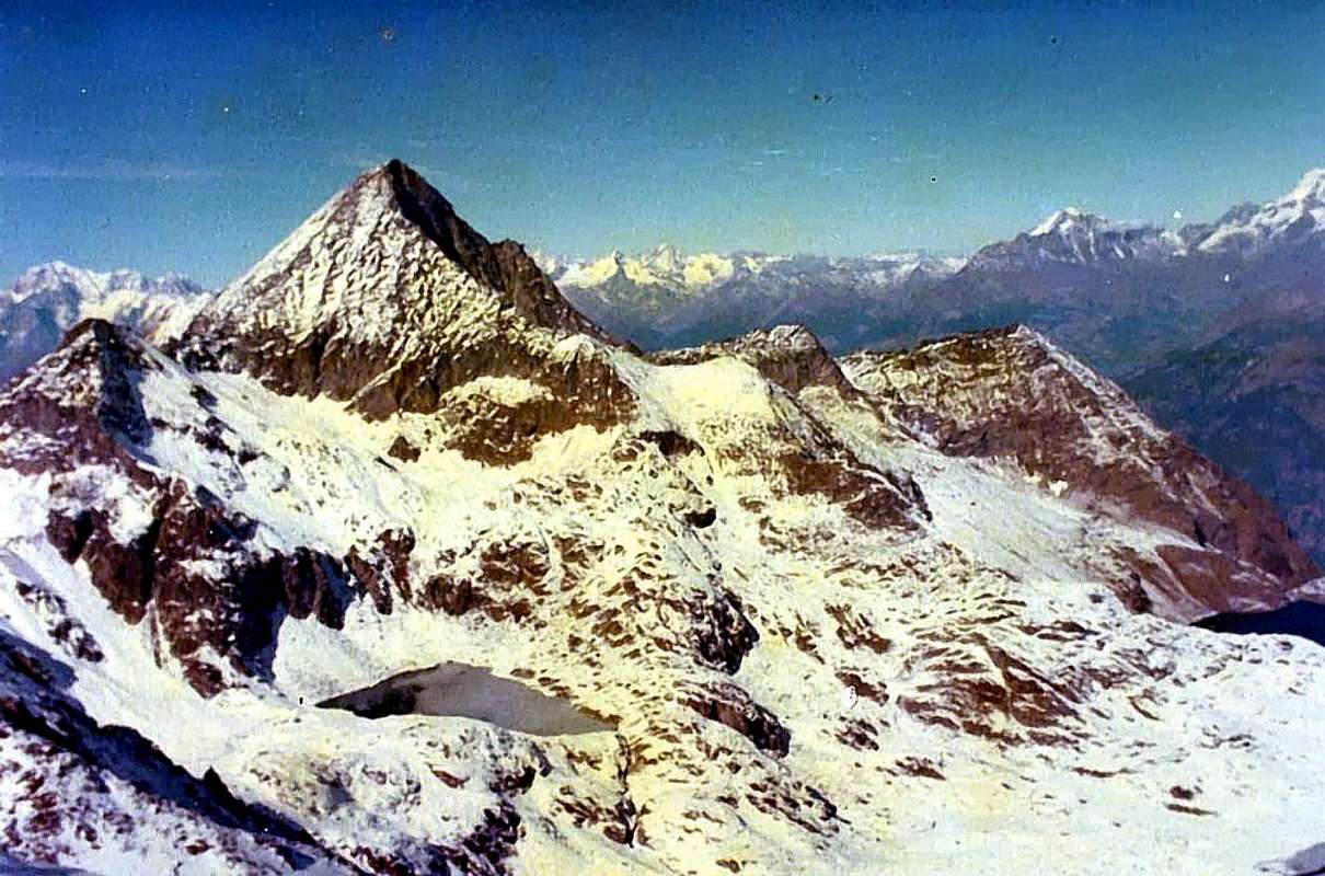
A) - From Champdepraz Common (523m) or by the Municipalities of Verrès (390m) in Southeast, or Montjovet (489m) in Northwest to catch up with the Regional Road, South of Dora Baltea and Motorway A5, to Champdepraz (523m), located at the entrance of the with the same name valley. From this go along way towards Southeast with a first series of seven windings road to the junction, near the Bridge of Gorf, for Gettaz des Allemands (995m, old village that bears witness to the passage of Walser People) a dozen others, even closer, door in the upper part of the vallon, dominating from steep and wild precipices overhanging the Torrent de Chalamy, which originates at the base of the Northern Slope of the Invers of Lake Gelato. Left to right (West) to the branch Crestaz (1.293m) with its ancient ironmines now abandoned and closed, the same goes with a long diagonal to the South reaching Villages Barbustel or Barbuste (1.240m) and the adjacent Covarey, just before you reach Volla or Voella also called in old time as Chevrère (1.307m; Museum of the Regional Nature Park of Mont Avic, small restaurant with a few rooms amongst the houses not long ago renovated keeping the style of the Aosta Valley), where it ends with ample parking. Parked in the large square climb the path n° 5B to Serva Lake (1.801m) at the foot of Bec L'Espic, and then through the n° 5C that, heading more towards Southeast, reaches the Alps Bayet and Cousse and then the Barbustel Hut located on a rocky-grassy promontory immediately above the Lago Bianco ((2.209m); E/F; 3h'00/3h'30 by Voella). from the Refuge Barbustel recently built, located midway between the Lac Blanc and Lac Vallette (2.132m, 2.170m; 0h'15). From this trace the beautiful and wild Vallon Lake, in the Upper Valley of Champdepraz and, with the trail n° 6/102, pass in succession the White Lake (2.132m), through a short descent, Nero (2.166m) and Cornuto (Horned; 2.168m), passing just above their edges and reaching the Northern Alpage Pisonet (2.301m), located in a beautiful clearing at the end of this first part of the walloon below and a distinctive and overhanging rocky promontory. From this, the same, which gradually turns into beautiful trail, from the West turned decidedly first in the South and then back again to the West the slope with a dozen hairpin bends to stand at Grand Lake (2.485m; 1h'45/2h'00). The same appears to be the most extensive of all the Valley of Aosta and the beginning of the second and higher part of the vallon. Flanking its Northern shore is reached at a waterfall (great place to eat), its tributary and immediately below the Bivouac Verthuy of the Forest (2.535m; private and always closed), amid a cluster of lakes called the Leità (E; 1h'30/2h'00 from Barbustel). From the Great Lake to the Northwest to continue for a short distance to reach the Bivouac of the Forest with trail n° 6/102; allowing the continuation of this North-northwest towards the Plateau of Great Betassa, continuing instead take the path Intervalleys n° 102 to the Southwest, which in the end becomes a track, reaching the Col Medzove or Mezove (2.614m; E; 0h'30 by Grand Lake; 1h'45/2h'00 from Barbustel). Start the climb up some traces reaching a bump in altitude 2.849 meters followed by a collar rock; should always follow the ridge for every 350 meters of the climb, facing a series of rocky plates much broken and covered with debris. Nevertheless, the climbing is enough fun, safe and almost always easy (steps I° and II°) to reach the Summit (PD/PD-; 1h'00 from the base; 3h'00 Barbustel; 4h'30/5h'00 Mont Blanc Champorcher). a short and easy downhill to the Lake Margheron (2377m), below the Alp of Medzove (2.396m) and near the end of the Vallon of Savoney (secondary of Clavalitè). The subsequent ascent to the Col dell'Etsely or Etseley and still said the Echelley or of Eyèle (2.812m) is just over 1 hour, but the path is steep and tiresome. By contrast the descent is easy and manageable and at the same time reach first the Alpage de l'Etsely Damon (Superior; 2.437m) and then the Refuge E. Borroz-Rotary Clavalité to Cuneu or Cuneux (2.156m), just above Grand-Alpe (2.117/29m). This concludes the second stage or the first if you started by la Cort.
B) - From Camporcher-Château (1.427m) Continue with the road to the small village of the Cort and the subsequent parking in the ground on the Royal Road to the entrance of the Southern Sector of the Regional Park of Mont Avic. From the La Cort Hamlet, continue verse West-northwest through Royal Road to Dondena reaching not very after a small parking 1.800 meters about; noumerous signs to entry in the Park); to begin awry immediately with the path n° 10 that part (North) and it goes up again with steeply zigzagging bringing itself, with direction Northeast, at first towards a small secondary torrent and subsequently placing side by side that more important descendant from the impending Lake Muffé. To go up again along the bank right hydrographic of the same one with the path, almost muletrack, that unties him with a series of hairpin bends flanking the wood, alternate to rectilinear lines in diagonal. Go out, leaving on the right (East) the deviation for the La Grand Cort Alp (1.944m, that from he is quietly seen here, abandoned among green pastures) so in the superior tableland in her narrowing among the appendixes of the Mont Ros (2.289m) to West and you it terminal of the Southwestern ridge that it climbs to the Cima Perche (2.396m; also with the toponym of Perché, or Perforated), or Southern shoulder of the Cima Piana (Flat Top also called Mont de Panaz 2.512m). Continue on the valley floor through less steep slope with run mostly open and, abandoning on the left (West) the deviations for the Lake Vernouille (2.145m) with the paths n°9C/10B and, momentarily, also the n° 10, goes up with the n° 10C reaching the ruins of the Muffé Pasture (2.076m), close to the homonym Lake suffered to East (2.119m; 0h'30). From this to ascend up with direction Northwest in a area even more disclosed among morainic soil (numerous sources that gush out a little everywhere) again meeting the path n° 10, that it originates from the Loch Vernouille, few more than hundred metres more aloft. To abandon therefore the aforesaid variation continues with, that goes in opposite (Northeast) towards the nearby Lake Bianco Hill (2.308m), and to proceed with this last I pour the neighbour Croix Hill (2.287m) through the path n° 10C, reaching it with a final line of a more steep, but always easy. A short descent leads quickly to the Barbustel, at Lake Bianco in the High Champdepraz Valley or Lakes Valley (E/F; 1h'15/1h'45).
A) - Dal Comune di Champdepraz (523 m) oppure da quelli di Verrès (390 m) a Sudest, oppure Montjovet (489 m) a Nordovest raggiungere con la Strada Regionale, a Sud della Dora Baltea e dell'Autostrada A5, quello di Champdepraz (523 m), sito all'ingresso dell'omonimo vallone. Da questo percorrere la strada verso Sudest con una prima serie di sette tornanti insino al bivio, presso il Ponte di Gorf, per Gettaz des Allemands (995 m, vecchio villaggio testimoniante il passaggio dei Walser); una dozzina d'altri, ancor più ristretti, porta nella parte alta del vallone, dominando dall'alto erti e selvaggi dirupi sovrastanti il Torrent de Chalamy, originantesi proprio alla base del Versante Settentrionale dell'Invers del Lago Gelato. Lasciata a destra (Ovest) la diramazione per Crestaz (1.293 m) con le sue antiche miniere di ferro ormai abbandonate e chiuse, la stessa procede con un lungo diagonale verso Sud raggiungendo i Villaggi di Barbustel o Barbuste (1.240 m) e l'attiguo di Covarey, appena prima di raggiungere Volla o Voella od anche Chevrère in tempi più remoti (1.307 m; Museo del Parco Naturale del Monte Avic, piccolo ristorante, con alcune camere, tra le case da non molto tempo ristrutturate mantenendo lo stile valdostano), dove termina con ampio parcheggio. Parcheggiato nell'ampio piazzale si sale con il sentiero n° 5B fino al Lago della Serva (1.801 m), ai piedi del Bec L'Espic, e poi tramite il n° 5C che, dirigendosi più verso Sudest, raggiunge le Alpi Bayet e Cousse e non molto dopo il Rifugio Barbustel sito su d'un promontorio roccioso-erboso appena sopra al Lago Bianco ((2.209 m); E/F; 3h'00/3h'30 da Voella). dal Rifugio Barbustel di recente costruzione, sito a metà strada tra il Lac Blanc ed il Lac Vallette (2.132 m, 2.170 m; 0h'15). Da questo risalire lo splendido e selvaggio Vallone dei Laghi, nell'Alta Valle di Champdepraz e, con il sentiero n° 6/102, oltrepassare in successione i Laghi Bianco (2.132 m), tramite una discesina, Nero (2.166 m) e Cornuto (2.168 m), transitando poco al di sopra dei loro bordi Settentrionali e raggiungendo l'Alpe Pisonet (2.301 m), situata in una bella spianata al termine di questa prima parte del vallone e sottostante ad un caratteristico promontorio roccioso. Da questa il medesimo, che progressivamente si trasforma in bella mulattiera, da Ovest volge decisamente dapprima a Sud e risale quindi nuovamente verso Ovest l'erta con una dozzina di stretti tornanti portandosi al Gran Lago (2.485 m; 1h'45/2h'00). Il medesimo risulta come il più esteso di tutta la Valle d'Aosta ed all'inizio della seconda e più elevata parte del vallone. Fiancheggiando la sua sponda Settentrionale si raggiunge, presso una cascatella (ottimo posto di ristoro), il suo immissario e subito appresso il Bivacco Verthuy della Forestale (2.535 m; privato e chiuso), collocato tra un nugolo di laghetti detti della Leità (E; 1h'30/2h'00 dal Barbustel). Dal Gran Lago continuare verso Nordovest per breve tratto raggiungendo il Bivacco della Forestale con il sentiero n° 6/102. Lasciando la continuazione di questo a Nord-nordovest verso l'altopiano della Gran Betassa, continuare invece a Sudovest con il sentiero Intervallivo n° 102, che nella parte finale diventa una traccia, raggiungendo il Col Medzove o Mezove (2.614 m; 0h'30 dal Gran Lago; 1h'45/2h'00 dal Barbustel). Una corta e facile discesa, sempre tramite sentiero, conduce al Lago Margheron (2.377 m), sotto l'Alpe di Medzove (2396 m) e quasi al termine del Vallone di Savoney (secondario della Clavalité). La successiva risalita al Col dell'Etsely o Etseley ed ancora detto dell'Echelley o d'Eyèle (2.812 m) risulta di poco superiore ad 1 ora, ma il sentiero è ripido e faticoso. Per contro la discesa opposta é facile ed agevole ed in pari tempo raggiunge dapprima l'Alpe de l'Etsely Damon (Superiore; 2.437 m) e poi il Rifugio E. Borroz-Rotary Clavalité al Cuneu (2.156 m), appena sopra Grand-Alpe (2.117/29 m). Qui si conclude la Seconda tappa o la prima se siete partiti da Champorcher-la Cort.
B) - Da Camporcher-Château (1.427m)Continuare con la strada in asfalto fino al Villaggetto di la Cort ed al successivo parcheggio in terra battuta sulla Strada Reale all'ingresso del Settore Meridionale del Parco Regionale del Mont Avìc. Da La Cort, continuare verso Ovest-nordovest tramite la Strada Reale per Dondena raggiungendo non molto dopo un piccolo parcheggio in terra (1.800 metri circa; pannello con nunerose segnalazioni per l'ingresso nel Parco del Monte Avìc); inizare con il sentiero n° 10 indirizzantesi subito a monte (Nord) risalendo ripidamente e tramite zig-zag portandosi, con direzione Nordest, dapprima verso un torrentello secondario e successivamente affiancando quello più importante, discendente dal soprastante Lac Muffé, presso l'omonima alpe. Risalire lungo la sponda idrografica destra del medesimo con il sentiero, quasi mulattiera, che si snoda con una serie di tornanti affiancando il bosco, alternati a tratti rettilinei ad altri in diagonale. Uscire, lasciando sulla destra (Est) la deviazione per l'Alpe La Grand Cort (1.944 m, adagiata tra verdi pascoli) così nell'altipiano superiore nella strettoia tra le appendici del Mont Ros (2.289 m) ad Occidente e la propaggini terminali della Cresta Sudovest risalente alla Cima Perche (2.396 m; o Perché, cioé Forata), o spalla Meridionale della Cima Piana o Mont de Panaz (2.512 m). Continuare sul fondo del vallone con percorso alquanto meno ripido e maggiormente dischiuso e, abbandonando sulla sinistra (Ovest) le deviazioni per il Lac Vernouille (2.145 m) con i sentieri n° 9C/10B nonché, momentaneamente, anche il n° 10; risalire tramite il n° 10C raggiungendo i ruderi dell'Alpe Muffé (2.076 m), vicino all'omonimo Lago, subito ad Est appresso (2.119 m; 0h'30). Da questo proseguire con direzione Nordovest in una zona ancora più dischiusa tra dossi prativi e terreno morenico (piccole sorgenti che sgorgano un pò dappertutto) incontrando nuovamente il sentiero n° 10, proveniente dal Lac Vernouille, poco più di un centinaio di metri a mezzacosta sopra. Abbandonare quindi la variante seguita, che continua in opposta direzione (Nordest) verso il Col de la Croix con sentiero n° 10C(2.387 m), e con quest'ultimo verso il Colle del Lago Bianco (2.308 m), raggiungendolo con un tratto finale di poco più ripido ma pur sempre facile. Una discesina conduce in breve al Rifugio Barbustel, presso il Lago Bianco nell'Alto Vallone di Champdepraz conosciuto anche come Vallone dei Laghi (E/F; 1h'15/1h'45).
Second Stage with Variant from Fénis-Clavalité (to Lavòdilèc Hill & Grande Chaux Alp)
From the E. Borroz-Rotary Clavalité Shelter or, just more in bottom, Grand-Alpe with the path 7/102/High Route n° 2, or (*** arriving with the Variant by Fénis-Clavalité Valley from Lovignana Pasture, through the farms dirt road concomitant with the trail n° 2/5, along the whole Val Clavalité) more directly from Meney Damon (1.952m) by an unnumbered shortcut towards Lavòdilèc Lake and overhanging Hill (2.863m). The descent towards the Northwest to the fork 2.474 meters, where you should temporarily abandon the trail n° 102, where this has a connection with the n° 4 from Grande Chaux then climb to Colle Coronas or Saint Marcel Hill. Should instead go down briefly with a small path unnumbered towards Petite Chaux (2.419m), whence then navigate to Grande via the dirt road. It also ends this stage, unless, of wanting to follow the full path, we continue through the above link and then climb to the Col Coronas or Corona (2.913m) and descend to the underlying Lake Corona (2.702m), Rane Lake (2.641m) and the Grauson New Alp (2.540m), at the former Bivouac Tentori. In doing so lengthens the stage of about two hours, but it shortens the rather long the next journey.
Dal Rifugio E. Borroz-Rotary Clavalité oppure, appena dabbasso, da Grand-Alpe col sentiero 7/102/Alta Via n° 2, o (*** arrivando con la Variante dal Vallone di Fénis-Clavalité con partenza dall'Alpe di Lovignana, tramite poderale concomitante con il sentiero n° 2/5, lungo l'intera Val Clavalité) in modo più diretto dall'Alpe di Meney Damon (1.952 m) tramite un sentierino-scorciatoia non numerato verso il Lago di Lavòdilèc e soprastante Colle (2.863 m). La discesa verso Nordovest raggiunge il bivio 2.474 metri, ove conviene abbandonare momentaneamente il sentiero n° 102, dove questo presenta un collegamento con quello n° 4 proveniente dalla Casa di Caccia di Grande Chaux per poi salire al Colle Coronas o di Saint Marcel. Conviene invece scendere brevemente con un sentierino non numerato a Petite Chaux (2.419 m), donde poi traversare alla Grande tramite la poderale. Termina anche questa tappa, a meno che, volendo seguire integralmente il percorso, si continui tramite il collegamento suddetto per poi salire al Col Corona o Coronas (2.913 m) e scendere al sottostante omonimo Lago (2.702 m), al Lago delle Rane (2.641 m) ed all'Alpe di Grauson Nuove o Superiore (2.540 m), presso l'ex Bivacco Tentori. In questa maniera la tappa viene allungata di circa 2 ore, ma ci si avvantaggia per quella piuttosto lunga della giornata successiva fino al Rifugio d'Arbolle.
Third Stage with Variant from St. Marcel & Nature Preserve Turati (to Corona Laures Arbolle Hills & Refuge)
In the third or fourth stage, always with respect to the Variant of Departure, which, bypassed the Col Corona through the paths 4/102 in ascent and 8B/102 downhill towards the Lake Corona and Grauson Nuove (if you have not already done so with the hypothesis number 2 above), reaching, through the trail 8A/102 from Gimillan Hamlet in Valley of Cogne, in succession the three beautiful Lakes Lussert (2.713m, 2.790m, 2.906m, fourth or "d'En-Haut" 2.923 m, just departed to the South from its original location and the way of the Pas du Valaisan 3.210m, can be reached in a short time). The climb to the Col des Laures above is easy through an area of great "clapeys" (boulders piled wildly); the subsequent descent into the Vallon of Laures leads to the junction of Laures 2.933 meters (here also comes the trail n° 4 from Refuge Ernesto Ménabreaz) and then up towards the Arbolle Pass, with a short but steep final stretch. The crossing to the West on the ancient Glacier of Mount Emilius or Lac Gelé, at the foot of the Northern Faces of the three Punta Rossa, is easy if in the snow, but not simple in the case of "verglass". in this case we have to have caution and be alert to frequent rock falls from the wall immediately above. Then quickly, even through the track of an old path restored and unnumbered, but always 102, you will reach that of the "Normal Route" to Emilius and immediately after Lake Gelato (2.957m). By here the descent to the Refuge Arbolle is simple along the namesake Vallon, but also a little boring through the path 14/102.
Nella terza o quarta tappa, sempre rispetto alla Variante di partenza, che, scavalcato il Col Corona con i sentieri 4/102 in salita e 8B/102 in discesa al Lago Corona e Grauson Nuove (se non l'avete già fatto con l'ipotesi numero 2 di cui sopra), si raggiungono, per mezzo del sentiero 8A/102 dal Villaggio di Gimillan in Val di Cogne, in successione i tre splendidi Laghi di Lussert (2.713 m, 2.790 m, 2.906 m; un quarto o "d'En-Haut" 2.923 m, appena discostato a Sud dal percorso originale e sulla via del Pas du Valaisan 3.210 m, é raggiungibile in breve tempo). La salita al soprastante Col des Laures é facile attraversando una zona di grandi "clapeys" (macigni ammucchiati selvaggiamente); la successiva discesa porta nel Vallone delle Laures fino al bivio 2.933 metri (qui giunge anche il sentiero n° 4 dal Rifugio Ernesto Mènabreaz) per poi risalire verso il Col d'Arbolle, con un tratto finale corto ma ripido. La traversata verso Ovest sullo antico Ghiacciaio del Monte Emilius o del Lac Gelé, ai piedi del Versante Settentrionale delle tre Punta Rossa, é facile se in neve, ma non semplice in caso di "verglass". in questo caso bisogna avere cautela e stare attenti alla frequente caduta di pietre dalla parete subito soprastante. Poi in breve, anche tramite la traccia d'un antico sentiero ripristinato e non numerato, ma sempre 102, si raggiunge quello della "Via Normale" all'Emilius e subito dopo il Lago Gelato (2.957 m); da qui la discesa verso il Rifugio di Arbolle é semplice lungo l' omonimo Vallone, ma anche un pochino noiosa col sentiero 14/102.
Fourth Stage (Descent Arbolle towards St. Grat Hermitage Pila-Resort & Pont-Suaz)
The last lap, starting by Arbolle, leads to the Hermitage of San Grato (1.773 m) and the Pont Suaz (567 m). After bypassed the Chamolé Hill (2.641m) through the paths n° 14/18/19A/TVC to reach the homonym Lake (2.325m), nearby the arrival of Chamolé Ski-lift by Pila. In descent, passing the Chamolé Alp (2.152m), continue towards the St. Grat Hermitage (1.773m) with the path n° 19/19C/20/102. Finally becomes a walk though, came at the Hermitage, we decide to go through to Pila (1.800m) via the private road concomitant with the trail n° 14I. But this choice is leave the path n° 102 and you do not complete the course. Otherwise, as good "Purists", from St. Grat Hermitage follow the yellow pole and, with path n° 14L/102, get off at the first towards the locality of L'Anvy (1.484m) and then to Peroulaz (1.359m), on the Regional Road. But if you did you also 99 you do 100; do not be overcome by fatigue and a desire to get concluding a nice downhill through the woods leads to the Village Manzoud (1.228m), at the Shrine of Sainte Colombe (915m), the Chief town Charvensod (810m) and finally Pont Suaz, whence, crossing the bridge over the Dora Baltea, towards Aosta City.
L'ultima tappa, partendo da Arbolle porta all'Eremitaggio di San Grato (1.773 m) ed al Pont Suaz (567 m). dopo lo scavalcamento del Colle di Chamolé (2.641 m) tramite i sentieri n° 14/18/19A/TVC raggiungesi l'omonimo Lago (2.325 m), presso la Stazione d'arrivo della Seggiovia di Chamolé con partenza da Pila. In discesa, passando per l'Alpe di Chamolé (2.152 m), si continua verso l'Eremo di San Grato (1.773 m) col sentiero n° 19/19C/20/102. Diventa una Passeggiata se, giunti all'Eremitaggio, si decide d'attraversare verso Pila (1.800 m) tramite la poderale concomitante con il sentiero n° 14I. Però in questa scelta si abbandona il sentiero n° 102 e non si completa il percorso. Altrimenti, da bravi "Puristi", da San Grato seguite la palina gialla, e con sentiero n° 14L/102, scendete prima a L'Anvy (1.484 m) e poi a Péroulaz (1.359 m), sulla Regionale. Ma se avete fatto 99 fate anche 100; non lasciatevi sopraffare dalla stanchezza e dal desiderio di arrivare concludendo. Una bella discesa attraverso i boschi vi conduce al Villaggetto di Manzoud (1.228 m), al Santuario di Sainte Colombe (915 m), al Capoluogo di Charvensod (810 m) ed infine al Pont Suaz, donde, attraversata la Dora Baltea, ad Aosta Città.
Difficulties & Equipment
Hikers and Expert Hikers (from EE to EE/A).
Da Escursionistico a Escursionistico Esperto (da EE a EE/A).
Hiking with tent and sleeping bag.
Da Escursionismo con tenda e sacco a pelo.
Campings
Remember that free camping is forbidden (except for emergency reasons, over 2.500m, from darkness until dawn).
Mountain Condition
Meteo: you can find all the needed informations at the official site of the Valle d'Aosta Region:


 4211 Hits
 78.27% Score
 9 Votes