
-
 21332 Hits
-
 85.36% Score
-
 20 Votes
|
|
Mountain/Rock |
|---|---|
|
|
39.50264°N / 105.42014°W |
|
|
Hiking, Mountaineering, Trad Climbing, Sport Climbing, Bouldering, Aid Climbing, Big Wall, Mixed, Scrambling |
|
|
Spring, Summer, Fall, Winter |
|
|
9463 ft / 2884 m |
|
|
Overview
Colorado's newest state park opened to the public on May 18, 2013. The park is located approximately 40 miles southwest of downtown Denver, north of US Highway 285 and about six miles west of Conifer. The Park sits divided between Park and Jefferson counties, in Pine, Colorado.
The first 1,720-acre parcel of land was donated to Colorado State Parks in 1986 by Frances Hornbrook Staunton. Subsequent parcels of land were added over the years to make up the now 3,828 acre park. Read more about the story of Staunton State Park history page.
Staunton State Park is the legacy of Frances H. Staunton. As her beneficiaries, present and future generations are entrusted with this land--to enjoy, protect and treasure as she did.
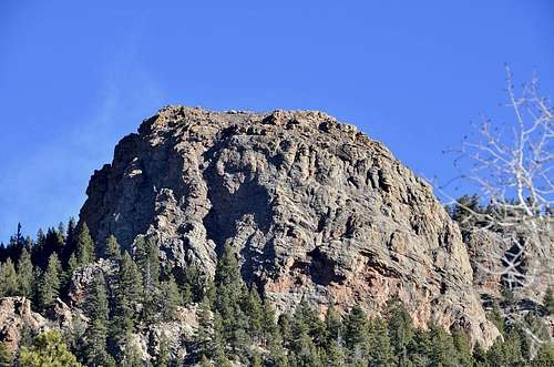
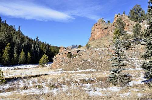
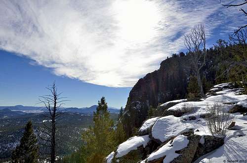
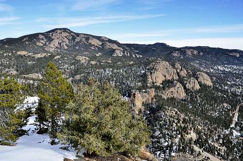
Lions Head is highest named peak in the park, unique shape can be seen and recognized miles away, it was time to visit this beautiful park and meet this nice, little and unknown peak.
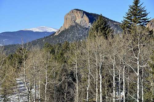 Lions Head
 Getting There
Directions from Denver:
From C470, take US Highway 285 south to Shaffers Crossing, about 6 miles west of Conifer. Turn north on Elk Creek Road and follow the signs 1.5miles to the park entrance.
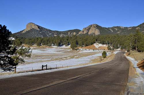
Road to Staunton Park
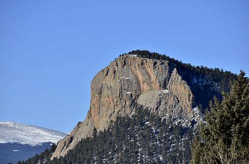
Lions Head from park entrance.
Route
 |
 |
 |
Distance: 6 miles each way.
Elevation Gain: About 2000 ft
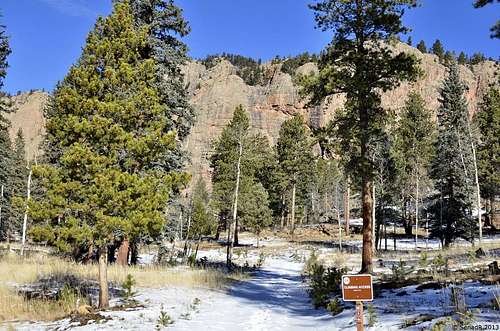
Before you leave Parking area, grab from Ranger Station Staunton State Park Trail Map and carefully study trail toward Elk Fall Overlook.
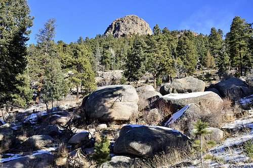
Staunton State Park may be known for its rocks, history ,scenery, waterfall, hikers will be happy to know the park is also home to a nice mountain. To get to the top of Lions Head, one has to ‘’catch’’ trail to Elk waterfall overlook, after that point everything is easy. While the trail tothe falls is still under construction (Spring 2013), the overlook gives waterfall fans a chance to see the waterfall from top to bottom.
The hike to the overlook starts on the Staunton Ranch Trail.Technically, the trail starts in the main parking lot, but if you park at the group picnic area, you can cut a half mile or more off the round trip distance.From the group picnic area, cross the main road and look for the Staunton Ranch Trail sign on your left in the trees.
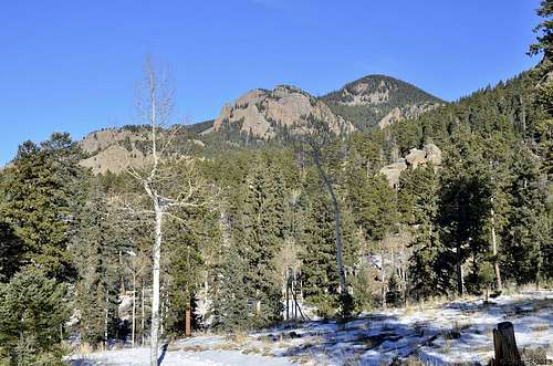
The first section of the Staunton Ranch Trail is new. It'smainly dirt, with very few rocks, making it very easy on the legs and feet. The trail winds through the trees for 1.65 miles. The forest is thick in spots and thin in spots, so sometimes you'll be in the shade, sometimes the sun. As you walk, look through the trees at the surrounding rock formations.
 |
 |
 |
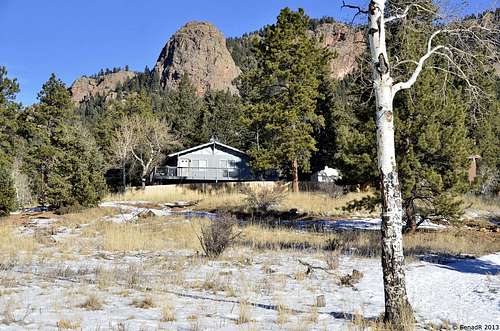
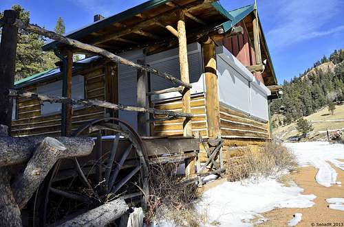
As you hike the Staunton Ranch Trail, look for homes. A half mile in is a gray house surrounded by a fence. I believe this is employee housing. (You'll notice a road going to the house.) (Remember this spot, it will be important later.) When you get about 1.45 miles from the trailhead start looking in the trees to your left, you may spot an old homestead or a few.
At about 1.65 miles, the Staunton Ranch Trail turns onto a road. The road is now your trail for the next 3+ miles. A short distance away is one of two major trail splits in the park. Here hikers can turn on the Old Mill Trail and see the northeast side of the park. We continued on the main Staunton Ranch Trail. Just a few steps away is another trail split, this one takes climbers and observers to the Staunton Rocks climbing area.
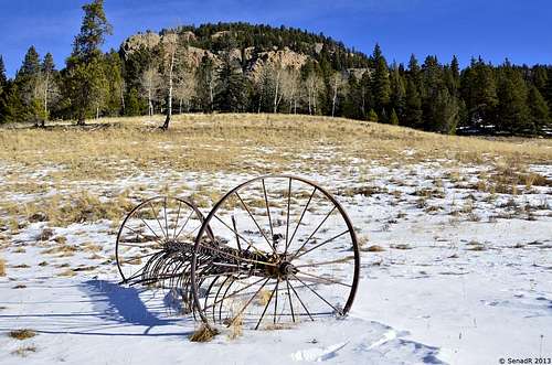
It's another mile or so until the Stounton Ranch Trail end sat a fence. Turn right here on the appropriately named Border Line Trail to skirt the edge of the park's border and circle to the northeast side of the park. Hikers going toward Elk Falls Pond and Elk Falls can take the Marmot Passage Trail or the Bugling Elk Trail. Since the Bugling Elk Trail was shorter, we took that option. The Bugling Elk Trail has a bit of a steep climb, then its drops into a scenic meadow. Look closely in the meadow and you may spot some old farm equipment. There's even a small BE trail marker that says 1/2 way on it. A little encouragement to keep you going to the pond.
 |
 |
 |
Elk Falls Pond is a nice spot to take a break. The pond has a rock formation at one end that makes for scenic photos. Walk around the area and you should spot a historic homestead below the dam, a newer home and an outhouse. When you're done wandering around, it's time for another steep climb above the lake on the Lion's Back Trail. As you hike,if you need a break, look through the trees at the view of the lake below you.
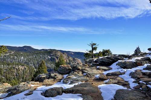
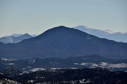
The Lion's Back Trail is the last mile to the overlook. At the end of the trail is a sign, "Elk Falls Overlook, 250 feet." Hike up this short, rocky, steep trail and you'll be treated to a view of Elk Falls.As you look across the valley at the falls, count how many different drops you see. There's a cascade at the top, that leads to the main drop. The main drop has a shelf in the middle so you may say it's two drops. There's a pool at the bottom of that big drop that leads to several smaller cascades. Just beautiful.Find a spot on the rocks here and enjoy the falls. Look around and you may see Pikes Peak to the south and a snow-capped Mount Evans to north.
Find a spot on the rocks here and enjoy the falls. Look around and you may see Pikes Peak to the south and a snow-capped Mount Evans to north.
From this point Lions Head summit is minutes away, trail end here at overlook but if you follow ridge line or if you decide to navigate thru trees you won’t miss summit. If views from overlook point are great, from top of Lions Head it gets even better.
Enjoy.
 |
 |
 |
Google Map:
<ahref="https: maps.google.com="" maps?q="39.493924,-105.383024&hl=en&sll=39.832555,-105.119692&sspn=0.83522,2.108002&t=h&ie=UTF8&z=14&ll=39.493924,-105.383024&source=embed" style="color:#0000FF;text-align:left" "="">View LargerMap</ahref="https:>
Red Tape
Staunton State Park FeesPark Passes
Daily Park Pass: $7
Annual Park Pass: $70 - Good at all 42 state parks.
Please visit the ParkPasses page for additional information.
Group Picnic Area
$90 per day
$10 reservation fee
maximum 60 people
Please call 303-816-0912 for more information or to make a reservation
PARK HOURS: The park hours vary for the season. November-February the park will be open from 8am-5pm. The entrance gate closes 1 hour before park closing. Please plan ahead and be back to your vehicle before the park closes.
ENTRANCE: There may not always be an attendant at the entrance station. A state park pass is required on all vehicles entering the park. The daily fee is $7.00. Please plan ahead and bring exact change to purchase your park pass at our self serve station.
PARKING: During the winter months parking may not be available at all of the parking lots. Please plan ahead and know which lot to park in for your hike.
TRAILS: Our trail system will be available throughout the fall and winter months. Trails will be available for snowshoeing and cross country skiing when snow conditions exist. Please plan ahead as trail conditions may vary depending on the weather.
TRAILS: Our trail system will be available throughout the fall and winter months. Trails will be available for snowshoeing and cross country skiing when snow conditions exist. Please plan ahead as trail conditions may vary depending on the weather.
Brian Kalet - Dec 18, 2013 2:29 pm - Hasn't voted
Minor detailLooks like 9500 is slightly higher than Lions Head & inside Staunton State Park. It is the highest named peak in the park, though...
Senad Rizvanovic - Dec 18, 2013 2:44 pm - Hasn't voted
Re: Minor detailThank you for pointing that out to me, I've made some corrections .