
-
 1513 Hits
-
 79.04% Score
-
 10 Votes
|
|
Mountain/Rock |
|---|---|
|
|
38.54315°N / 110.49412°W |
|
|
Emery |
|
|
Hiking |
|
|
Spring, Summer, Fall |
|
|
5965 ft / 1818 m |
|
|
Overview
This is a small yet challenging and rewarding peak that most people just drive by on their way to Horseshoe Canyon or the Maze District. While the round trip distance (including summit exploration) is less than three miles, this will take a few hours to complete due to the steepness of the terrain. There is a local, possibly out of print "San Rafael Desert Auto Tour" brochure that mentions a "steep, narrow trail on the southwest face." While that trail seems to no longer exist, the general route it probably took is still valid today.
Getting There
The Flat Tops are located along the Lower San Rafael Road between Utah Highway 24 and Horseshoe Canyon. There is a large sign on Highway 24 marking this turnoff and distances to various attractions, so you can't miss it. The road is unpaved, but is generally passable to all vehicles unless there has been a recent storm. Canyonlands National Park maintains a website dedicated to the road status (Hwy 24 to Horseshoe Canyon): https://www.nps.gov/cany/planyourvisit/road-conditions.htm
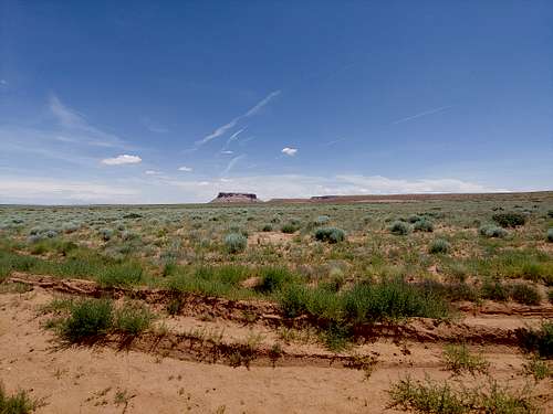
At about 9.5 miles, Little Flat Top will be on your left as you head up over a pass between it and Big Flat Top.Those with high clearance vehicles will want to look for a track heading toward the rocks just before the cattle guard. Those with low clearance should probably continue just past the cattle guard to a pulloff on the right. This will only add a few minutes of easy walking to the journey.
Route

As this aerial photo shows, you will first need to work your way around to the back side of the butte. You can either stay low to make the approach easier, or start traversing higher and higher to shorten the eventual climb. There is a notch on the far western edge of the flat top that will lead to the same final summit approach, but it appears to be even steeper than the route described here. Eventually, you will come to a prominent drainage descending from a weak point in the rock face. This is where you will need to start climbing. The drainage is steep and there are some minor bouldering problems. The terrain adjacent to it is even steeper and made of loose sand and mud. Fortunately, the falling danger is minimal, as the sand makes it very easy to dig in and regain footing as needed. Elevation gain here is about 550 feet, and you will feel all of it.
Once at the top of the drainage, you will see rocky chutes to both your left and right. Both do seem to lead to the summit, but the one to the left is clearly the easier of the two. Once you've made it to the top of that, congratulations! The worst is behind you. The final obstacle is to work your way up to the ledge directly in front of the cliffs and traverse over to where the summit opens up. There will be large boulders to your right, so there is no exposure here (and there may even be shade).


(the rocky chute)
As the name implies, the summit of Little Flat Top is...well...mostly flat. It's also expansive. You can walk about at your leisure, taking photos in all directions. Just make sure to retrace your steps carefully, as there aren't many ways back down!

This is a neat arch you will encounter at the top of the drainage. It may be possible to descend down a chute to its left, but when viewed from below, it is clearly steeper than the route described here.

And finally, a couple of summit views. This one looks south to the Henry Mountains with the parking area below.

And this view looks to the east, toward Big Flat Top and the La Sal Mountains.
Red Tape
None. The Flat Tops are on public BLM land.
When to Climb
Spring and Fall are best. Summer can be very hot in the San Rafael Desert, and the steepness of the terrain could be treacherous in the icy winter. The route does have some morning shade along it.
Camping
Both the high and low clearance trailheads described here serve as dispersed camping sites. The closest developed campground and services of any kind are located at Goblin Valley State Park to the west.
External Links
Add External Links text here.