
-
 18061 Hits
-
 84.82% Score
-
 19 Votes
|
|
Mountain/Rock |
|---|---|
|
|
38.02531°N / 105.58419°W |
|
|
Custer |
|
|
13143 ft / 4006 m |
|
|
Overview
 A wintry Little Horn to the Left and its taller sibling, Horn Peak on the right
Little Horn Peak is located in the northern section of the Sangre De Cristo Mountains of Southeastern Colorado. A prominent peak facing east towards the Wet Mountain Valley just south of the town of Westcliffe. It lies within the boundaries of the Sangre De Cristo Wilderness.
Due to the its steep rocky terrain and class 3 exposures on its final approach, at 13,143ft, Little Horn Peak boasts a challenge to all who climb it. Winter climbing is not for the novice. Depending on the severity of the winter, snow pack, can remain until July on some treed sections of the route. Be prepared for any conditions when hiking the area
Although, ranked at number 531 of Colorados tallest mountains, the challenge that Little Horn Peak and its terrain offers makes for a much higher ranking and difficulty factor in climbing compared to many of the taller mountains that surround it. Including its sibling to the north, Horn Peak.
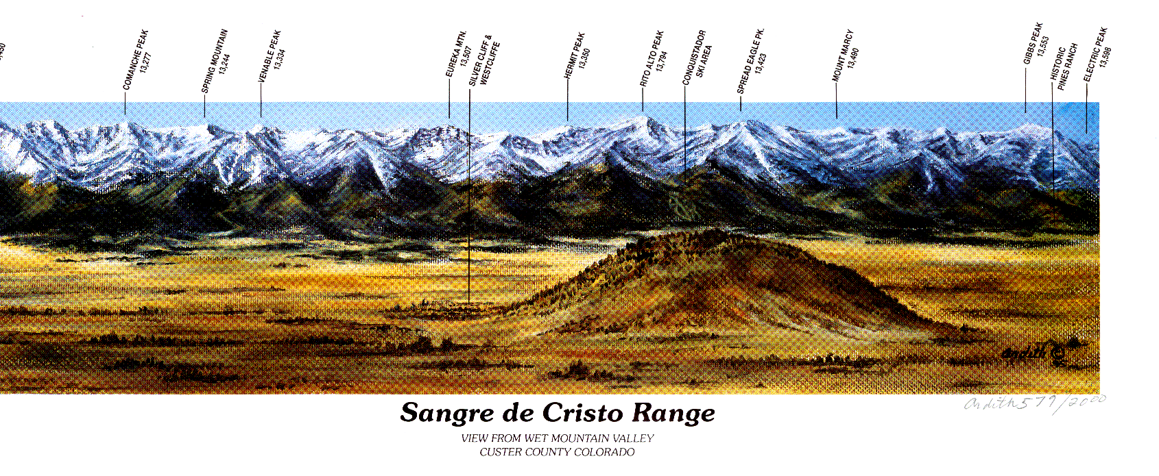
Surrounded by many of Colorados landmark peaks, including The Crestones, Humboldt Peak, Mt. Adams, Kit Karson Mountain and many others, Little Horn Peaks summit provides for some spectacular view and photo opportunities. There are also many stocked alpine lakes for the avid fisherman. Trout can be found in abundance in most if not all lakes. Check local fishing rules and regulations for possible "catch and release" laws.
Views from the top:
 Little Baldy,Colony Baldy & Humboldt Peaks
 Little Baldy,Colony The Crestones, Kit Carson Mtn & Others
 Mt Adams
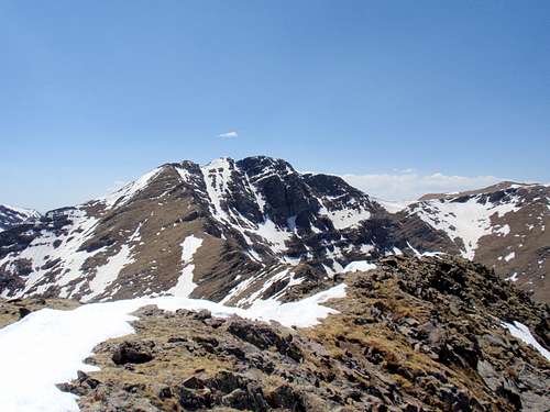 Ridge to Fluted Peak. Fluted Peak included
 Commanche Pk, Venable Pk, Spring Mtn and others
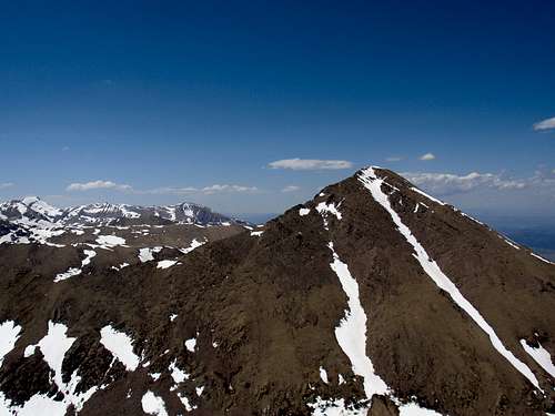 Horn Peak and Others
 Northern Wet Mountain Valley
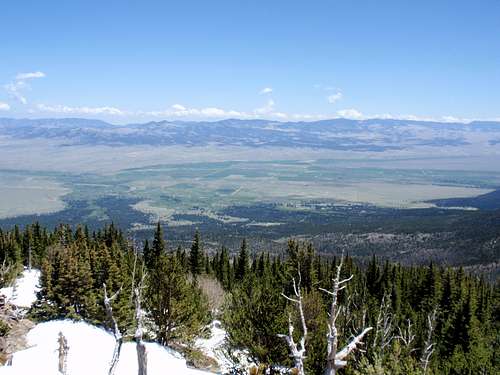 Southern Wet Mountain Valley
Getting There
From the town of Westcliffe: Travel 3.4 miles south on Hwy 69 from Hwy 96 to Schoolfield Rd (aka Rosita Rd/County Rd 328). Turn right, heading west and follow the signs to the Horn Creek Trailhead. The trailhead parking area is about 10 to 11 miles south of Westcliffe. All, but the last half mile are paved. The last section of dirt road is passable by any vehicle. The dirt road is not plowed in the winter.Available Routes
Access to the climb is from the Horn Creek trailhead or the Horn Creek spur trail approximately 2/10 of a mile before the Horn Creek Trailhead parking area. Both are signed. The Spur trail will take you to the Rainbow trail and direct you to the Dry Lakes trail and drainage. The Horn Creek trail would be your choice for the east ridge or the Horn Lakes Drainage.There are no established trails to the top of Little Horn. Access to the peak depends on snow conditions and is available from at least four different approaches. These include the Horn Lakes drainage. This route comes in from the southwest side of the peak near the saddle that lies between Little Horn Peak and Fluted Peak. This route is rated a class 2 rock scramble. Take the Horn Creek trail to the most northerly lake. There is supposed to be a trace trail, but it can be difficult to locate. A topo map and gps might come in handy locating the lake. Access to the saddle is found here.
Another route option is from the Dry Lakes drainage. A more difficult access is available from the northwest side of Little Horn Peak. There is also a more simpler route from the drainage that hits the east ridge route from just above tree line. The other two options available are: if already climbing Fluted Peak from another direction. Follow the ridgeline east to Little Horn Peak or from Little Horns east ridge. The east ridge is probably the most popular. This is the route I took.
The East Ridge Route is accessed from the Horn Creek trail. Travel approximately 1/3 of a mile past the registration booth near the trailhead. At approximately 9700ft elevation, you will come across a clearing. At that point you will turn right (north) and basically, follow a gully to the ridgeline. Due to the density of the woods, You will have to bob and weave quite frequently until the treeline ends. The trees end around 11,700ft. Once you’ve left the trees, continue following the ridge gaining elevation. The ridge is narrow enough to easily follow it out of the trees. Basically, just keep climbing and you will eventually see the peak.
If you are an adventurer and the conditions are right, you can summit both Little Horn Peak and Fluted Peak in the same day. If you’re an animal, you can continue around the "horn" to Horn Peak as well.
Views along the east ridge route
 Ridgeline
 False Summit
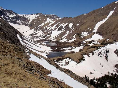 View of Dry Lakes
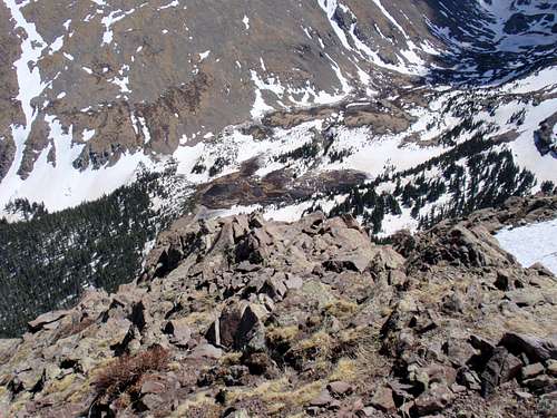 View of Horn Lakes
 View of Ridge from false summit to true summit
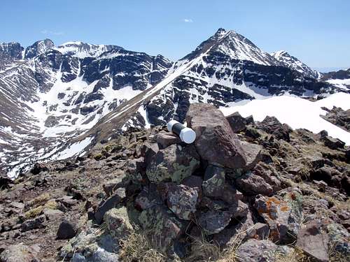 The peak register
Red Tape
There is currently no red tape. Permits for hiking or camping are not required.Camping, Food And Lodging
Depending on your route of choice, there are places to camp with running water in both, the Horn Creek and Dry Lakes drainages. Most years, snow remains in the treed sections of the higher elevations til mid june.If you’re looking for a more modern campground with amenities, the Alvarado Campground is located a few miles north, near the Comanche/Venable Lakes trailhead. For availability, visit:
Alvarado Campground
Local food and lodging is also available in the nearby towns of Westcliffe and Silver Cliff. For a list of lodgings visit:
Motels and Lodging
External Links And Helpful Information
Click For a digital map of all Peaks in the Southern Wet Mtn. Valley
Click For a digital map of all Peaks in the Northern Wet Mtn. Valley
For additional information pertaining to the local forest and current conditions, contact:
San Carlos Ranger District
or the local work center office of the Forest Service.
USDA (Unites States Deptartment of Agriculture/Forest Service)
Westcliffe Work Center
5 Hermit Ln
Westcliffe, CO. 81252
Phone 719 783 2079 or 719 269 8500
Click for current weather conditions
A Taste of our Local Culture
My "Slightly" Embellished Trip Reports And Photo Slideshow
My first trip reportMy second trip report
Little Horn Peak-5-31-08