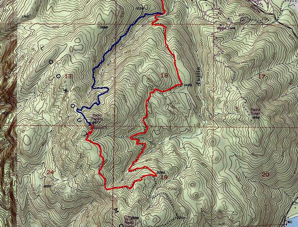
The red route is the preferred route here even though it may look a bit longer in terms of distance.
Note that the South summit of LO Mtn is shown at the very bottom edge of this map. The topo states it is 2676 feet so only 1 foot less than the North summit. For sticklers for detail who want to bag this as well, you can see a road junction where you would want to branch off from the approach to the North summit. It would certainly be sensible to do both at the same time given the possible common approach if you were interested in the South summit. In fact my intended route was to take the red route then take off to the South summit, head back North to the saddle between the two then up to the North summit, and finally down the blue route on the descent. Unfortunately a late start and the short daylight of winter led to darkness so I stuck to just the North summit and the safer (if dark) option of the road route.
The blue route looks good on paper. But Lord Klenke described the terrain as "full of big ferns, man-eating ferns." Also, as Redwic reports below the road seems to be abandoned and overgrown and thus not worth the hassle. Take the red-line route. Bike it if you like as it is a good road at a modest angle.


Comments
Post a Comment