Toggle navigation
Mountains
Routes
Images
Trip Reports
Forum
What's New
People
Areas & Ranges
Articles
Trailheads
Canyons
Huts & Campgrounds
Albums
Logistical Centers
Fact Sheets
Lists
Custom Objects
Gear
Plans & Partners
WELCOME TO SUMMITPOST
SIGN IN
REGISTER
Pyrénées: Nestes & Luchonnais
Additional Parents
Image
Luchon
View High-Resolution Image
Luchon
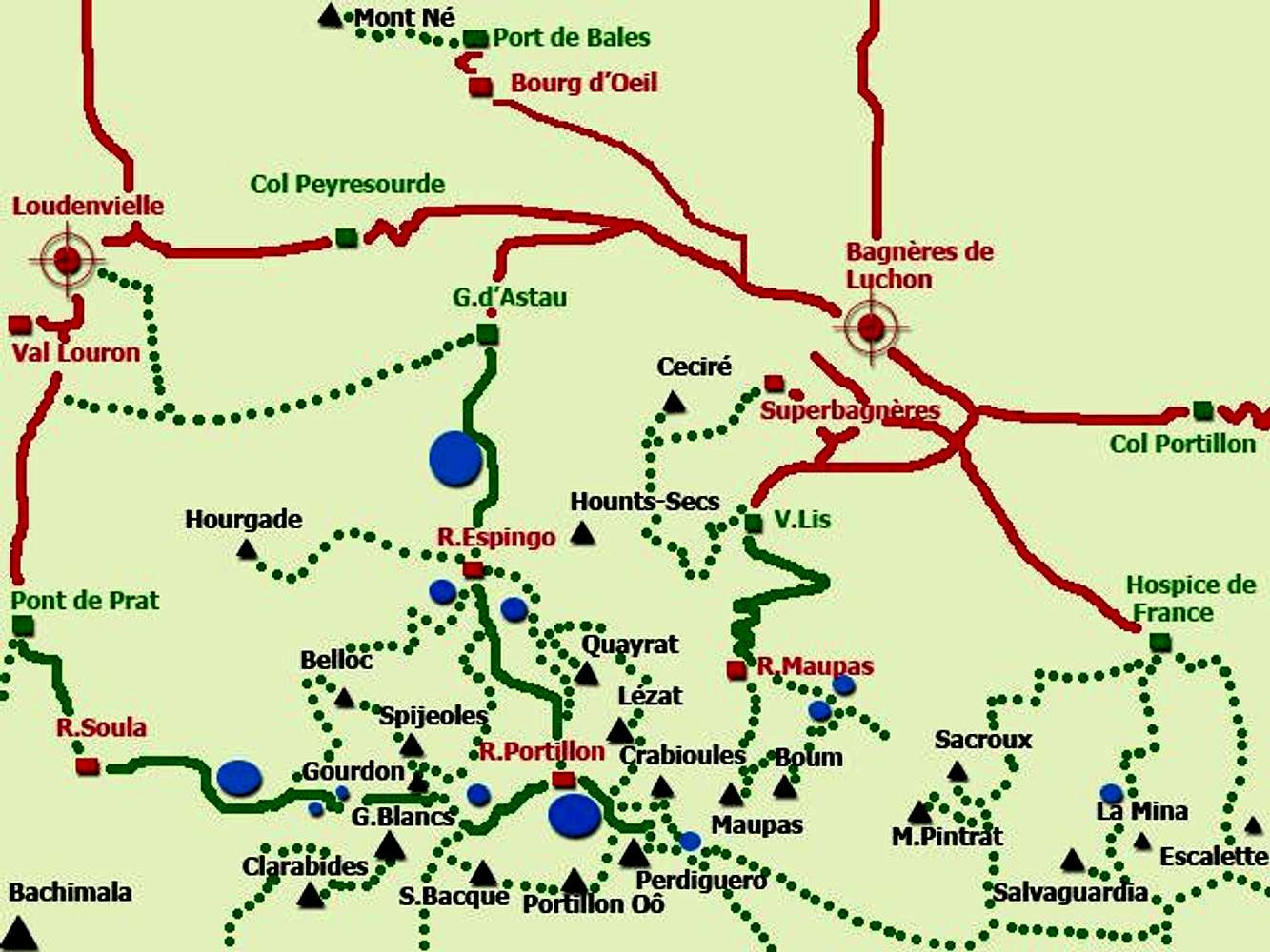
sketh of the main summits of area of Luchon. The green lines solids are the routes to connect the refuges and the line of points are the normal paths and routes to this peaks. The trailheads are the green square.
« PREV
NEXT »
Rafa Bartolome
on
Sep 7, 2007 4:05 am
Comments & voting
Other parents
Lat/Lon:
42.69200°N / 0.51880°E
Image Type(s):
Topo/Diagram
,
Informational
Image ID:
334062
4261 Hits
71.06
% Score
1
Votes
Log in to vote
Comments
No comments posted yet.
to post!
Don't have an account?
Pyrénées: Nestes & Luchonnais
(Area/Range)
« PREV
Viewing
#29 of 45
GALLERY
NEXT »
Rafa Bartolome's Image Gallery
« PREV
Viewing
#4188 of 6100
GALLERY
NEXT »
×
You need to login in order to vote!
User Name
Password
Remember me
Forgot your password?
Log me out when I close my browser.
Keep me logged in all the time.
sign in as a user
Don't have an account?
Register now for FREE
Rating available
Suggested routes for you
People who climb the same things as you
Comments Available
Create Albums
Register Here


