
|
|
Mountain/Rock |
|---|---|
|
|
33.34000°N / 110.8705°W |
|
|
Gila |
|
|
Spring, Fall, Winter |
|
|
6647 ft / 2026 m |
|
|
Overview
Madera Peak is located just south of the copper mining town of Miami, Arizona, and is the northernmost summit in the Pinal Mountains.
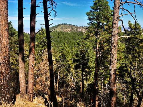
Madera Peak rises more than 3,000’ above the towns of Miami and Globe, but is overshadowed by Pinal Peak and Signal Peak, which rise more than 4,000’ above the same communities.
Those mountains are far more popular than Madera Peak, which gets quite a bit fewer visitors. However, the mountain is easily accessible, with a 2WD access road less than 3 miles from the summit just 90 minutes’ drive from downtown Phoenix.
The hike is all on road, but the road is very steep in some sections. This makes for some challenging terrain and some caution is recommended.
Madera Peak is ideally hiked between March and May; October and November; although it can be hiked all year. Snow may be present during winter months, which can easily be overcome. Summers may bring overwhelming heat; but it might be tolerable if starting a hike early in the morning given the short distance to the summit.
Getting There
To reach Madera Peak, take US-60 East from Phoenix past the eastern valley suburbs. Miami is approximately 45 miles east of Apache Junction. Continue past the town of Superior through a gorgeous rocky canyon. Eventually you will enter the town of Miami on US 60. You need to exit and drive through small neighborhoods to reach Cherry Flats Road, and it can be a little confusing.
The best way is to take a right off US-60 onto Latham Blvd, which turns into Altarest in less than a quarter mile. Once on Altarest take the first right up Milton Avenue which winds up the hillside and reaches Cherry Flat Road after a little over a quarter mile.
Once at the junction with Cherry Flat Road, take a left and continue for ¾ of a mile. Then continue to the right for 2 ¾ miles. There is a Y-junction with the well-graded Cherry Flats Road continuing to the right, and a rough road going steeply on the left. The rough road is the summit road. Park at the base of this road. There is space for several cars. The elevation here is about 4,525’.
Route
Hiking up Madera Peak is pretty straight-forward. After about two miles, over 1,700’ will be gained, and the road reaches the top of a hill. The road then drops about 75’ and then goes up again 80’ to another hilltop. Then, the road drops again over 90’. Then the tough part begins. The road climbs nearly 500’ in just over a third of a mile. During this stretch, you will pass the summit tower; which isn’t really on the summit. Once the road tops out, there is a side road leading to the true summit. That road is only a tenth of a mile. The summit has a register; but not much in the way of views. The total one-way distance is 2.75 miles; gaining just under 2,300’.
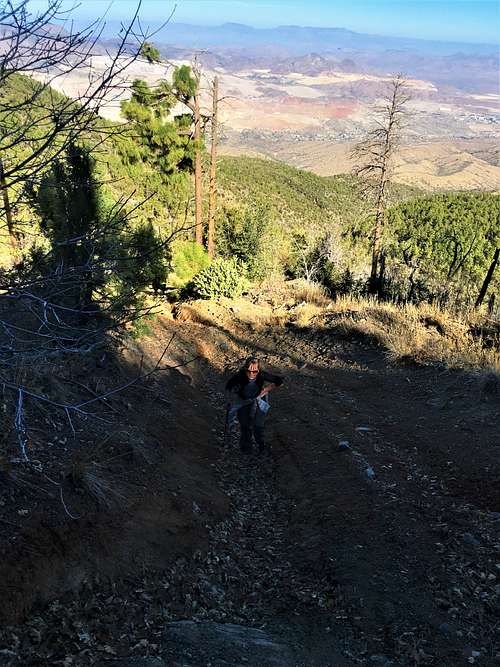
If wanting great views, continue back to the main road and take a left and continue south towards nearby summits, like Peak 6517 or Peak 6670. Either are excellent options for additional summits to reach, because there are excellent views on the way, and because Madera Peak itself is only a 5.5-mile round trip hike, which leaves time to venture over to other summits.
Red Tape
Madera Peak is in the Tonto National Forest. See the Tonto National Forest page to see if there are any road closures: https://www.fs.usda.gov/alerts/tonto/alerts-notices
External Links
Scott Surgent Trip Report: http://www.surgent.net/highpoints/az/range/madera.html