
-
 1049 Hits
-
 81.74% Score
-
 14 Votes
|
|
Mountain/Rock |
|---|---|
|
|
48.09923°N / 90.8018°W |
|
|
Cook |
|
|
1830 ft / 558 m |
|
|
Overview
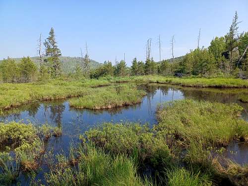
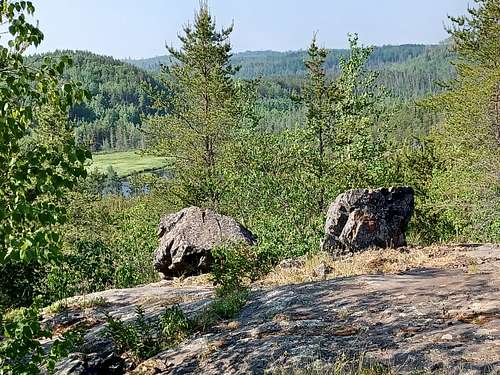
The vast, lake strewn wilderness between Minnesota and Ontario has many low ridges but views are hard to come by in the thick forest and brush. So the thought of hiking up an average ridge in this part of the world does not seem to promise more than an ordinary ‘tunnel of trees’ experience. Surprisingly, views are to be had on many parts of the mild climb up to Magnetic Rock, and the monolith at the end of the climb makes up for the viewless ‘summit’.
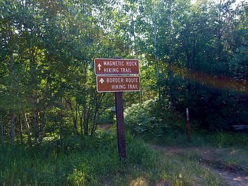
Getting There
The remote trailhead for Magnetic Rock is also the western terminus of the 65 mile Border Route. This long-distance hiking trail requires navigation skills and a lot of tolerance for trees, brush and insects. The small, well-marked trailhead can be found 45 miles northwest up the paved Route 12 (aka the Gunflint Trail) from Grand Marais MN. Route 12 soon ends a few miles past the trailhead, and there is no access from Canada
Route
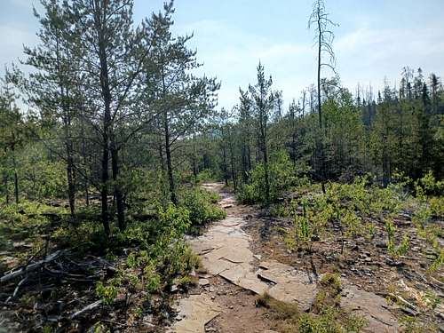
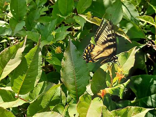
As you plunge into the brushy start of the trail you quickly start seeing more of the surrounding ridges than is usual in upper Minnesota. Unfortunately, the views are due to a couple of cataclysmic natural events. In 1999 a freak derecho type storm fell millions of trees in the area. This was followed in 2007 by the huge Ham Lake fire that burnt through large swaths of forest and left few survivors. You will see the charred remains of dead trees sticking up above the recovering forest as you climb.
Because of the enhanced views (I hiked this in June 2023), the 1.5 mile hike had a light airy feel, with plenty to see. A lot of the trail is on solid rock, you are literally walking on exposed Canadian Shield.
But the star of this little hike is the large rock monolith in a small wooded clearing to the left of the trail. A small sign makes sure you do not miss it and continue down the ridge on the Border Route. Magnetic Rock has a black color and starkness that makes one think of extra-terrestrial origins, ‘2001 A Space Odyssey’ style. However, the rock is a terrestrial relic of the ice age, apparently a large piece of magnetite pushed up on its end. I estimate 30 feet high.
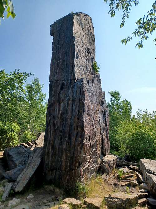
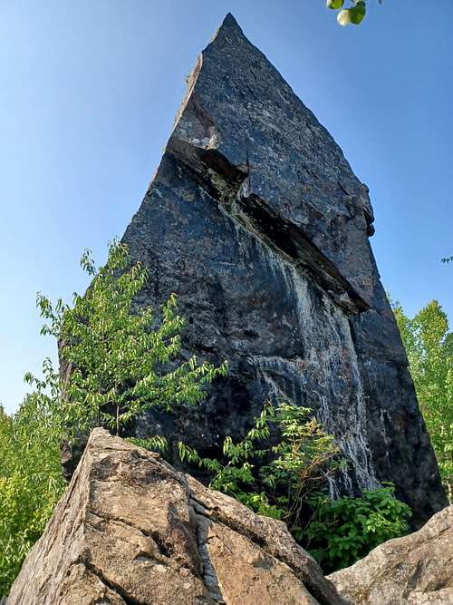
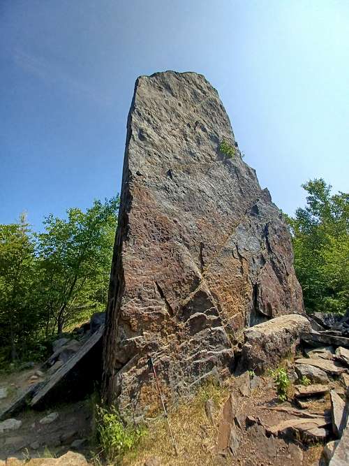
I have heard from many sources that the rock is magnetic, but I did not see any big compass fluctuations personally.
It is possible to rock climb Magnetic Rock, from what I found on the Internet Mountain Project Link. I am not a technical climber, so I cannot comment at all.
Return the way you came, unless you have some sort of shuttle set up further down the Border Route. I have not hiked this piece, but have enough experience with other parts of the arduous and psychologically taxing Border Route to warn you that the trail can sometimes be hard to discern, and confusing. Navigation is not always easy, trail or not. And bugs and brush should be expected.
Red Tape
None - part of Sperior National Forest, Gunflint District
When to Climb
I hiked in mid-summer. Of course, if you wait until winter, there will be no bugs and much less brush. I would love to snowshoe this someday. Anyone with experience on this trail in winter please drop me a line.
Camping
Campsites exist on the Border Route trail. See below.
External Links
Please get a good map of the area, do not rely on this write-up. Voyageur Maps is a good one (map 9). Though a canoers map, it shows the trail system well, and shows designated campsites.
Border Route Trail: Border Route Their trail guide (Marcia Scott and Chuck Hoffman) is excellent.
Great book on area hikes: Hiking the North Shore by Andrew Slade North Shore Hiking