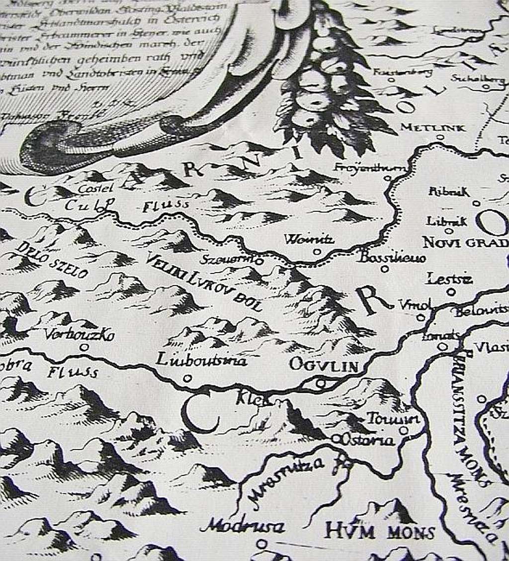
Map detail from the book
...
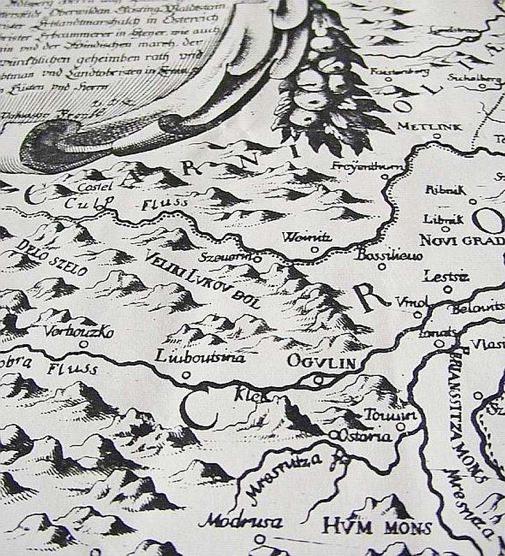
Map detail from the book
"Die Ehre des Herzogtums Crain"
(Glory of the Duchy of Carniola)
by Johann Weichard Valvasor, published in 1689.
Klek is shown SW of town Ogulin.
Measure unit for the map was Croatian mile
(miliaria Croatica), which roughly equals 13000 metres. Measured by todays standards, mapscale is 1:750000


