Toggle navigation
Mountains
Routes
Images
Trip Reports
Forum
What's New
People
Areas & Ranges
Articles
Trailheads
Canyons
Huts & Campgrounds
Albums
Logistical Centers
Fact Sheets
Lists
Custom Objects
Gear
Plans & Partners
WELCOME TO SUMMITPOST
SIGN IN
REGISTER
map for the trail towards the...
map for the trail towards the...
View High-Resolution Image
map for the trail towards the...
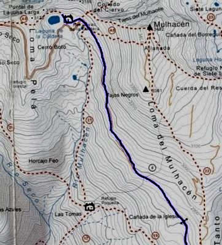
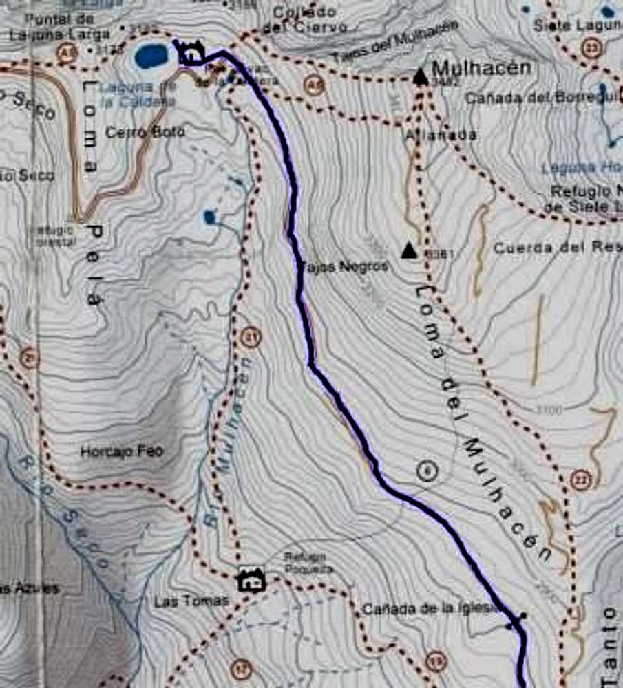
map for the trail towards the Laguna de la Caldera, with the optional normal route to Mulhacen. part of the Map of the Sierra Nevada National Park, 1:50.000 (available at the tourist information)
« PREV
NEXT »
maulwurf
on
Feb 20, 2002 8:43 am
Comments & voting
Other parents
Lat/Lon:
37.05000°N / 3.3167°W
Image ID:
5160
4201 Hits
0
% Score
0
Votes
Log in to vote
Comments
No comments posted yet.
to post!
Don't have an account?
maulwurf's Image Gallery
« PREV
Viewing
#16 of 21
GALLERY
NEXT »
×
You need to login in order to vote!
User Name
Password
Remember me
Forgot your password?
Log me out when I close my browser.
Keep me logged in all the time.
sign in as a user
Don't have an account?
Register now for FREE
Rating available
Suggested routes for you
People who climb the same things as you
Comments Available
Create Albums
Register Here

