Toggle navigation
Mountains
Routes
Images
Trip Reports
Forum
What's New
People
Areas & Ranges
Articles
Trailheads
Canyons
Huts & Campgrounds
Albums
Logistical Centers
Fact Sheets
Lists
Custom Objects
Gear
Plans & Partners
WELCOME TO SUMMITPOST
SIGN IN
REGISTER
Map Hochflachkofel / Cima di Pianalto
View High-Resolution Image
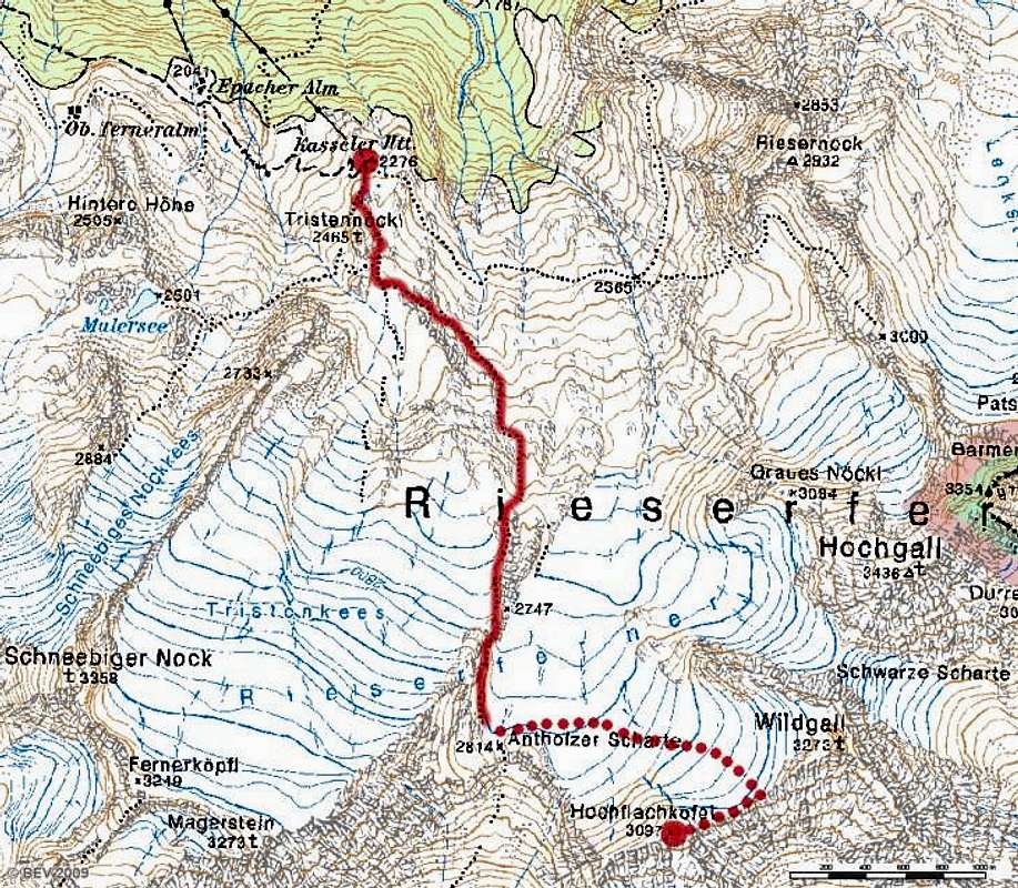
Map Hochflachkofel / Cima di Pianalto
Digital map of Hochflachkofel / Cima di Pianalto. Selfdrawn red line, wich is the normal route. Source of the digital map:
www.austrianmap.at
.
« PREV
NEXT »
Jurgen
on
Apr 16, 2009 6:11 am
Comments & voting
Other parents
Lat/Lon:
46.89915°N / 12.12410°E
Image ID:
506441
2555 Hits
71.06
% Score
1
Votes
Log in to vote
Comments
No comments posted yet.
to post!
Don't have an account?
Hochflachkofel / Cima di Pianalto
(Mountain/Rock)
You are at
the First
Image
Viewing
#1 of 1
GALLERY
You are at
the Last
Image
Jurgen's Image Gallery
« PREV
Viewing
#681 of 689
GALLERY
NEXT »
Hochflachkofel / Cima di Pianalto
(Mountain/Rock)
Loading....
×
You need to login in order to vote!
User Name
Password
Remember me
Forgot your password?
Log me out when I close my browser.
Keep me logged in all the time.
sign in as a user
Don't have an account?
Register now for FREE
Rating available
Suggested routes for you
People who climb the same things as you
Comments Available
Create Albums
Register Here


