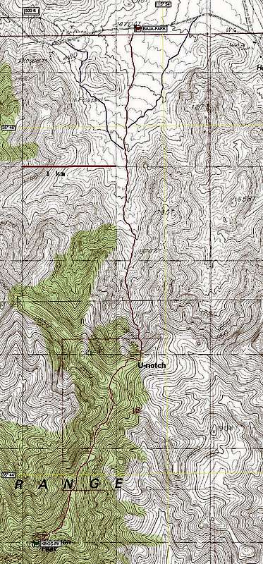
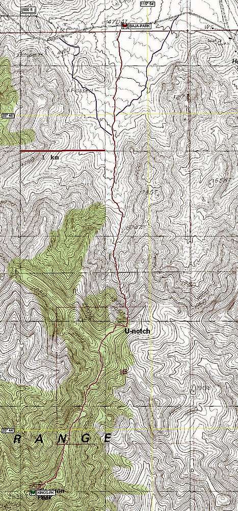
The red line is a GPS trace for our route south through the bahada. The purple lines on either side denote crude roads, which allow you to avoid brush for about 0.9 miles. Unfortunately, the brush in this first section is fairly mild anyway; the thick brush starts after the roads end.


