Welcome to SP!  -   
 
 New features are here! - Read More... 
Areas & Ranges·Mountains & Rocks·Routes·Images·Articles·Trip Reports·Gear·Other·People·Plans & Partners·What's New·Forum

Map of Damavand & Dokhaharan Massif

 
[ Sizes: Orig | Large | Med | Small | Thumb ]
Map of Damavand & Dokhaharan Massif
Click on above image to see large map.

The cone of Mt. Damavand and the 4000 m peaks of the Dokhaharan Massif.
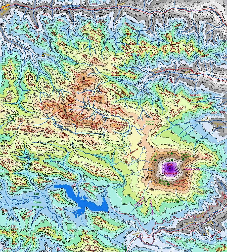
This map has been created by me based on the 1:50 000 maps. It is to scale and covers an area 36 Km (E-W) by 42.5 Km (S-N)(between 51:48:30 to 52:12:30 East & 35:49:30 to 36:12:30 North).
The green icons show the location of the shelters on Mt. Damavand (these shelters do not appear on the original 1:50 000 map and their location on the above map is only approximate).


Comments

No comments posted yet.


Sign in to post!

Don't have an account? Register now.


Rate This Image
Current Score: 85.87

Log In To Vote
 Central Alborz Mountains (Area/Range)

Map of Dizin/Kandovan Pass...
« PREV

Viewing
#20 of 28
GALLERY
Map of Shah Alborz (Taleghan)...
NEXT »

 nader's Image Gallery

Tunnel Gulch
« PREV

Viewing
#4164 of 4649
GALLERY
Veravasht
NEXT »


 Damavand (Mountain/Rock)


 Dokhaharan (Mountain/Rock)


 Volcanic Seven Summits (List)


Image Data

naderSubmitted by nader
on Nov 11, 2007 3:01 pm

Image ID: 355695
Hits: 4971 

Lat/Lon: 36.00000°N / 51.50000°E

Image Type(s): Alpine Climbing


"Smokey, this is not 'Nam. This is bowling. There are rules."   --Walter Sobchack   

© 2006-2012 SummitPost.org. All Rights Reserved.