Toggle navigation
Mountains
Routes
Images
Trip Reports
Forum
What's New
People
Areas & Ranges
Articles
Trailheads
Canyons
Huts & Campgrounds
Albums
Logistical Centers
Fact Sheets
Lists
Custom Objects
Gear
Plans & Partners
WELCOME TO SUMMITPOST
SIGN IN
REGISTER
Vorderer Tajakopf
Additional Parents
Image
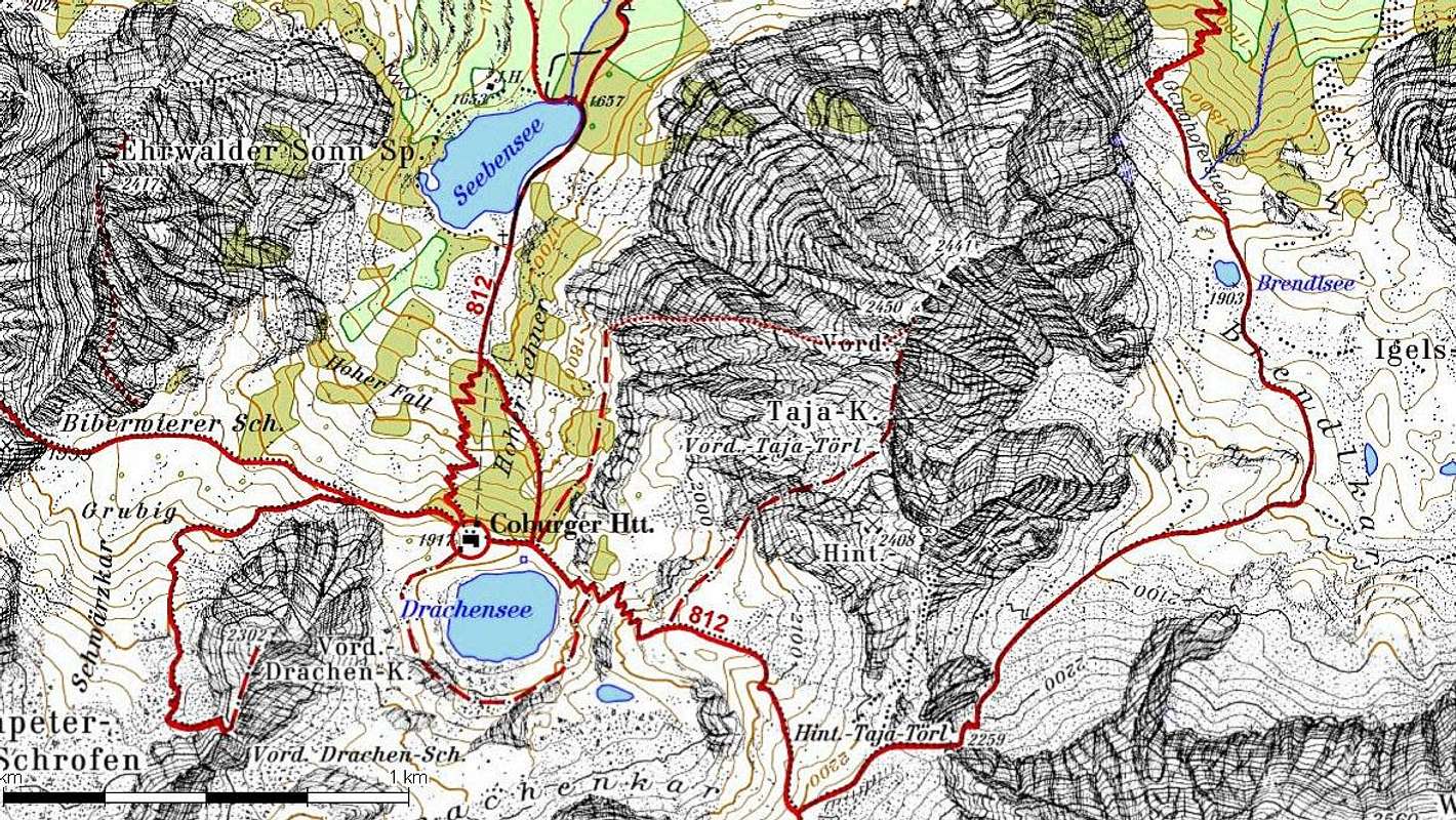
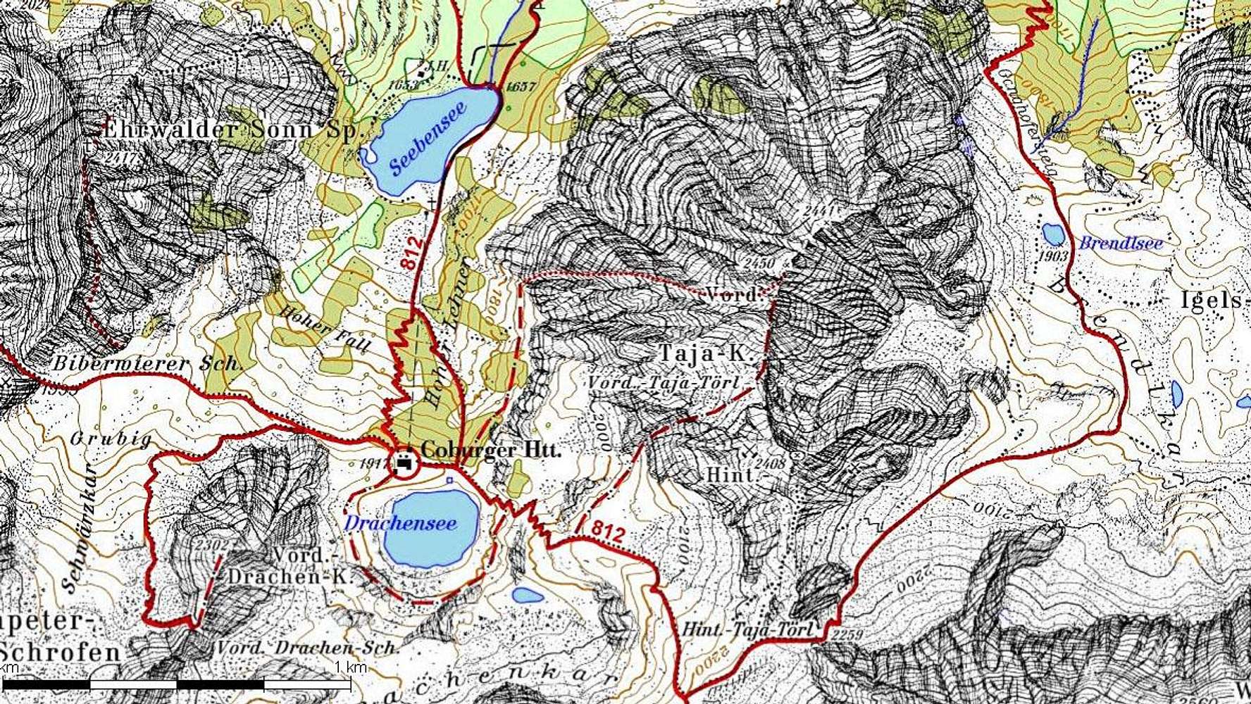
Map of the Tajaköpfe
View High-Resolution Image
Map of the Tajaköpfe
A section of the DAV map for the Seebensee and Tajakopf, showing the trail network. The dotted line leading west to the summit is the Tajakopf via ferrata.
« PREV
NEXT »
mvs
on
Nov 13, 2006 10:32 pm
Comments & voting
Other parents
Lat/Lon:
47.36490°N / 10.94480°E
Image ID:
243766
2967 Hits
0
% Score
0
Votes
Log in to vote
Comments
No comments posted yet.
to post!
Don't have an account?
Vorderer Tajakopf
(Mountain/Rock)
« PREV
Viewing
#27 of 27
GALLERY
You are at
the Last
Image
mvs's Image Gallery
« PREV
Viewing
#1111 of 1138
GALLERY
NEXT »
×
You need to login in order to vote!
User Name
Password
Remember me
Forgot your password?
Log me out when I close my browser.
Keep me logged in all the time.
sign in as a user
Don't have an account?
Register now for FREE
Rating available
Suggested routes for you
People who climb the same things as you
Comments Available
Create Albums
Register Here


