Toggle navigation
Mountains
Routes
Images
Trip Reports
Forum
What's New
People
Areas & Ranges
Articles
Trailheads
Canyons
Huts & Campgrounds
Albums
Logistical Centers
Fact Sheets
Lists
Custom Objects
Gear
Plans & Partners
WELCOME TO SUMMITPOST
SIGN IN
REGISTER
Chokecherry Mountain (NV)
Additional Parents
Image
Map one
View High-Resolution Image
Map one
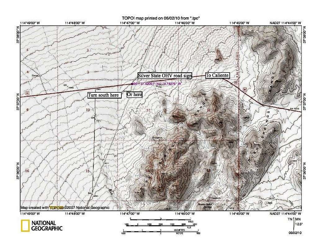
If coming from Caliente, it is about 16-17 miles to this turnoff (not exact). Look for "Delamar 15" sign (left road If coming from Las Vegas. The best road doesn't have a gate that you have to go through.
« PREV
NEXT »
Dean
on
Jun 3, 2010 11:36 am
Comments & voting
Other parents
Image ID:
626356
1753 Hits
75.81
% Score
6
Votes
Log in to vote
Comments
No comments posted yet.
to post!
Don't have an account?
Chokecherry Mountain (NV)
(Mountain/Rock)
« PREV
Viewing
#20 of 26
GALLERY
NEXT »
Dean's Image Gallery
« PREV
Viewing
#4133 of 7927
GALLERY
NEXT »
×
You need to login in order to vote!
User Name
Password
Remember me
Forgot your password?
Log me out when I close my browser.
Keep me logged in all the time.
sign in as a user
Don't have an account?
Register now for FREE
Rating available
Suggested routes for you
People who climb the same things as you
Comments Available
Create Albums
Register Here


