Toggle navigation
Mountains
Routes
Images
Trip Reports
Forum
What's New
People
Areas & Ranges
Articles
Trailheads
Canyons
Huts & Campgrounds
Albums
Logistical Centers
Fact Sheets
Lists
Custom Objects
Gear
Plans & Partners
WELCOME TO SUMMITPOST
SIGN IN
REGISTER
Red Cone
Additional Parents
Image
map
View High-Resolution Image
map
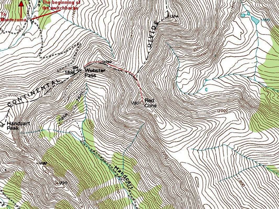
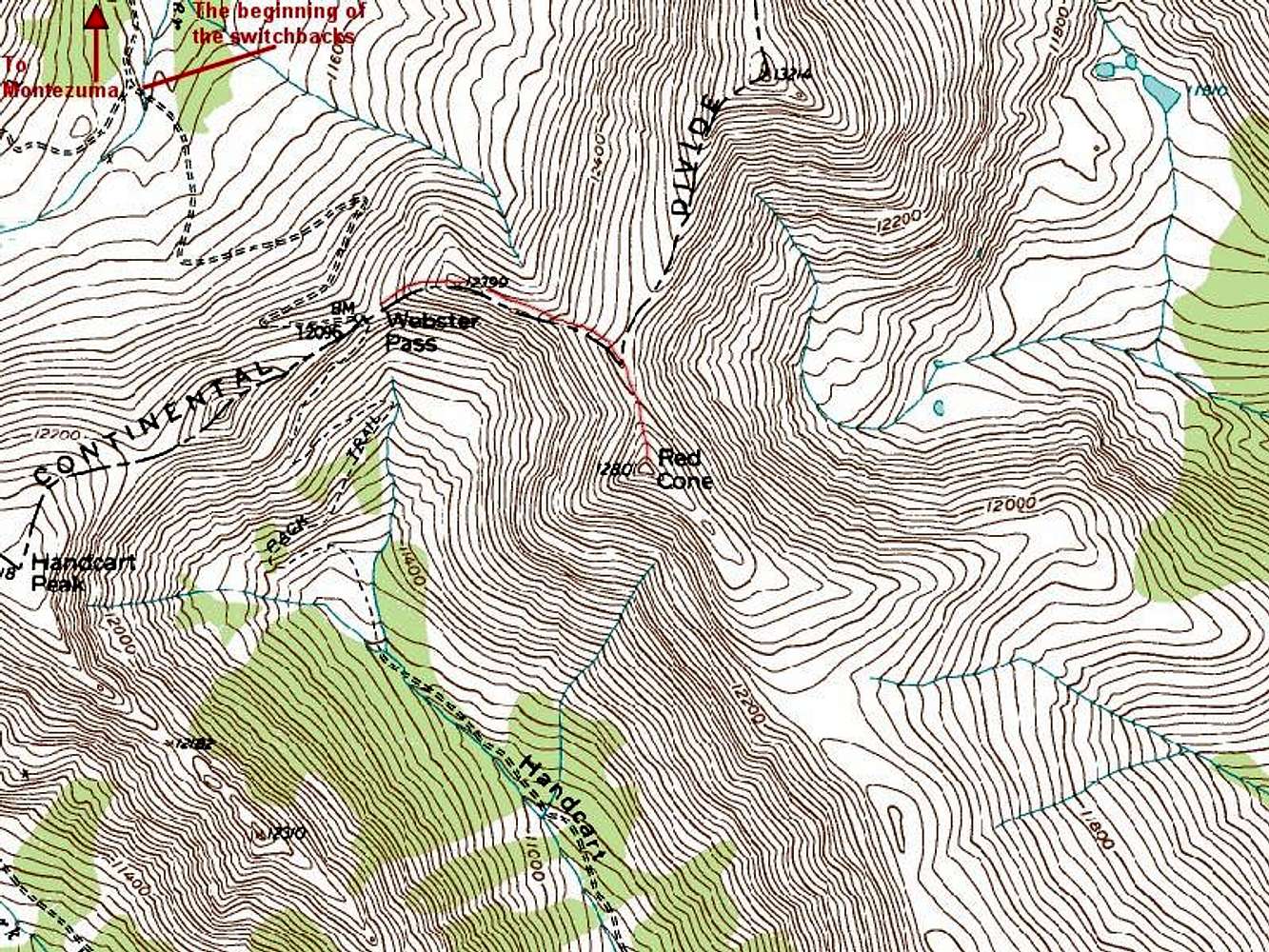
The red line has been added by me and shows the position of the road north of the summit of the Red Cone (the road of course continues south of the Red Cone too). You can park at the beginning of the switchbacks and hike the rest of the way.
« PREV
NEXT »
nader
on
Sep 10, 2006 5:01 pm
Comments & voting
Other parents
Lat/Lon:
39.52660°N / 105.8225°W
Image Type(s):
Alpine Climbing
Image ID:
224603
3832 Hits
72.08
% Score
2
Votes
Log in to vote
Comments
No comments posted yet.
to post!
Don't have an account?
Red Cone
(Mountain/Rock)
« PREV
Viewing
#10 of 13
GALLERY
NEXT »
nader's Image Gallery
« PREV
Viewing
#13135 of 15249
GALLERY
NEXT »
Montezuma to Webster Pass
(Route)
Loading....
×
You need to login in order to vote!
User Name
Password
Remember me
Forgot your password?
Log me out when I close my browser.
Keep me logged in all the time.
sign in as a user
Don't have an account?
Register now for FREE
Rating available
Suggested routes for you
People who climb the same things as you
Comments Available
Create Albums
Register Here


