Toggle navigation
Mountains
Routes
Images
Trip Reports
Forum
What's New
People
Areas & Ranges
Articles
Trailheads
Canyons
Huts & Campgrounds
Albums
Logistical Centers
Fact Sheets
Lists
Custom Objects
Gear
Plans & Partners
WELCOME TO SUMMITPOST
SIGN IN
REGISTER
Peak 13253 ft (Harrison Flat)
Additional Parents
Image
Map
View High-Resolution Image
Map
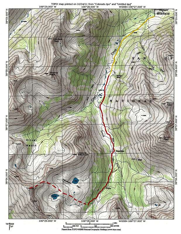
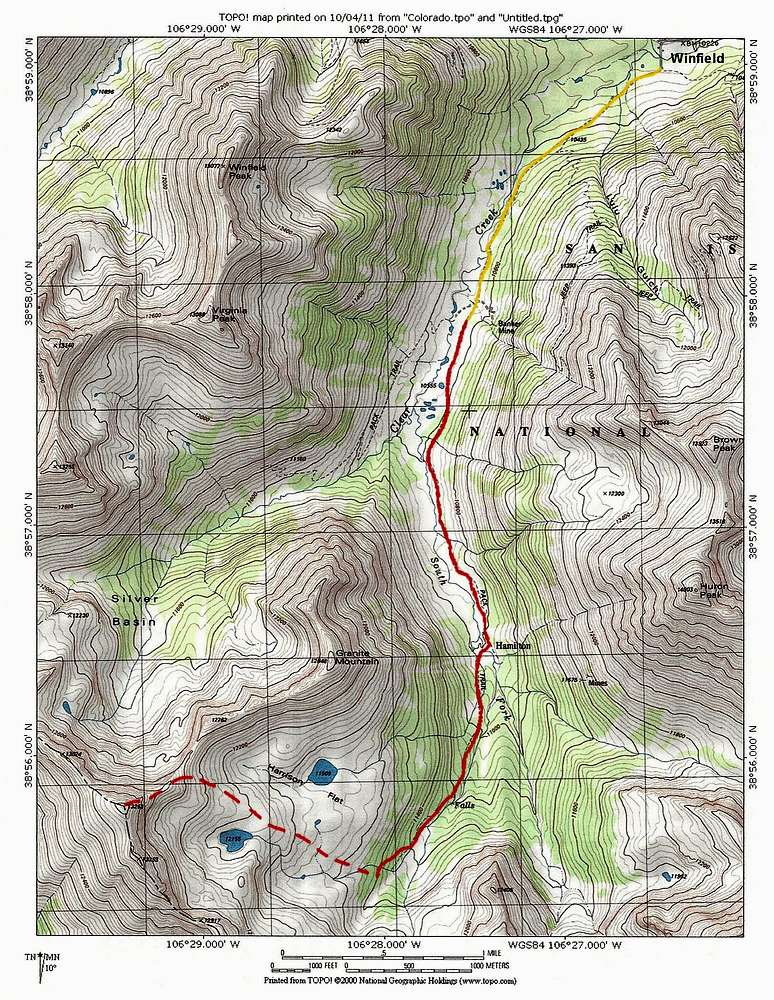
Yellow line shows the 4WD road from the ghost town of Winfield to the Huron Peak/Lake Ann Trailhead Solid red line is a portion of the trail to Lake Ann. Dashed red line is the path I took after leaving trail
« PREV
NEXT »
nader
on
Oct 8, 2011 10:38 pm
Comments & voting
Other parents
Image Type(s):
Alpine Climbing
Image ID:
752300
2282 Hits
74.01
% Score
4
Votes
Log in to vote
Comments
No comments posted yet.
to post!
Don't have an account?
Peak 13253 ft (Harrison Flat)
(Mountain/Rock)
« PREV
Viewing
#24 of 24
GALLERY
You are at
the Last
Image
nader's Image Gallery
« PREV
Viewing
#8330 of 15219
GALLERY
NEXT »
From Harrison Flat
(Route)
Loading....
×
You need to login in order to vote!
User Name
Password
Remember me
Forgot your password?
Log me out when I close my browser.
Keep me logged in all the time.
sign in as a user
Don't have an account?
Register now for FREE
Rating available
Suggested routes for you
People who climb the same things as you
Comments Available
Create Albums
Register Here


