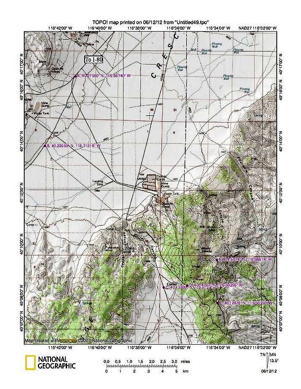
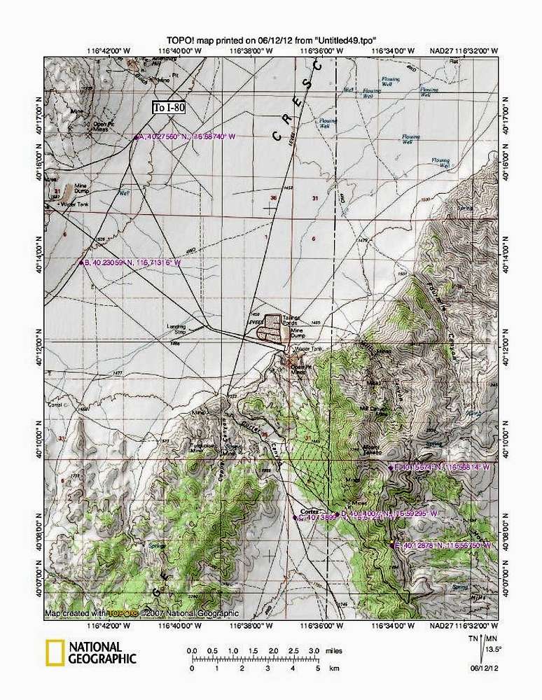
From Crescent Valley, it is about 12 miles to a turnoff at waypoint A 40.2756 116.6874. Then at the next fork, go right past the conveyor and proceed to a 4 way stop. Go through the 4 way (you can't legally go left or right anyway) to waypoint B 40.2306 116.7132 and turn left and head toward Cortez Canyon. Once through Cortez Canyon, the county road continues to the right at a junction where a road to the left leads to a security checkpoint. Here you need to find your way to the old ruins of Cortez itself. Nothing is signed so check out Ken Jones GPS track and map found
HERE. Finding the road past the cemetary is the key as the road will continue on to hook into an old haul road which is no longer private (as marked on my topo) but open to the public. We turned right (left is private) and proceeded up the haul road, and made our way around the point of the mountain to the next key waypoint E (40.1288 116.5675 elev 7666)_where a rougher road leaves the haul road and heads up the mountain. You could park at this point and walk from there. (about 4 1/2 miles with 1600 feet elevation gain)


