|
|
Mountain/Rock |
|---|---|
|
|
60.11175°N / 149.51476°W |
|
|
Download GPX » View Route on Map |
|
|
Mountaineering, Skiing |
|
|
Spring, Summer, Fall |
|
|
4826 ft / 1471 m |
|
|
Overview
Marathon Mountain is often overlooked by the famous Race Point of the legendary Fourth of July foot race. The true summit sits over 1,500 feet higher and offers a more rugged mountaineering experiance, complete with scrambeling, knife ridge walking and a short glacier crossing. While the race course and Jeep trail may be packed with people, even on weekends it would be rare to find another person on the upper summit slopes.

Getting There
After arriving in Seward the trailhead for the standard route is within walking distance of most of downtown, which is good because the street parking can be limited. The trail head starts at the intersection of 1st and Monroe streets behind a large yellow gate marking the start of the Jeep Trail(sometimes referred to as the "hikers trail"). If there is no parking you can easily park at the two lakes park behind AVTEC, a short distance away.

Route
There are numerous ways up to the summit, but the standard and most reliable summer route is via the Jeep trail and Marathon Bowl. The Jeep trail is a wide steep road that is used to assist in rescues as needed and stops at a water reservoir after around 900 feet of elevation gain. From here the steepness kicks back as you stoll along a gentle path along a pleseant bench before another short section of steep trail leading you to the Marathon Bowl. There is a peaceful creek running through the bowl, this is the last place to get reliable water and also a great flat spot to camp at if desired. From here there are many options to gain the Northwest ridge, but the easiest and least scree bashing way is to aim for a system of grassy ramps that zig zag cliff bands on the lower portion of the ridge after the first rocky section.

Once on the ridge the hiking is enjoyable class 2-3 scrambling with one section of 4th class if you stay true to the ridge right at the top of the "Y" shaped coulior. You can avoid the 4th class section by decending Southwest into the top of the "Y" coulior and side hilling below the ridge crest and steeper cliffs.

From here you will shortly run into a split in half boulder, this will be where you will want to decend to the west and gain the prominent scree gully.

After this point there will be a few more fun moves with exposure before the ridge widens and turns to grassy patches again before a false summit.

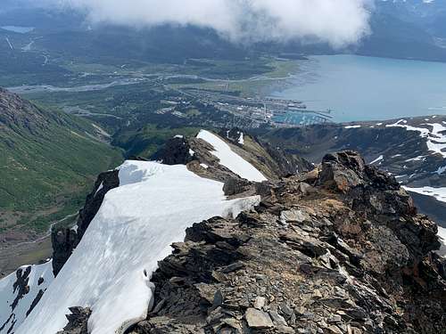
After the first false summit you will be able to see the final two summits, the furthest summit is the true high point. The rock on the second summit is actully enjoyable to scramble on but it is short lived, as you will undoubtedly run into the last obstacle the glacier saddle seperating you from the third summit. This section can be either easy soft summer snow or bullet hard glacier ice. It most definitely requires at least a light ice axe and katoolas when in the early season, later season it would be smart to bring full crampons and a more substancial ice axe. After the ice saddle it is a easy hike to the summit, on a blue bird day you will have views of the harding icefield and the gulf of Alaska as rewards!

To decend reverse the route and remeber to split off imediately after the split boulder to gain easy access to the prominent scree gully, which will rapidly increase your descent time and save your knees! This will deposit you right into the bowl.

Red Tape
No access issues, besides limited parking.
When to Climb
June-October. By early July the route will be mostly snow free and the saddle crossing will be easy, while still allowing for snow to be in the scree gully, further easing the decent. By mid September the saddle will be exposed glacier ice.
Camping
In and around Seward there are numerous campgrounds. On route, camping is excellent in the Marathon Bowl!
