Toggle navigation
Mountains
Routes
Images
Trip Reports
Forum
What's New
People
Areas & Ranges
Articles
Trailheads
Canyons
Huts & Campgrounds
Albums
Logistical Centers
Fact Sheets
Lists
Custom Objects
Gear
Plans & Partners
WELCOME TO SUMMITPOST
SIGN IN
REGISTER
"Marble Peak"
Additional Parents
Northeast Ridge
Image
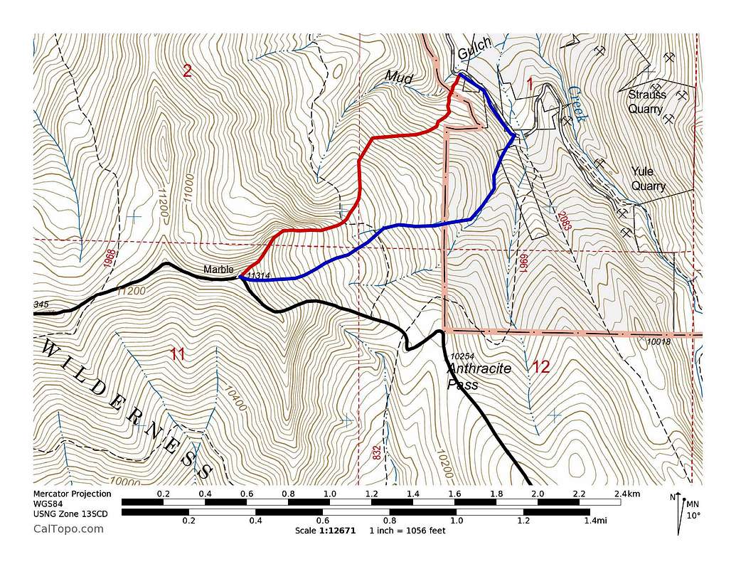
Marble Peak's Routes
View High-Resolution Image
Marble Peak's Routes
Marble Peak's Routes: Red = Northeast Ridge, ~2 miles with ~2,400' of elevation gain. Blue = East Bowl, ~2.6 miles with ~2,400' of elevation gain. Click to enlarge.
« PREV
NEXT »
Brian Kalet
on
Jan 3, 2014 12:00 pm
Comments & voting
Other parents
Lat/Lon:
39.03280°N / 107.1892°W
Image Type(s):
Topo/Diagram
Image ID:
881784
3395 Hits
0
% Score
0
Votes
Log in to vote
Comments
No comments posted yet.
to post!
Don't have an account?
"Marble Peak"
(Mountain/Rock)
You are at
the First
Image
Viewing
#1 of 1
GALLERY
You are at
the Last
Image
Brian Kalet's Image Gallery
« PREV
Viewing
#386 of 414
GALLERY
NEXT »
Northeast Ridge
(Route)
Loading....
×
You need to login in order to vote!
User Name
Password
Remember me
Forgot your password?
Log me out when I close my browser.
Keep me logged in all the time.
sign in as a user
Don't have an account?
Register now for FREE
Rating available
Suggested routes for you
People who climb the same things as you
Comments Available
Create Albums
Register Here


