
|
|
Mountain/Rock |
|---|---|
|
|
48.86011°N / 121.71354°W |
|
|
Whatcom |
|
|
5820 ft / 1774 m |
|
|
Overview
Looking for a scenic scramble in Mount Baker's Heather Meadows/Artist Point area, but finding yourself a little short on time? Resigned to hauling yourself and your family up Table Mountain, but dreading the prospect of sharing the trail with legions of day hikers? Thankfully, there is a perfect answer to this dilema: Mazama Dome.
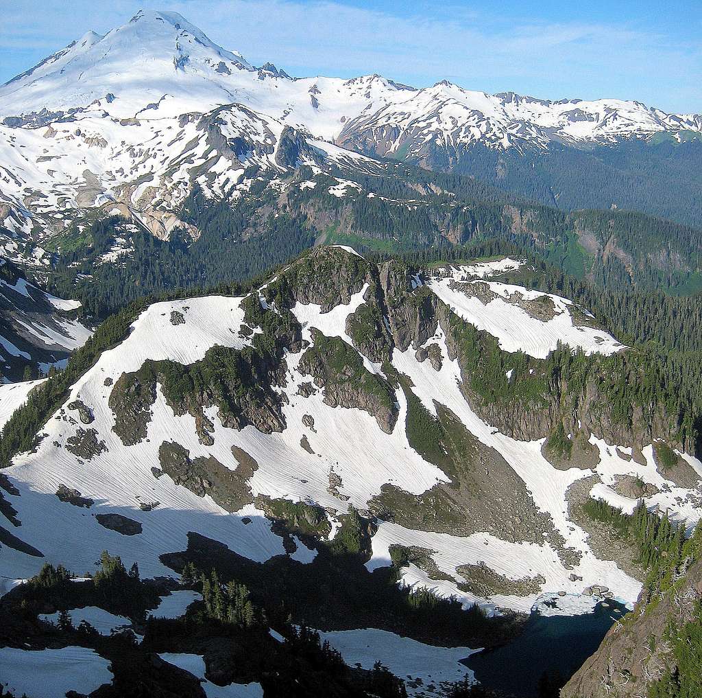
Mazama Dome is a 5820' high point located seven miles northeast of Mount Baker, and conveniently, just 1.3 miles (as the crow flies) from the end of the Mount Baker Highway. While it may not win any awards for prominence (400'), it offers up views that are arguably better than Table Mountain, at the expense of a small amount of class 2 scrambling and route finding.
While solitude is not a guarantee on this peak, lack of a well defined path once leaving the established trail suggests limited use. For those who desire a little more of a challenge, Mazama Dome can be combined with nearby Mount Herman and/or Barometer Mountain to fill out a full day of class 2/3 scrambling.
Getting There
Navigate yourself to the end of the Mount Baker Highway (SR542). For those coming from Interstate 5, SR542 begins at exit 255. Those coming from points south may find it advantageous (and shorter) to cut across to SR9 via SR20 at Burlington, then rejoin SR542 near Deming. The end of SR542 forms a one-mile, counterclockwise loop around Picture Lake and vicinity. The trailhead for Bagley Lakes will be found on the west end of this loop. Avoid the temptation to continue up the side road to Artist Point (provided it is plowed and open). While it is possible to approach Mazama Dome from Artist Point, it will add unecessary distance to your trip. As an interesting option, one could do a Mazama Dome/Table Mountain '2fer' loop, provided they had either arranged a car shuttle, or didn't mind the resultant road walk.
Route
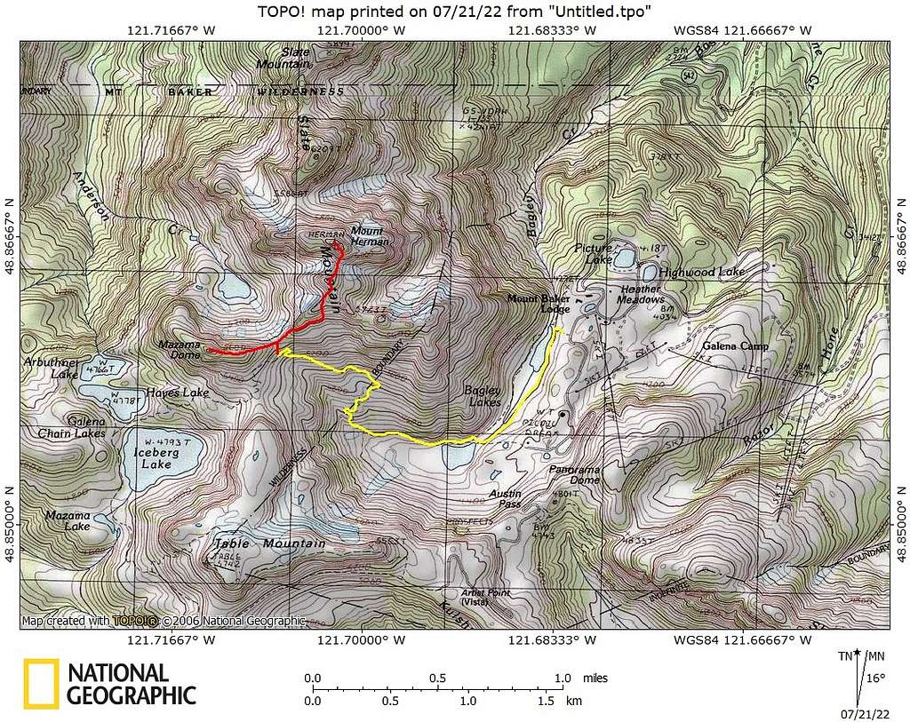
Hike the Bagley Lakes trail for approximately two miles, until at a point roughly 1/4 mile before Herman Saddle (est. 5300'). This point will be just beyond the final swithback on the uphill portion of the trail. If you find yourself going downhill toward Herman Saddle (also est. 5300'), you have gone too far. We found that hiking the first portion of the trail on the east side of Lower Bagley Lake was slightly easier than the west side.
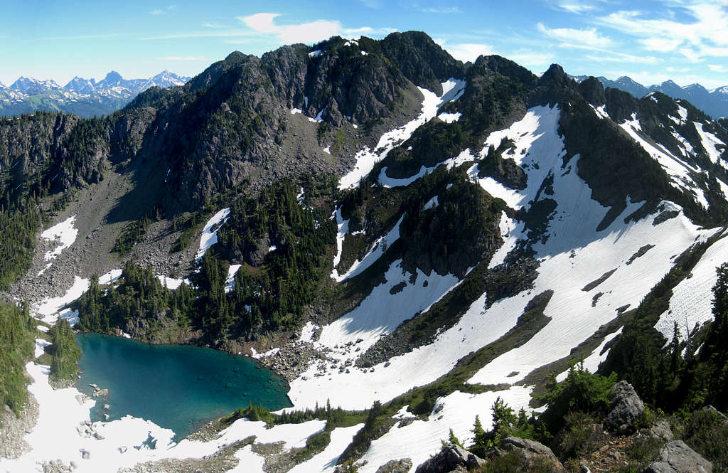
From the aforementioned point, look up and to your right at the obvious saddle (est. 5420') between Mazama Dome and Mount Herman. Locate a faint side path and follow it steeply northwest for about 300' to the saddle. Upon arrival, you will have a nice look at an unnamed lake (est. 4980') which resides between Mazama Dome and Mount Herman. From the saddle, turn left, and follow the obvious and open East Ridge of Mazama Dome for roughly 1/3 mile to the summit.
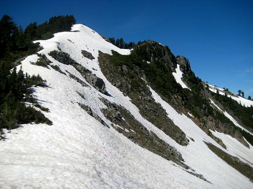
The ridge will level off temporarily at 5700', followed by easy scrambling to the top. If you find yourself doing anything more difficult than class 2, you're doing it wrong.
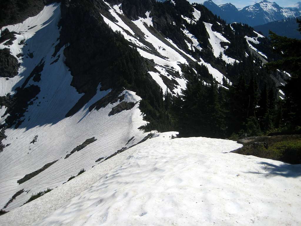
An ice axe and instep crampons may be beneficial in early season, depending on snow conditions. Please note that if you are combining this scramble with Mount Herman as part of a '2fer', you should ascend Mazama Dome first. This will give you the ability to scout and preplan your final route up Mount Herman, which provides multiple options depending on snow conditions.
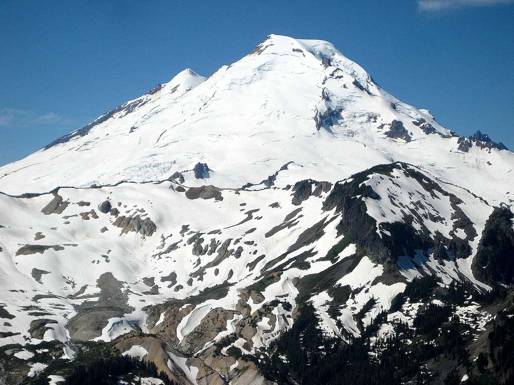
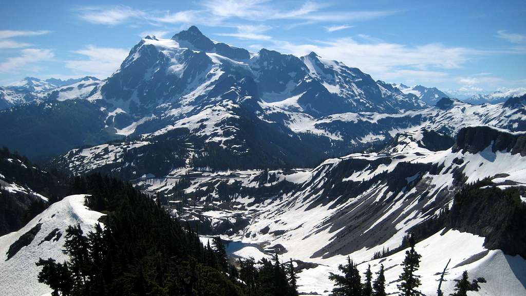
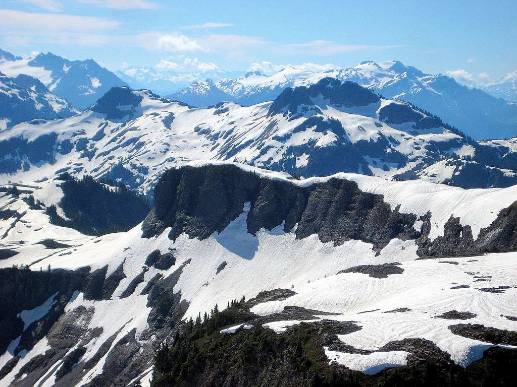
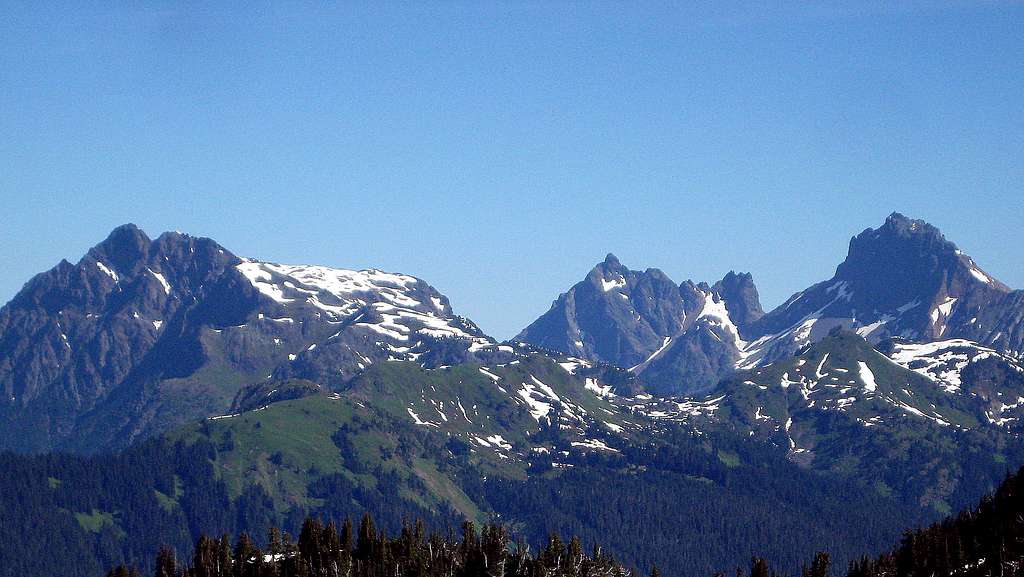
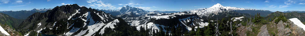
Mazama Dome provides fantastic views for a modicum of effort. Mount Baker and Mount Shuksan dominate the views to the southwest and southeast, with plenty of majestic North Cascade peaks filling in the views to the north and east.
Red Tape
A Northwest Forest Pass will be required for parking at the Bagley Lakes Trailhead or Artist Point Trailhead.
When to Climb
The Mount Baker Highway is open year round. Please use common sense and evaluate avalanche conditions for winter and early spring ascents.
Camping
There are no shortage of camping options along SR542 enroute to this area. For those who desire to camp at the Mazama Dome/Mount Herman saddle or Mazama Dome summit, I saw nothing specifically prohibiting it.