Toggle navigation
Mountains
Routes
Images
Trip Reports
Forum
What's New
People
Areas & Ranges
Articles
Trailheads
Canyons
Huts & Campgrounds
Albums
Logistical Centers
Fact Sheets
Lists
Custom Objects
Gear
Plans & Partners
WELCOME TO SUMMITPOST
SIGN IN
REGISTER
McReynolds Peak topo map
View High-Resolution Image
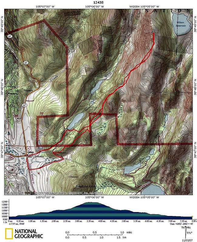
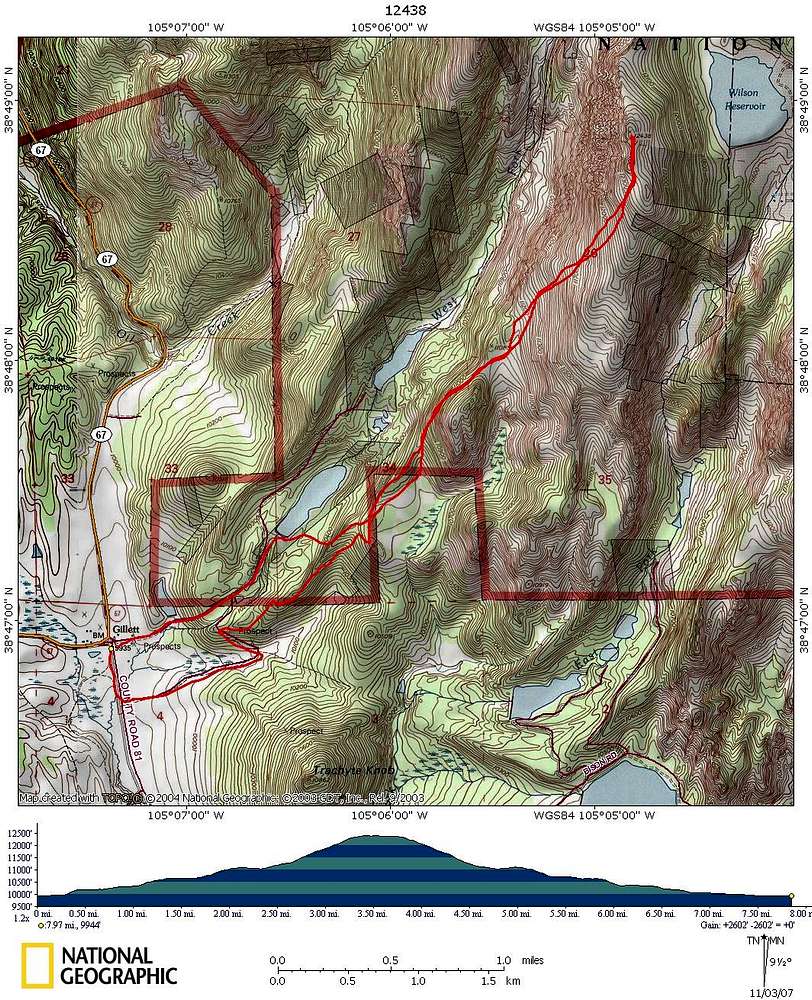
McReynolds Peak topo map
This is our GPS track of our climb of "McReynolds Peak" near Pikes Peak via the West Fork drainage. The more southerly track was our descent route.
« PREV
NEXT »
shknbke
on
Nov 4, 2007 11:19 pm
Comments & voting
Other parents
Lat/Lon:
38.81260°N / 105.0797°W
Image ID:
353342
3039 Hits
74.01
% Score
4
Votes
Log in to vote
Comments
No comments posted yet.
to post!
Don't have an account?
"McReynolds Peak"
(Mountain/Rock)
You are at
the First
Image
Viewing
#1 of 1
GALLERY
You are at
the Last
Image
shknbke's Image Gallery
« PREV
Viewing
#288 of 654
GALLERY
NEXT »
"McReynolds Peak"
(Mountain/Rock)
Loading....
×
You need to login in order to vote!
User Name
Password
Remember me
Forgot your password?
Log me out when I close my browser.
Keep me logged in all the time.
sign in as a user
Don't have an account?
Register now for FREE
Rating available
Suggested routes for you
People who climb the same things as you
Comments Available
Create Albums
Register Here


